Just when I thought my foot pain was behind me and I was ready to start hiking again, something much more serious got in the way.
On Friday morning, January 24, I went to Hayward Kaiser for a treadmill test. I thought that this would be just another routine test, and how hard could it be to walk on a treadmill? Halfway through the test, the doctor suddenly told me to get off the treadmill and sit down. He said that he had seen something abnormal, and they immediately put me in a wheelchair and took me to the emergency room. A short time later, I was in an ambulance hooked up to monitors and IVs and speeding to Kaiser Santa Clara with lights and sirens going. In Santa Clara they did an angiogram, and found that a couple of my coronary arteries were 80% blocked, and that I would need bypass surgery.
After a couple of weeks in the hospital with all kinds of scary stuff happening, they let me go home to recuperate. It has now been three weeks since the surgery, and I'm beginning to feel like my normal self again. Most of the time it doesn't hurt -- only when I cough -- and I can go for short walks and do a lot of stuff as long as it doesn't involve lifting, pushing or pulling anything heavier than 10 lbs. I'm low on energy and take a lot of naps, and I'm not supposed to drive.
So it's going to be a long time until I can get back into any serious hiking, probably at least several months. In the meantime, I'm going to see what I can do about writing a few more stories about some of my memorable trips from long ago.
Wednesday, February 19, 2014

Sunday, December 15, 2013
Backpacking with the Scouts 1956-1961
I'm still taking it easy with the hiking and I don't know how long it will be before my foot feels good enough for long walks. In the meantime, I can still add stuff to this blog. I'm going to ignore the common advice that a blog should stay focused on a single subject, and start adding posts about other stuff. Mostly, I want to share some stories and photos from long ago in places far from the East Bay. I've got a lot to choose from, but I decided to start way back near the very beginning of my interest in hiking and wilderness.
It was June, 1956, and I was 11 years old, when I went on my first backpacking trip. I had joined Boy Scout troop 204 in Lafayette, a troop that took scouting more seriously than most. They were well organized and had a lot of activities going on, including a 10-12 day, 60 mile wilderness trip every summer. It was pretty scary for a shy little kid like me, but I soon made a lot of friends and began to fit in.
The backpacking trip took a lot of preparation. Lots of things were different about backpacking in those days. Our equipment was all very low-tech and inexpensive. We got a lot of it from Army-Navy surplus stores. There were a lot of them around, selling left-over stuff from World War II. My dad helped me build my own wooden pack frame. For tents, each boy carried a "shelter half", a piece of canvas that buttoned together with another one to make a pup tent big enough for two. We had cheap sleeping bags, but no pads or mattresses. To pack up, we would lay out everything on the shelter half, wrap it up and lash it to the pack frame.
Cooking was done on wood fires with #10 tin cans for pots, and a few flat aluminum pans. When we arrived at a campsite, all of the boys spread out to gather wood -- small dead sticks broken from the lower branches of lodgepole pines. Our food was mostly dehydrated -- freeze dried food was not available yet. We didn’t use any kind of water purification; we just drank right out of the lakes and streams. We usually went early in the season — late June or early July, and there was usually plenty of water and lots of snow. Often, there was too much water — streams difficult to cross and meadows flooded. And there were plenty of mosquitos too. Repellent and head nets were standard equipment. Near the midpoint of each trip, we would be resupplied by air drop. A plane would fly over and drop boxes of food with parachutes.
This was way before the days of overflight restrictions, wilderness permits and group size limitations. It was also before anyone thought much about protecting the environment. We picked up our trash and filled in our fire pits, but otherwise didn't think much about our impact on the land. It didn't seem to matter much because there was hardly anyone else there. We would often go for days without meeting other people on the trail.
Anyway, there I was, eleven years old with almost no camping experience, going on my first trip. We met at the scout cabin at about 4 am, and 30 or 40 of us got on a chartered bus and rode to Hetch Hetchy in Yosemite. It was a hot day, and after hiking across the dam, we climbed a dusty trail endlessly switchbacking up the side of the canyon. It was very hard for me, panting hard to get enough air and dying of thirst. Someone told me that holding a small pebble in my mouth would help with the thirst, and it seemed to work at least a bit. I was totally exhausted when I finally reached our campsite in a meadow named Beehive.
Early the next morning, I was startled awake by a very loud explosion. Our scoutmaster liked to wake everyone up with a large firecracker. I was mostly recovered from yesterday’s hiking, but now I was suffering from diarrhea, probably from the change in food, or the water, and I was pretty miserable. I was thinking maybe this was all a big mistake, and there was no way to escape. But after hiking a few miles, we came to Lake Vernon, and the view of the lake and the high granite domes beyond it was really impressive. Day by day, I got stronger and used to the routine, and I noticed more and more what a beautiful place it was.
Ever since I had joined the troop, I had suffered with anxiety about rumors of a tough initiation. It happened around the sixth day at Wilmer Lake. I was blindfolded and led through a lot of ceremonial stuff, and then I was told that I was going to be thrown into the river. Two older boys held my arms and feet and swung me several times, then let me go. I was expecting icy cold water, but some other boys caught me and it was all over.
Each day of hiking we had been gaining elevation, and about the seventh day patches of snow appeared here and there, and when we reached Grace Meadows at about 10,000 ft., there was snow all over. We found some patches of bare ground in the trees, and camped there. It was here that we had the air drop. Our scoutmaster was an airline pilot, and he had connections in the air force, and so the plane that appeared was a World War II era bomber, a B-29, I believe.
We spent a couple of layover days there, and one morning, one of the older boys led a climb up nearby 11,000 ft. Forsyth Peak. I went along, and it was one of the most exciting things I had ever done. It was windy and cloudy, and all around us seemed like an endless expanse of snowy mountains. After that I was thoroughly hooked on climbing to high places. I always thought that some day I would learn how to do some real climbing with ropes and stuff, and never got around to it. But I have enjoyed many years of hiking around in the mountains and scrambling up peaks here and there.
For the following seven summers, I went on similar trips with the troop. All but two of them were crossings of the northern Yosemite area, a beautiful area that doesn't get as much attention as the high country further south. The other two trips followed the John Muir Trail from Devils Postpile to Tuolumne Meadows, another of my favorite areas.
Here are some of the highlights (and low points) of those trips:
On the 1957 trip, my second, there was a boy a year younger than I who was not doing well. He was a spoiled kid who was not very active and somewhat overweight, and was having a hard time keeping up. The other boys teased him mercilessly. On the second day, we faced a 2000 ft. climb over a ridge, and the scoutmaster asked me to hike with him. I was pretty insecure myself, so I was afraid that I would end up a target of their teasing too. But I did it, and without all the jeering from the other boys, this kid managed to get himself up the ridge, and he made it through the rest of the trip. And no one teased me about it either.
Also on that 1957 trip, one of the older boys was leading the troop as we approached Benson Lake where we planned to camp on the beach. It was a wet year, and about a mile before the lake, the trail was under water. We waded on through thigh-deep water, with terrible mosquitos, until we reached the beach, which was under several feet of water. We had to wade back out and ended up camping on a brushy hillside where the mosquitoes weren't quite as bad but still pretty miserable.
In 1959, at a rest stop, our scoutmaster, Ken Clifford, was busy doctoring the blisters of one of the boys. At that point it had pretty much been decided that a career in medicine was in my future, since I was good in science and that's what my family wanted. As Ken was taping up the boy's blister, he said to me something like "If you want to be a doctor, you should pay attention to this". What I should have paid attention to was the fact that I wasn't really interested in another boy's blisters, and years later I realized that I really didn't want to be a doctor, and I dropped out of my third year of medical school at UCSF.
In 1961, I remember a very long, cold night spent next to a fire in thin clothing and no sleeping bag. A group of us were camped at Minaret Lake, and a couple of older boys and I set out to do some exploring. We had climbed to Cecile Lake and were heading down a long talus slope toward Iceberg Lake when one of the boys slipped and badly sprained his ankle. He didn't think he could make it back, so we half carried him down to Shadow Lake. He and I spent a freezing night together while the other boy went for help.
I've always had a good memory for the places where I have been. From a very early age I was obsessed with maps and always knowing where I was. Even though it was more than 50 years ago, I still have quite clear memories of a lot of the special places that we visited on those trips. Many of these places in northern Yosemite I have never been back to, but that's not because I didn't care about seeing them again. It's because they take several days of hiking for the average person to get to, and I usually didn't have the time for a week-long trip. These days I could make the time, but I'm probably not physically up to it anymore. But who knows? Maybe someday.
 |
| fooling around, Smedberg Lake, 1957 me at Pleasant Valley, 1957 |
 | ||
| Typical large campfire -- Spiller Creek, 1959 |

 |
| At the end of one of the trips -- I'm in 2nd row, far left -- Scoutmaster Ken Clifford at far right |


Tuesday, December 10, 2013
Stuck Under a Horse
Now I know what it feels like to be between a rock and a hard place -- or in my case between a rock and a 1200 lb. horse.
I've been trying to take it easy with the hiking lately because of the pain in my left heel. But riding a horse is not too hard on the feet, so yesterday Maureen and I took our horses out for a short ride in Garin Park. The horses are boarded at Alta Vista Equestrian Center right next to the park, and we ride there pretty regularly. Our horses are both 25-year-old geldings and hardly anything bothers them on the trail. Maureen usually rides Zach, an Appaloosa, and I ride Rio, a quarter horse. Our rides are usually uneventful, and not worth a blog post, but yesterday was different.
Everything was fine for the first half hour or so as we rode out into the park. Then Maureen decided to head off the trail up a short steep hillside that connects with another trail. The horses were working hard, trotting up the hill when suddenly Rio stopped and his legs started to buckle. I turned him sideways so he wouldn't back down the hill, and then he just lay down and rolled over on his downhill side. Several times in the past few years he has started to do something similar, but he always was able to get back up and keep going, so I didn't think of trying to jump off. Besides, it happened so fast I don't know whether I could have anyway. So there I was with my right leg stuck under Rio, and no way I could pull it out. Rio just lay there, not trying to move. My leg hurt quite a bit because a rock was pressing into my calf muscle. I tried to get him to move, but I didn't want him to move too much because I knew I might get hurt much worse if he did a lot of struggling to get up.
Maureen was up the hill from us, and she got off Zach, who was getting freaked out, and soon realized that she couldn't help me unless she let him go. So he ran back and forth a bit and then went under some low hanging trees, which freaked him out even more and he took off out of sight over the hill.
It seemed to me that I was stuck there for about 20 minutes, but it was probably not really that long. Maureen tried to pull on Rio to get him up, and he began flailing his hooves, and she got kicked a few times, but not badly. I got my other foot against Rio's neck and pushed hard, and very slowly my leg moved a couple of inches. Then Maureen thought that maybe the saddle was making it harder for Rio to get up, and we managed to undo the cinch. Finally, Rio moved again and I was able to pull my leg all the way out leaving my boot under him. Then he got to his feet. He was still a bit wobbly, but Maureen was able to lead him back down to the base of the hill. I brought down the saddle and put it back on him so we wouldn't have to carry it, and then we started walking back on the trail.
About half way back to the barn, we saw someone riding a horse and ponying another (leading him without a rider). When they got closer we saw that it was a young woman riding Zach, and it was her horse that she was ponying. She said that she had been heading out for a ride and saw Zach running back and forth by the gate to the barn. We all walked our horses back down the trail. By now Rio was doing fine, and Zach was wet with sweat, but seemed OK too. We had really worried about him hurting himself on his wild run.
We put the horses away and were driving back home thinking that it was all behind us now, when Maureen noticed that her phone was missing. We went back to the barn and looked all over, even back up the trail a ways, but it was getting dark, so we gave up. Back at home, I had heard of an app called "Find my iPhone", so I tried to download it to my phone. It required me to upgrade my system software, which seemed to get hung after loading half way, and I thought that I was going to lose my phone too. Then the TV stopped working. After getting everything working again (except for the app which didn't work), I was so ready for a drink.
The next morning, we went back to the barn and walked out to the site of the incident, and there was the phone lying in the grass. But it didn't work, and after charging all day it still doesn't work. And I ended up doing way more walking than I probably should have on my sore foot, but besides my foot, I have aches and pains just about all over now. But I shouldn't complain. I feel very lucky that we got through it with no serious injuries to either people or horses.
I've been trying to take it easy with the hiking lately because of the pain in my left heel. But riding a horse is not too hard on the feet, so yesterday Maureen and I took our horses out for a short ride in Garin Park. The horses are boarded at Alta Vista Equestrian Center right next to the park, and we ride there pretty regularly. Our horses are both 25-year-old geldings and hardly anything bothers them on the trail. Maureen usually rides Zach, an Appaloosa, and I ride Rio, a quarter horse. Our rides are usually uneventful, and not worth a blog post, but yesterday was different.
Everything was fine for the first half hour or so as we rode out into the park. Then Maureen decided to head off the trail up a short steep hillside that connects with another trail. The horses were working hard, trotting up the hill when suddenly Rio stopped and his legs started to buckle. I turned him sideways so he wouldn't back down the hill, and then he just lay down and rolled over on his downhill side. Several times in the past few years he has started to do something similar, but he always was able to get back up and keep going, so I didn't think of trying to jump off. Besides, it happened so fast I don't know whether I could have anyway. So there I was with my right leg stuck under Rio, and no way I could pull it out. Rio just lay there, not trying to move. My leg hurt quite a bit because a rock was pressing into my calf muscle. I tried to get him to move, but I didn't want him to move too much because I knew I might get hurt much worse if he did a lot of struggling to get up.
Maureen was up the hill from us, and she got off Zach, who was getting freaked out, and soon realized that she couldn't help me unless she let him go. So he ran back and forth a bit and then went under some low hanging trees, which freaked him out even more and he took off out of sight over the hill.
It seemed to me that I was stuck there for about 20 minutes, but it was probably not really that long. Maureen tried to pull on Rio to get him up, and he began flailing his hooves, and she got kicked a few times, but not badly. I got my other foot against Rio's neck and pushed hard, and very slowly my leg moved a couple of inches. Then Maureen thought that maybe the saddle was making it harder for Rio to get up, and we managed to undo the cinch. Finally, Rio moved again and I was able to pull my leg all the way out leaving my boot under him. Then he got to his feet. He was still a bit wobbly, but Maureen was able to lead him back down to the base of the hill. I brought down the saddle and put it back on him so we wouldn't have to carry it, and then we started walking back on the trail.
About half way back to the barn, we saw someone riding a horse and ponying another (leading him without a rider). When they got closer we saw that it was a young woman riding Zach, and it was her horse that she was ponying. She said that she had been heading out for a ride and saw Zach running back and forth by the gate to the barn. We all walked our horses back down the trail. By now Rio was doing fine, and Zach was wet with sweat, but seemed OK too. We had really worried about him hurting himself on his wild run.
We put the horses away and were driving back home thinking that it was all behind us now, when Maureen noticed that her phone was missing. We went back to the barn and looked all over, even back up the trail a ways, but it was getting dark, so we gave up. Back at home, I had heard of an app called "Find my iPhone", so I tried to download it to my phone. It required me to upgrade my system software, which seemed to get hung after loading half way, and I thought that I was going to lose my phone too. Then the TV stopped working. After getting everything working again (except for the app which didn't work), I was so ready for a drink.
The next morning, we went back to the barn and walked out to the site of the incident, and there was the phone lying in the grass. But it didn't work, and after charging all day it still doesn't work. And I ended up doing way more walking than I probably should have on my sore foot, but besides my foot, I have aches and pains just about all over now. But I shouldn't complain. I feel very lucky that we got through it with no serious injuries to either people or horses.
Monday, November 25, 2013
11-24-13 Black Diamond Mines
On a Sunday morning, we got a call from our son, Chris, asking if we wanted to go with him and our two grandsons, Elisjsha (age 10) and Zachery (age 8), to Black Diamond Mines. It sounded fun, so Maureen and I went along. Luckily, Chris has a minivan with plenty of room so we all rode together, including his wife, Jonnie and our granddaughter, Makaila (age 3), who we dropped off in Concord to spend the afternoon with a friend.
When we got to the park, we found out that Chris picked today to come because they were having open house in the mines. As a park district employee he keeps up with events like this. At the Hazel-Atlas mine entrance, they handed everyone a hard hat and a flashlight. Neither seemed necessary, since there were no low ceilings and it was all well-lit. We followed the tunnel deep into the mountain, mostly through sandstone, and it was interesting to see the tilted layers, and in places ripple marks where the sandstone had been deposited beneath the sea. there were holes where we could see into huge chambers that had been hollowed out by mining.
Coal mines were started here soon after the gold rush, and it was a busy place for much of the last half of the 19th century with 5 towns and thousands of miners, many of whom were recruited from mining areas of England and Wales. Then, from the 20's through the 40's, mining was resumed for sandstone for making glass. That was the part of the mine that we were exploring. We only went about a quarter mile, but they said that there were over 200 miles of tunnels in the area.
Back out of the mine, we continued on the trail up a steep little ravine. At the first trail junction, Maureen and Elisjsha decided to head back down on the trail to the right that led down another little ravine. Chris, Zachery, and I went on up to the top of the ridge and turned left, climbing another quarter mile or so to a hilltop with a great view to the valleys and ridges to the southeast.
I enjoy hiking with kids, but it takes a lot of patience and flexibility. I thought the boys would be really interested in the mine and the rocky trail, and maybe they were, but didn't show it much. They seemed much more interested in stopping for a snack along the way. The trail is quite steep, and both boys complained about how hard it was and "how much farther do we have to go?", but then a minute later were running ahead up the trail. On the way down, Zachery was running down a steep gravely place, right after his dad had told him not to run, and of course, he slipped and fell. It probably hurt, but no real damage was done.
Back at the bottom of the hill, we met up again with Maureen and Elisjsha, found a table and ate some lunch, then headed back to the car. The boys found a couple of sticks which became light-sabers, and fought a little battle up and down the mounds of tailings on the way. It all added up to a nice afternoon and we all had fun.
about 1.5 miles, 500 ft. climb

When we got to the park, we found out that Chris picked today to come because they were having open house in the mines. As a park district employee he keeps up with events like this. At the Hazel-Atlas mine entrance, they handed everyone a hard hat and a flashlight. Neither seemed necessary, since there were no low ceilings and it was all well-lit. We followed the tunnel deep into the mountain, mostly through sandstone, and it was interesting to see the tilted layers, and in places ripple marks where the sandstone had been deposited beneath the sea. there were holes where we could see into huge chambers that had been hollowed out by mining.
 |
| in the mine |
 |
| on the trail |
Back out of the mine, we continued on the trail up a steep little ravine. At the first trail junction, Maureen and Elisjsha decided to head back down on the trail to the right that led down another little ravine. Chris, Zachery, and I went on up to the top of the ridge and turned left, climbing another quarter mile or so to a hilltop with a great view to the valleys and ridges to the southeast.
 |
| Zachery and Chris at the top of the hill |
I enjoy hiking with kids, but it takes a lot of patience and flexibility. I thought the boys would be really interested in the mine and the rocky trail, and maybe they were, but didn't show it much. They seemed much more interested in stopping for a snack along the way. The trail is quite steep, and both boys complained about how hard it was and "how much farther do we have to go?", but then a minute later were running ahead up the trail. On the way down, Zachery was running down a steep gravely place, right after his dad had told him not to run, and of course, he slipped and fell. It probably hurt, but no real damage was done.
Back at the bottom of the hill, we met up again with Maureen and Elisjsha, found a table and ate some lunch, then headed back to the car. The boys found a couple of sticks which became light-sabers, and fought a little battle up and down the mounds of tailings on the way. It all added up to a nice afternoon and we all had fun.
 |
| View east from Sommersville site |
about 1.5 miles, 500 ft. climb

Tuesday, November 12, 2013
11-8-13 Anthony Chabot
A Friday afternoon and Maureen and Cherry were going riding, and I felt like a hike. For the last couple of months I've had a pain in my left heel and it has gotten worse lately. But it wasn't too bad that day and I didn't think it would give me any problems. On a couple of my hikes I've explored some of the northern end of Anthony Chabot Regional Park, going out from Bort Meadow on the Grass Valley Trail and Ranch Trail. Both times I had turned left at the Goldenrod Trail and made a loop, but I had never turned to the right. I wasn't sure how this would work, because the map shows the Goldenrod Trail deadending without connecting with any other trail or road. I figured we could find some way to get from there to the Parkridge Drive park entrance.
So Darby and I started off from the Bort Meadow Staging Area on the now familiar trail past the meadow and then steeply up the hillside to the west. Turning right onto the Goldenrod Trail at the top, we found it much the same as to the left. A young guy on a mountain bike passed us and asked if we knew where the trail ended. I had to tell him I didn't know either. Soon we came to a gate with a road on the other side. The biker went out through it, but the trail continued so we kept following it. The trail ended at another gate, and through it was what appeared to be an equestrian facility, but it was deserted -- no people or horses. A couple of the structures looked quite new, and signs said that they had been funded by the 2008 bond issue. It looked like it could be a nice place to keep a horse, and it was surprising that it was unused. At the far end of the facility, past an interesting old Spanish-style building, we came to a gate with a sign "Private Property", and a driveway beyond it. I looked at my iPhone and saw that we were only 100 yards or so from Skyline Blvd. So we walked down the driveway and found the street. This part of Skyline is a divided road with a trail along the center divider, so we didn't have to worry about the traffic.
At Parkridge Dr. we turned right and walked several blocks on sidewalks to the end of the street and the park entrance. A few yards from there, we turned right on the Macdonald Trail which gradually descended along the eastern ridge back to our starting point. It seems that this section of the Bay Area Ridge Trail is a popular trail with mountain bikers, and several of them passed us going dangerously fast. I noticed a sign for the Brittleleaf Trail heading down the east side of the ridge. I don't know what Brittleleaf is or why anyone would want to go down this .39 mile, steep dead end trail, but maybe one of these days I will check it out.
Coming down the last hill, my heel was hurting quite a lot now, and I was glad to be near the end of the hike. It probably wasn't a good idea to hike with a sore foot because the next day I could barely walk on it. Now, after a couple of days rest, it is not so bad, but I need to take it easy for a while.
Back home, I looked up Oakland City Stables, and found out that it was in use as recently as last year and that it was the site of a popular program to let city kids learn about riding and working with horses. It has an interesting history going back to the 1820's and the Peralta family, the original landowners of most of the East Bay. Apparently, the city closed it because they couldn't find a suitable manager for it and didn't want to provide any funding to keep it open.
4.6 mi. 900 ft. climb

So Darby and I started off from the Bort Meadow Staging Area on the now familiar trail past the meadow and then steeply up the hillside to the west. Turning right onto the Goldenrod Trail at the top, we found it much the same as to the left. A young guy on a mountain bike passed us and asked if we knew where the trail ended. I had to tell him I didn't know either. Soon we came to a gate with a road on the other side. The biker went out through it, but the trail continued so we kept following it. The trail ended at another gate, and through it was what appeared to be an equestrian facility, but it was deserted -- no people or horses. A couple of the structures looked quite new, and signs said that they had been funded by the 2008 bond issue. It looked like it could be a nice place to keep a horse, and it was surprising that it was unused. At the far end of the facility, past an interesting old Spanish-style building, we came to a gate with a sign "Private Property", and a driveway beyond it. I looked at my iPhone and saw that we were only 100 yards or so from Skyline Blvd. So we walked down the driveway and found the street. This part of Skyline is a divided road with a trail along the center divider, so we didn't have to worry about the traffic.
At Parkridge Dr. we turned right and walked several blocks on sidewalks to the end of the street and the park entrance. A few yards from there, we turned right on the Macdonald Trail which gradually descended along the eastern ridge back to our starting point. It seems that this section of the Bay Area Ridge Trail is a popular trail with mountain bikers, and several of them passed us going dangerously fast. I noticed a sign for the Brittleleaf Trail heading down the east side of the ridge. I don't know what Brittleleaf is or why anyone would want to go down this .39 mile, steep dead end trail, but maybe one of these days I will check it out.
Coming down the last hill, my heel was hurting quite a lot now, and I was glad to be near the end of the hike. It probably wasn't a good idea to hike with a sore foot because the next day I could barely walk on it. Now, after a couple of days rest, it is not so bad, but I need to take it easy for a while.
Back home, I looked up Oakland City Stables, and found out that it was in use as recently as last year and that it was the site of a popular program to let city kids learn about riding and working with horses. It has an interesting history going back to the 1820's and the Peralta family, the original landowners of most of the East Bay. Apparently, the city closed it because they couldn't find a suitable manager for it and didn't want to provide any funding to keep it open.
4.6 mi. 900 ft. climb

Sunday, November 3, 2013
11-3-13 Wall Point - Mt. Diablo
 |
| View west from Wall Point |
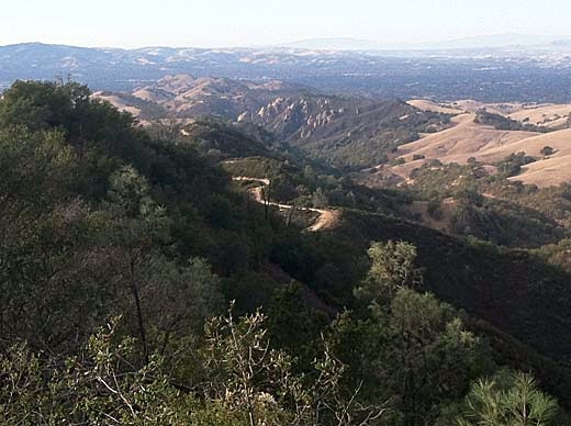
When I arrived at the end of Green Valley Road, I found that it required a self-service parking fee. I needed $5.00 (with senior discount), but I only had 3. I wasn't going to give up my hike for a couple of bucks, so I put what I had in the envelope and hoped that I would get away with it. I figured that it would cost them way more than $2 to track me down and give me a ticket. We'll see what happens.
I started off up over the first hill and down into Pine Canyon. Everything is very dry now, but still quite pretty in the late-season afternoon light. There was quite a lot of fall colors (at least a lot for California) along the way, especially the maples and sycamores. At the bottom of the canyon, I turned right, heading upstream and climbing gradually along the dry creek bed. After a mile or so, the road climbs more steeply and keeps climbing for a good long way. As it begins to head away from the creek, I turned right on the Secret Trail, a single-track trail that is not exactly secret since it is well-signed. It climbs some more, then cuts across the side of the ridge to the south and connects with the Wall Point Road. I turned right again and began returning along the ridge. Now it was apparent that I had gained a lot of elevation and there were lots of great views of the Blackhawk and Danville areas. The ridge, part of the Black Hills, is covered with chaparral with lots of big sandstone outcrops -- very scenic. Soon a little climbing brought me to a high point and I began to wonder where exactly was "Wall Point". Looking at the map later I found that it was at that high point. From there, the road goes up and down along the ridge, but mostly down, until the loop is done, and there is only the last small hill to cross.
Sometimes these days I remember hikes from long ago as not being too hard, but that was when I was young and in good shape. When I try them again I find them much harder than I remembered. That didn't happen so much today. I ended up tired, but not completely worn out, and it was an enjoyable afternoon.
6.2 miles, 1300 ft. climb

Sunday, August 25, 2013
8-23-13 Anthony Chabot
 |
| Ranch Trail |
Darby and I started off from the Bort Meadow Staging Area and headed up the valley on the Grass Valley Trail. Not far beyond the Bort Meadow group camp area, the trail crosses the creek and switchbacks steeply up a spur ridge as the Ranch Trail. We came across a guy with a couple of dogs who leashed them and passed by without incident. Near the top of the ridge, we turned left on the Goldenrod Trail and went about a half mile, then turned left on the Buckeye Trail. It descends steeply down log steps into a little canyon. We passed the guy with the two dogs again -- apparently he was doing this loop in the opposite direction. Otherwise, we met no one else on the trail.
We were back at the car after just an hour of hiking. This is a nice little loop for a relatively short hike. It's a bit of a workout, with some steep climbing, and it is a pretty area with lots of variety in the vegetation -- grassy hills, brush, shady woods. The map below, while still not perfect because my GPS track was somewhat erratic, shows the locations of the trails much more accurately than the park map, which as you can see, is way off.
2.4 miles, 500 ft. climb

Subscribe to:
Posts (Atom)