Showing posts with label Sunol. Show all posts

Tuesday, October 6, 2015

Sunol 10-5-15


A week and a half after hiking at Sunol I had another free day and I decided to go back and try the Welch-Flag Hill Trail that I had noticed on the map last time. This time the weather was cooler and felt like I could handle a bit more climbing. My plan was to find some place to park on Welch Creek Road and start hiking from there. The only problem with that is that the park doesn't allow parking on the road without a permit. It's a one-lane road with no shoulders and very few places where it would even be possible to park if it were allowed. But on most weekdays the park is very lightly used and there are no rangers around, so I figured that I could probably get away with breaking the rules a bit.

First, I drove a short distance up Welch Creek Road just to check out the beginning of the trail and see if there was room to park. About a quarter mile up I saw an unmarked gate on the right. Parking looked possible but not welcoming because of a ditch and a pile of logs in the way, so I turned around and went back down to near the start of the road where there was plenty of room on the shoulder.

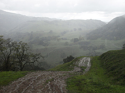
Hiking back up the road made me a bit nervous because the road is so narrow that it would be difficult to get out of the way if a car came by. Luckily, none did. Once through the gate and on the trail, I relaxed and enjoyed climbing a little oak wooded canyon. I noticed a lot of bumps and hollows along the way that were probably the result of old landslides. This whole area near the mouth of Welch Creek has some wild topography — very steep rocky hillsides rising from the valley that is the track of the Calaveras Fault. Soon the canyon opened up and then the trail climbed steeply up the nose of a ridge overlooking another steep little canyon which opens up into a valley. Soon there is a trail junction with the Flag Hill Loop Trail.

Looking back, a sign informs me that the "Welsh to Flag Hill Trail" terminates at the road and that I will have to return to Flag Hill. Obviously, they don't want people using the road as a trailhead as I did. By the way, I noticed that all of the signs along the way spelled Welsh with an "s", as in "someone from Wales", while on the map it is spelled with a "c". I turned left and continued up another steep ridge and then around the head of the valley. I came out on the ridge of Flag Hill a little below the summit, and enjoyed the big view over the central part of the park. Soon I was at the cliffs that I had seen on my previous hike, and cautiously approached the edge to take a photo. I generally like being on high places, but when it is a sheer drop off, I suddenly get very uncomfortable near the edge. I settled for a shot from a couple of feet back. The trail then continued down the ridge and back into the valley to complete a loop.

It turned to be a really nice hike with lots of interesting stuff to see along the way. If it weren't for the parking situation, I would heartily recommend it to anyone, but apparently the park district doesn't want people doing what I did today, and I wouldn't want to be responsible for getting someone into trouble for it. So I'll leave it up to you what to do with the information.

3.6 miles, 1000 ft. climb


Friday, October 2, 2015

Sunol 9-25-15


I was feeling rather aimless as I set out for a hike with Darby. We drove to Sunol without any plan and when we got there I looked at the map and noticed a trail that I don't remember seeing there before, the Flag Hill Loop Trail. We started off in that direction, but the day was pretty warm and my energy level was rather low, and wasn't too sure I felt like climbing all the way up Flag Hill. So when the trail began heading uphill away from the creek, I noticed that a well worn path continued along the creek. I thought we would follow it a short ways to see where it went. I was surprised to find that it just kept going. After a mile or so, I figured that it probably went all the way to Welch Creek Road, but then an old overgrown ranch road branched up the hill to the right, so I decided to check that out instead. It curved back along a bench a couple hundred feet above the creek, so we kept following it. The west face of Flag Hill was above us with some quite impressive cliffs at the top, cliffs that aren't visible from the main part of the park. The road finally dwindled away to nothing, but we soon found a gate that led to the Flag Hill Trail which we followed down to our starting point.

It was enough of a hike for a low-energy hot day, and it was interesting to see an unfamiliar corner of the park. The trail along the creek appeared to be quite well traveled, especially by horses, and I don't know why the park district doesn't show it on their maps. Maybe they don't want people disturbing the cattle, although much of the rest of the park is used for grazing as well. While hiking, I thought that we may have gone beyond the park boundaries, but the map shows that it is all park land. The Flag Hill Loop Trail will have to wait for another time, and I also noticed another unfamiliar trail on the map, the Welch-Flag Hill Trail. Perhaps I can combine them both in a future hike.

2.9 miles, 550 ft. climb


Sunday, February 1, 2015

Sunol 1-30-15

on the McCorkle Trail
The day started out foggy, but by noon it was beautifully clear and sunny, so after lunch, Darby and I headed to Sunol. My idea was to hike something like the route I took about 3 years ago when we got soaked by a rainstorm that started halfway through the hike. I've been trying to avoid duplication of trails in this blog, but finding new ones without a long drive is getting harder to do. So, although I've already covered most of this route, I'm just going to do it again because it is one of my favorite places. The part that I especially wanted to see was the eastern area of the park -- the backpacking camps and the McCorkle Trail.

The last time I hiked to the Little Yosemite area, the road along Alameda Creek was closed because of construction work on the Calaveras Dam. As today was a Friday, there was no one at the Visitor Center to ask, so I assumed that the road was still closed and we started out on the Canyon View Trail instead. Looking at the park map, I see that this trail is described as having a "gentle rise in elevation". It is true that it only climbs a few hundred feet, but the first part of the trail is uncomfortably steep before it levels off along the hillside. At the Cerro Este Road which leads down to Little Yosemite, we crossed it and continued on the Canyon View Trail, which joins the Camp Ohlone Road a little further on. It was great weather for hiking -- a little cool but clear and sunny. I noticed lots of woodpeckers flitting about in the oak trees. The hills were still nice and green, but just starting to look a bit dry again after a month of no rain. The creek was still running pretty good from the December rains. Above Little Yosemite, the creekbed is a lovely wide area of gravel and big old sycamores.

We turned left on the Backpack Road which climbs up into a pretty little valley with a large rugged rock jutting out of its center. Then we turned left on the McCorkle Trail which gradually climbs around the head of the valley and across the hillside. I was thinking that this would be a nice area to be spending the night in a backpacking camp. I've never camped here, but maybe someday I could talk my grandkids into it. Finally, I reached the junction with the Cerro Este Road. Last time I came this way, I continued up over the ridge at Cerro Este, but today I felt like I had had enough climbing. Besides, the sun was getting low, and I wanted to head for home.

At this point, I got a bit confused, and wished I had a park map with me. I didn't bring one with me because I figured I knew all of these trails by heart, but sometimes my memory isn't as good as I think it is. I knew that there was an old road that headed down this ridge to the west, but I wasn't sure just where it was. I knew about this road because I remember hiking on it the first time I ever came to Sunol. That was in the mid-50s before there was a park here. My uncle, John Bruce, a biology teacher as San Ramon Valley High School, had heard about the future park, and took our families out here to check it out. We hiked way up this ridge and enjoyed the views. I remember finding a tarantula along the way.

off-trail on the ridge
I probably should have turned left on the Cerro Este Road, but instead I headed cross-country over the brow of the ridge. The hillside became very steep for a long way down, and I had to step carefully to keep from slipping down. It seems that I'm not as agile as I once was. We finally came to the road and from there it was much easier going back to the Canyon View Trail. Later, at home, I was still curious about the road down the ridge that I remembered. The park map doesn't show anything there, but the USGS topo does, and a faint track shows up on satellite photos. I guess my memory is not as bad as I thought, but somehow I lost it. I think it was because there were a few cattle there and we swung wide around to avoid distrubing them.

It was a very good hike -- beautiful place, beautiful weather, and not really too hard.

6.1 miles, 1600 ft. climb


Wednesday, September 17, 2014

Sunol 9-16-14

Another Tuesday morning hike. I'm thinking that I should keep trying new places — at least new to me in the last few years, so I choose Mission Peak. It seems that I have been avoiding the place because I know that it is a pretty big climb to the top, and there is not much shade on the trail. I think maybe I'm ready for it today. So Darby and I drive to the Stanford Ave. Staging area in Fremont. Most Regional Parks are nearly deserted on weekdays, so it is quite a surprise to find the parking lot completely full and all of the nearby streets all parked up for blocks around. Something must be going on that I don't know about, but I don't feel like dealing with crowds, so I change plans and we drive to Sunol Regional Wilderness.

When I got home from the hike, I looked on-line and found out about Mission Peak. It seems that sometime recently, people started posting selfies on Facebook of themselves on the peak. Now, it has become an internet phenomenon, and hundreds of people are climbing Mission Peak every day to take their selfies. They have to line up at the summit to get to the pole for their shots. It is becoming a major problem for the park district. I guess that it is good that people are getting outdoors and getting some exercise, but it has become really crazy. It seems especially crazy that while all this is going on, I can drive a few minutes over the hill to Sunol, a wilder and more beautiful place in my opinion, and be the only one on the trail all day.

Sunol was deserted when we got there except for a couple of people doing maintenance work on the Visitor Center. We started off up the Indian Joe Creek Trail, one of my favorites. It winds up a tight little canyon shaded by maples and sycamores. After a while, it climbs steeply, and passes the Indian Joe Cave Rocks, a pile of basalt boulders that are great for a bit of climbing. I pass on the scrambling, though, and just concentrate on getting myself up the trail. By this time we have gained over 1000 ft. We turned right on the Cave Rocks Road, climbed some more, and then left on the Eagle View Road to the Eagle View Trail. After crossing a steep little ravine, the single-track trail contours across a very steep brushy hillside to the Vista Grande Overlook, the high point of the hike. By this time, the day was pretty warm, and Darby and I were both beat. We enjoyed the far-reaching views for a few minutes and then started down the Vista Grande Road which follows the crest of the sharp ridge. I remembered coming down this ridge in the spring a few years ago when it was beautifully carpeted with poppies. It was quite dry and dead today. We greatly appreciated finding running water at the faucet at High Valley Camp, and continued down the Hayfield Road back to our car.

Indian Joe Creek Trail
Indian Joe Cave Rocks
On Cave Rocks Road
Eagle View Trail
 I was quite worn out and Darby appeared to be too. On days like today, when he gets home he crashes on the floor and doesn't move the rest of the day. But it was really a nice hike with changes of scenery at every turn -- shady canyons, rocks, open hills with far off views. That's why I like to keep coming back to Sunol.

5.4 miles, 1400 ft. climb


Tuesday, September 9, 2014

Sunol 9-9-14

Maguire Peaks from Loop Trail
Seems that Tuesday hikes are becoming a regular thing. Maureen's horseback riding lesson means that I generally have the day free. I hadn't been to Sunol for a while, but I wanted to do something new, so I thought of the Maguire Peaks Trail. I had hiked it about 40 years ago, but my memories of that are pretty dim now. I do remember it as being a pretty long hike, and when I looked at the map I saw that it would be about 10 miles from the park headquarters. That sounded much longer than I had the energy for, but then I looked closer and saw that the park map showed a parking symbol on Welch Creek Road. Years ago, parking was not allowed anywhere on this road, but apparently, now it was permitted. The note on the map said that a permit would be needed, available at park headquarters. Starting from this road would cut the hiking distance by nearly half, so I set out to try it.

It was foggy when I left Hayward, but over the hill it was all sunny. Luckily, the day stayed relatively cool making the hiking much more enjoyable. Welch Creek Road is a steep winding one-lane road which is a bit scary to drive, and mostly with no shoulders, but I found a place to pull off about 100 yards above the start of the trail. Darby and I started off up the trail, a fire road climbing steeply out of the canyon. We passed what appeared to be the site of a former ranch, judging from the trees that didn't belong there — eucalyptus and redwoods. The redwoods were tall dead snags, victims of a fire. We kept climbing over a ridge and down into a little valley where a road branched left, so we turned on it. It soon became a single-track trail, and I realized that we must have made a wrong turn. But there was a trail marker, so we continued on. We passed through a group of cows with young calves lying in the grass nearby, and several of the cows started bellowing and coming after us. Undoubtedly they felt that their calves were threatened. I've never been attacked by a cow, so I was not really concerned, and we just kept walking past them and soon they went back to grazing.

On the north side of the peaks
We joined the correct trail again, and continued on the fire road around the west side of the peaks. The road climbed to a ridge with a great view of Sunol Valley and San Antonio Reservoir, and we sat on a bench for a few minutes to rest. A couple of guys appeared hiking the other direction. They said that they had started at the park headquarters, a long hike, but they looked pretty fit. We continued on down across the north side of the peaks, and finally around the east side to finish the loop. I noticed in several places patches of yellow-flowered tarweed, and its distinctive sweet aroma, something that I always enjoy about this season. The climb back over the first ridge was tiring, but no too bad, and we made it back to the car in pretty good shape. I usually use the gps on my iphone when I hike, and I did use it today, but I forgot to turn it off, so it read 29 miles when I got home — not very useful. Fortunately, the park map shows mileages for the trails.

Southeast of the peaks
It turned out to be a very nice hike, and it seemed to be a good place to get away from it all. It seems that this part of the park does not get a lot of use, especially on a weekday.

5.5 miles, 1300 ft. climb.


Friday, June 28, 2013

6-21-13 Sunol


A couple of months ago I heard about the Regional Parks Trails Challenge. It didn't sound like my kind of thing except for the promise of a free t-shirt. I could use a new t-shirt, so I checked it out. At first I was just curious about what trails they listed for the challenge, but the website won't let you see the trails until you register and wait a couple of weeks. I thought that maybe instead of waiting, I could go to one of the part visitor centers listed and ask someone about it. One of them was at Sunol, so I decided to go there and I might as well do a hike while I was there. I thought maybe it wouldn't be open on a weekday, so I looked at the EBRDPD website and all it said was that it was closed on Thanksgiving.

So I arrive at the park, and the visitor center is all locked up and there's no one around. I had been thinking of hiking to Maguire Peaks, a pretty long hike, but it was a hot day, and I didn't feel that energetic. Instead, Darby and I hiked the Canyon View Trail to Little Yosemite. It starts off with a steep climb for the first half mile or so, and we were soon quite hot and tired. As the trail levels off and bends around the shoulder of a ridge, we could hear running water in the canyon below, and Darby kept veering off the trail and trying to head for it down some very steep slopes. I put him on the leash to keep him with me and we made it down to the trail junction at Little Yosemite. We could hear some young guys down among the rocks, spashing around and making a lot of noise. I took Darby down to the water a little below them. He enjoyed wading around and drinking his fill.

I had intended to finish the hike by going down the gravel road, but we found a fence across it and a sign saying that the area was closed because of the construction of the new Calaveras Dam. So we reluctantly headed back the way we had come, climbing a couple hundred feet back up out of the canyon. We passed a young couple, and as we passed the woman said "Mr. Newey!". It was Marissa, a friend who we had known for quite a few years because of our horses. I didn't expect to see her on foot. She is a very talented young woman who is home for summer vacation while going to veterinary school in Dublin, Ireland. On our way back we passed several other groups of young people who appeared to be on their way to play in the water. There were a couple of teen-age girls hiking in skimpy bikinis. I didn't tell them that although the creek was running, there wasn't a whole lot of water there.

3.5 miles, 800 ft. climb

Sunday, November 11, 2012

9-6-12 Sunol


Only a few days after my last day of work and the beginning of my retirement, I wanted to take advantage of my new freedom and go for a hike. It was a hot day, but I didn't want to let that stop me, so I headed for Sunol. On the freeway, I realized that I had only three dollars cash with me and I would need a $5 entrance fee plus a $2 dog fee to get into the park. I found a convenience store with an ATM in the town of Sunol, and then drove to the Regional Wilderness.

I quickly discovered one of the advantages of being retired and having weekdays free. This being a Thursday, the entrance kiosk was closed, so I got to keep my money, and the place was almost deserted, with only a couple of cars in the parking lot and no one around.

It had been a very long time since I had been up the Flag Hill Trail, so I decided to try it. Since it was hot ( probably mid-90's), I let Darby splash around in the creek a bit before starting up the hill. I expected it to be a steep climb, and I was right. I was using my usual approach to hills, which is to slow down to a barely moving pace, but even that was not enough, and I had to stop for several rests on the way. In spite of the heat and the hard work, it was a beautiful hillside, with old oaks, golden grass and a blue sky with puffy white clouds. As we climbed, the views got bigger until we could see much of the park below us.

Along the top of the hill there is a band of rocks and cliffs. I remember years ago there being a flag on a pole stuck in the rocks at the top, the origin of the name, Flag Hill. It is gone now. We found some shade in some oak trees near the top, and sat down to eat a sandwich. I often don't bother to take water on hikes, but I did this time, and Darby drank about half of it.

We followed the dirt road down to the barn area that they call High Valley Camp, and then down the Hayfield Road back to the car. The heat and the climbing had taken a lot out of us, and we were both quite happy to be back.


4.3 mi. -- 1650 ft. up and down

Thursday, June 28, 2012

3-25-12 Sunol


After weeks of dry, sunny weather, the rains returned for a couple of weeks. After a lot of rain on Saturday, Sunday seemed to be clearing, so Darby and I headed to Sunol for a hike. I felt like pushing it a bit more than the past few hikes, so I planned to go follow the road up Alameda Creek, then take the McCorkle Trail up the hill to Cerro Este and down the other side.

The day started off very beautiful with bright sunshine between the shadows of puffy clouds. The hills were brilliant green. There were lots of nice scenes for photos. Just beyond Little Yosemite, some people with a couple of poodles off leash were coming the other way, so Darby and I went off the trail a bit to let them pass. Soon there were more people with poodles. It must have been some kind of poodle club because there were about 10 of them. After making sure all of the poodles had passed, we got back on the trail. Near the park boundary, we turned left up the hillside Backpack Road, and then left on the McCorkle Trail. It was beautiful with the dramatic clouds, but the clouds were becoming thicker to the west. The views along the trail are great. We could see back into the higher hills to the east, and there was a dusting of snow on some of them.

The climb from the creek was starting to wear me down, but the trail kept climbing. Soon raindrops were falling. I thought it was just going to be a little shower. Anyway, by now it would have been longer to backtrack that to keep going. We turned right on the Cerro Este Road, thinking we were almost at the top of the hill. It turned out to be more climbing than I expected, but we made it to the top and it was now it was pouring rain.

We went on down the other side, walking carefully in places in slippery mud. The road winds along the hillside going steadily down, but we could see that it looked like an awfully long way to the bottom. Passing the old barn called the High Valley Camp, there were a bunch of cows in the road, and when one started coming toward us, Darby got scared and barked at it. We made it through the cows, and then it was just another mile of trying to make it down without slipping in the mud. We had been hiking in the hard rain for a good hour at least, and I was pretty much soaked through. Darby wasn't too happy about it either.

7.8 mi. -- 2100 ft. up and down

Monday, June 25, 2012

11-12-11 Sunol Regional Wilderness


Several weeks after hiking in Garin, I had time for another hike. Once again, I was hoping to get some photos with a little fall color. Every year for the last 10 years or so, Maureen and I have put together a calendar with our photos to give as Christmas presents. I like to try to pick photos that fit the seasons, and we didn't have any that looked like fall or winter. I knew that along the creeks in Sunol there were a lot of sycamores and maples, so that's where we went.

It was not a nice day -- cold and overcast, and threatening to rain. But since I had the time, I may as well go anyway. Darby and I started off from the park headquarters, and wandered around a bit looking for promising scenes along the creek. I didn't find much. The flat lighting made everything kind of dull. We headed up the Indian Joe Trail. I was thinking of going all the way up to the top of the hill at Cerro Este, and looping back down the other side. Soon we found a nice place along the creek with yellow maple leaves and lots of dry brown sycamore leaves on the ground, and I took a few photos. I thought I was done, but as I started walking up the trail, I noticed the bright green moss on a leaning sycamore trunk, and stopped for one more shot -- which turned out to be the best of the bunch.

The trail gets steeper as it continues up the creek, and my progress slowed way down. I remembered hiking up here a year or two ago aiming for the cave rocks, but getting tired and giving up. This time I wanted to see if I could make it all the way, so I pushed on. I was surprised when I came upon the rocks just a hundred yards or so beyond where I turned back before.

The cave rocks are a jumble of house-sized rocks outcropping from the hillside. The spaces between them form small caves. I remember coming here nearly 30 years ago with my young sons. We had a great time climbing around on the rocks. I hadn't been here since then. I hadn't seen anyone else on the trail so far, but here there was a dad with his two small boys enjoying the rocks much like we did.

I enjoyed looking around the rocks, but I realized that I was pretty tired, and going all the way over the hill was not very appealing. We headed down, taking a connecting trail over to the hayfields road and going back down that way. Soon, the dad and two boys were behind me, and the younger boy kept running ahead, catching up with me, then waiting for the others.