Showing posts with label Briones. Show all posts

Sunday, January 11, 2015

Briones 1-10-15

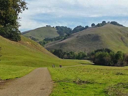
Old Briones Road
After a nice hike yesterday at Dublin Hills, I was ready to go again. Maureen was going to a training clinic at a ranch near Briones, and I thought I could go along with her and then do some hiking. She was going with her friend, Cherry, and when she told me that they would be leaving at 7 am, I decided to drive separately to avoid getting up so early. I took my time with breakfast and taking Darby for a walk, and I arrived at the Bear Creek Staging Area a little after 10. I didn't bring Darby this time because it was a Saturday and there would be lots of dogs on the trail (which there were).

The morning had started out overcast and foggy, but by the time I started hiking, it was sunny with only some distant haze. I followed the Old Briones Road up the valley, an easy walk until it started climbing to the crest of the hills. I remember when this was an unpaved public road in the 50s, before there was a park. My family drove it several times just to see what was there. In those days it didn't take much to entertain people and a Sunday drive was a popular activity. Today, there were plenty of other people out on the trail, probably with much the same idea in mind, just spending some time outdoors. Maybe things haven't changed so much after all.

The climb to the ridge wasn't too hard, and I had plenty of energy left. At the top, I passed a group of about 15 boy scouts. They looked a bit tired, and I overheard one of the dads telling them that this was a 10 mile hike and they had only done about a third of it so far. I hope they all survived it OK.

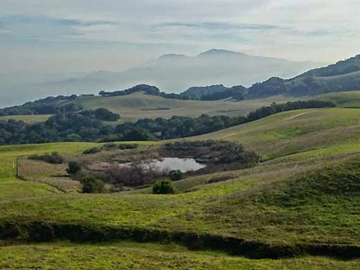
One of Sindicich Lagoons, with Mt. Diablo nearly lost in the haze
I turned left on the Briones Crest Trail and passed the two Sindicich Lagoons, weedy ponds that were partially filled from last month's rain. A couple of months ago they had been completely dry. After climbing over the shoulder of Mott Peak, the trail continued along the ridge, making a wide circle around the head of Abrigo Valley, with several mild ups and downs. There were nice views all around of distant hills. The wide trail went over a final hill and then suddenly became a narrow single-track heading quite steeply down the end of the ridge and back to the staging area.

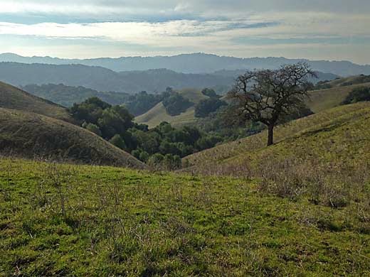
View southwest from near the west end of the Briones Crest Trail
The steep descent was a bit hard on my right knee, which hurts now and then from an old injury, but otherwise I was feeling pretty good. I drove over to the ranch where Maureen was having her clinic, and ate some lunch as I watched a group of riders learning some of the finer points of Cowboy Dressage.

5.5 miles, 1000 ft. climb


Monday, July 21, 2014

Briones 7-19-14

Diablo View Trail

It was a Saturday and Maureen was going to spend a few hours at her riding teacher's ranch practicing Western Dressage. It seemed like a good day for a hike, and if I chose someplace in that area, we could share a ride. Then she decided to ride with her friend, Marsha, but we could still come home together. My recent hikes had all been rather short ones, so I wanted to do a longer one today, just to prove to myself that I could still do it. So I decided to do a loop into the northeast part of Briones Regional Park. Briones is a fairly large park with lots of trails, so there are many different possibilities for a loop hike.

I drove north through Walnut Creek and parked in the Alhambra Creek Staging Area. I started hiking up the Diablo View Trail. The morning fog was gone and it was a beautiful day. I was soon climbing along a ridge with several ups and downs, much of it shaded by oaks. I turned right on the Spengler Trail, descending to cross a small creek and then climbing again. This part of the trail felt quite remote although it is not really far from roads and homes. Over a hill and down the other side, I came to the junction with the Blue Oak Shortcut. Up to this point I had been feeling pretty strong, but now the hike turned more serious. The trail climbs to the top of the main ridge in unrelenting steepness, gaining 700 ft. elevation in a little more than half a mile. Once I was at the top, I knew it would be mostly downhill, but I was quite tired. In planning the hike, I had thought about extending my loop further west, but now all I wanted was to get back to the car. I was also starting to be a bit concerned about the time. I didn't want Maureen to be waiting for me to drive her home. Now that I was gradually descending along grassy hilltops, I felt a bit revived, and was able to keep up a pretty good pace down into the valley of Alhambra Creek and back to the trailhead.

Even with that stretch of steep climbing, it was a very enjoyable hike. There were plenty of other people out on the trails, but for much of the way I was alone. I noticed quite a few mountain bikers, and I was glad that I wasn't one of them trying to pedal up some of those steep grades. In several places I saw unofficial single-track trails through the woods, with cyclists speeding along them. I don't imagine that the park rangers appreciate that too much. When I got to the ranch, Maureen was still riding but almost done, so my timing worked out pretty well.

6.0 miles, 1550 ft. climb


Tuesday, May 27, 2014

Briones 5-26-14

Starting up Pereira Trail
It's Memorial Day, and Maureen is going for her weekly horseback riding lesson. She suggests that I could go along and do some hiking while she rides. Her teacher, Jessica, recently moved to a ranch on Bear Creek Road near Briones Regional Park. Sounds like a good idea to me, but since her lesson lasts an hour, it would have to be a relatively short hike. Looking at the map, I noticed that the park has expanded west a bit sometime in the last 30 years and there are some trails I haven't been on yet.

I start off by finding a gate about a half mile north of the Bear Creek Entrance and park on the road shoulder. The gate is locked and there are no signs indicating that this is a legitimate entrance to the park, but I climb over the gate anyway and start up the Deer Creek Trail. The hills have just turned from green to golden in the last week or two, so there are still a few nice green patches. It is an easy walk up this little canyon, and soon I come to a trail junction. I turn left on the Pereira Trail. A right turn would have been on the Briones Crest Trail which circles the whole park. I'm soon on a ridge heading south again. I come to a trail branching right to the Ivan Dickson Memorial. I follow it to the next little hilltop where I can see that it goes down the hill a bit to some kind of stone monument. Since I have no idea who Ivan Dickson was, I didn't bother going all the way down to it. When I got home, I looked it up and found that he was a member of the Berkeley Hiking Club who cared a lot about parks and trails, and left the park district funds to establish a volunteer trail maintenance program, which has continued since his death in 1993. Sounds interesting, and maybe I'll check it out. I continued down the ridge to complete my loop, and almost to the road walked around a little pond with lots of bullfrogs jumping into the water ahead of me.

It was a nice little hike, although I would have liked to go further, but I didn't want to keep Maureen waiting.

2.0 miles, 500 ft. climb


Wednesday, August 8, 2012

5-13-12 Briones

more photos


Briones has been one of my favorite parks, but I hadn't been there in a pretty long time. I guess it seemed like a longer drive than closer parks, but it is really not so far. The weather had been cool for a couple of days, and the morning started out foggy so I didn't try to get an early start. By noon, it was starting to clear, so Darby and I drove north on 580 and through the tunnel to Orinda. I saw that traffic was barely moving in the other direction, surprising for a Sunday, so I figured that we should return on 680 instead.

We started hiking from the Bear Creek Road entrance and headed southeast on the Seaborg Trail. Late spring rains and cool weather had kept the grasses green. Usually by the middle of May they would be getting dry. The trail was a easy fire road for a mile and a half or so, then climbed about 600 feet to a ridge top. I remembered that there were nice views from Lafayette Ridge, which branches from this ridge a quarter mile south, so we walked over there. We weren't disappointed. The view is great to the east and south. Mt. Diablo, Lafayette Ridge, Las Trampas and Rocky Ridges, the town of Lafayette, and the east side of the Berkeley Hills.

After a few photos, we retraced our steps and continued north along the ridge. There was still a fair amount of climbing to do as the ridge gains a couple hundred feet of elevation. The views continue to be good, first on one side, then the other as the road winds along the crest. It was still cool and windy, but clear and sunny now. We passed several other hikers, but for much of the way we were alone.

There are a collection of small antennas at one of the high points, peak 1433. Just short of this peak, I looked to the east at the very steep chaparral covered slopes that form a natural amphitheater there. I've always remembered these slopes, because in my boy scout days, a friend and I hiked up there and found a rough path out to a shallow cave that kids had carved out of the cliff. We hung out there and enjoyed the view. The ridge continues around to the northwest in gentle ups and downs, past the high point, Briones Peak.

Another memory came back, this time of hiking up to this area with my high school girlfriend. This must have been around 1961, before Briones was open as a park. There was an old unpaved county road connecting Bear Valley to Alhambra Valley, and we had parked at the summit. When we returned from our hike, there was an guy in a truck there to chew us out for trespassing, but he let us go.

On the Old Briones Road Trail, Darby and I headed southwest down off the ridge and along the valley back to the trailhead, passing many more hikers.


6.5 mi. -- 1550 ft. up and down