Friday, October 17, 2014

Wildcat Canyon 10-17-14

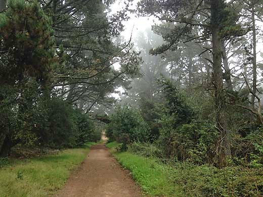
View from San Pablo Ridge Trail
I've been trying visit most of the larger regional parks, and Wildcat Canyon near Richmond was an obvious one that I hadn't got to yet. That's mostly because it is not the easiest to get to from Hayward. It's not really such a great distance, but it means passing through some of the worst traffic in the area, and I saw plenty of it this morning. I left home a little after 9 am, which I thought would miss the worst of the commute, but ran into barely moving traffic on 580 in Oakland, and got off at High Street to take my chances on surface streets. So I wound through much of Oakland and Berkeley — an interesting tour of lots of funky neighborhoods, but a slow and tedious one. Well over an hour later, I made it to the Alvarado Park Staging Area of Wildcat Regional Park.

I immediately saw that things have changed since I was here around 40 years ago. The entrance road used to continue about a mile and a half up the canyon to a parking area. Now, that road was the trail. Darby and I started off and soon turned left on the Belgum Trail. I soon passed a sign with information about the Belgum Sanitorium that once existed on this hillside. It was established in 1914 by Dr. Hendrik Belgum to treat the mentally and emotionally disturbed. It was housed in a large stucco mansion that had been built earlier. All that remain now are some foundations and some palm trees and other exotic plants. It sounds like it was a rather strange and interesting place.

The trail soon climbed high above the sanitorium site and along a ridge to a junction with the Clark-Boas Trail coming up from El Sobrante, and the San Pablo Ridge Trail. It was all open grassland with great views all around the north bay. It was a cool, mostly overcast day which was good for hiking, but up on the ridge, the cold wind was a bit too much. From the junction, the fire road headed down across the ridge, but a well-worn path led straight up a steep hill. I chose the path to avoid losing elevation, but it was a hard climb. Then, back on the fire road, there was another steep climb up a higher hill. I was slowly making my way up when I was passed by a couple of young women going much faster and making me feel old. Finally a third hill brought us to the Mezue Trail heading down a spur ridge to the right, which took us down to the Wildcat Creek Trail, where we turned right again. It would have been nice to follow a shady trail along the creek, but it stays high up the hillside with no view of the creek at all. After a while the dirt road became a wide paved road, the old access road that I remembered from years ago.

Other than the change in the road, the park was pretty much as I remembered it — steep grassy hills with nice views and little wooded canyons — much like many of the east bay parks.

5.9 miles, 1200 ft. climb


Thursday, October 2, 2014

Redwood 10-2-14

Macdonald Trail
Hot weather was forecast for today, so I thought of where I could go hiking where it might be a little cooler. I chose Redwood Regional Park, but I thought I would try some trails that I hadn't been on in many years. I wanted to hike the Macdonald Trail in Anthony Chabot Regional Park from Redwood Road to the top of the hill at Parkridge Drive, a segment of the Bay Area Ridge Trail that I had missed in my recent hikes. But I wanted to make a loop out of it, and the only way I could figure that was to walk along Skyline Blvd. for a mile or two until I could get into Redwood Park. After that I could loop around along the Dunn Trail and the west ridge, a part of Redwood that I hadn't seen in many years.

Darby and I started hiking from the Macdonald Staging Area at about 9:30 am, early enough that it was still nice and cool. Actually, it stayed relatively cool all morning, with a nice northerly breeze. The climb up the hill wasn't too hard, and soon we were up on the ridge with some nice views through the trees. We left the park at Parkridge Drive, and walked through several residential blocks to Skyline Blvd. The walk along Skyline was much nicer than you would expect on a major street through a residential neighborhood. It's a divided road with a nice path through the median shaded by big old pine trees all the way.

Skyline Blvd.
At Redwood Road, we followed it east a few feet and then followed a trail past the Skyline Ranch Equestrian Center. Soon we were at the Trudeau Center, the former site of the EBRPD headquarters, and continuing on the Dunn Trail into the park. The trail is signed for off-leash dogs, so we were on the alert for them. We passed a couple of them with no problems because the owners were considerate enough to keep their dogs under control. The trail winds in and out of a number of little ravines with some redwoods, but mostly oak and bay trees. The Baccharis Trail led to the West Ridge Trail, and then we turned off on the Toyon Trail, a single-track leading down off the ridge. I don't think I had ever been on this trail that contours along some very steep wooded slopes. At the bottom, the Golden Spike Trail took us to the Big Bear Staging Area, and then back to our car.

I was a bit tired at the end, but it didn't seem like a particularly hard hike. It felt like maybe 4 or 5 miles, so I was surprised when I looked at the GPS on my phone and it read 7.75 miles. I usually don't look at the distance on my phone until I am done hiking. That way I don't give myself any excuse to feel more tired because of how far I have come. I guess the nice weather and the lack of any really steep hills made it easier.

7.75 miles, 1300 ft. climb


Wednesday, September 17, 2014

Sunol 9-16-14

Another Tuesday morning hike. I'm thinking that I should keep trying new places — at least new to me in the last few years, so I choose Mission Peak. It seems that I have been avoiding the place because I know that it is a pretty big climb to the top, and there is not much shade on the trail. I think maybe I'm ready for it today. So Darby and I drive to the Stanford Ave. Staging area in Fremont. Most Regional Parks are nearly deserted on weekdays, so it is quite a surprise to find the parking lot completely full and all of the nearby streets all parked up for blocks around. Something must be going on that I don't know about, but I don't feel like dealing with crowds, so I change plans and we drive to Sunol Regional Wilderness.

When I got home from the hike, I looked on-line and found out about Mission Peak. It seems that sometime recently, people started posting selfies on Facebook of themselves on the peak. Now, it has become an internet phenomenon, and hundreds of people are climbing Mission Peak every day to take their selfies. They have to line up at the summit to get to the pole for their shots. It is becoming a major problem for the park district. I guess that it is good that people are getting outdoors and getting some exercise, but it has become really crazy. It seems especially crazy that while all this is going on, I can drive a few minutes over the hill to Sunol, a wilder and more beautiful place in my opinion, and be the only one on the trail all day.

Sunol was deserted when we got there except for a couple of people doing maintenance work on the Visitor Center. We started off up the Indian Joe Creek Trail, one of my favorites. It winds up a tight little canyon shaded by maples and sycamores. After a while, it climbs steeply, and passes the Indian Joe Cave Rocks, a pile of basalt boulders that are great for a bit of climbing. I pass on the scrambling, though, and just concentrate on getting myself up the trail. By this time we have gained over 1000 ft. We turned right on the Cave Rocks Road, climbed some more, and then left on the Eagle View Road to the Eagle View Trail. After crossing a steep little ravine, the single-track trail contours across a very steep brushy hillside to the Vista Grande Overlook, the high point of the hike. By this time, the day was pretty warm, and Darby and I were both beat. We enjoyed the far-reaching views for a few minutes and then started down the Vista Grande Road which follows the crest of the sharp ridge. I remembered coming down this ridge in the spring a few years ago when it was beautifully carpeted with poppies. It was quite dry and dead today. We greatly appreciated finding running water at the faucet at High Valley Camp, and continued down the Hayfield Road back to our car.

Indian Joe Creek Trail
Indian Joe Cave Rocks
On Cave Rocks Road
Eagle View Trail
 I was quite worn out and Darby appeared to be too. On days like today, when he gets home he crashes on the floor and doesn't move the rest of the day. But it was really a nice hike with changes of scenery at every turn -- shady canyons, rocks, open hills with far off views. That's why I like to keep coming back to Sunol.

5.4 miles, 1400 ft. climb


Tuesday, September 9, 2014

Sunol 9-9-14

Maguire Peaks from Loop Trail
Seems that Tuesday hikes are becoming a regular thing. Maureen's horseback riding lesson means that I generally have the day free. I hadn't been to Sunol for a while, but I wanted to do something new, so I thought of the Maguire Peaks Trail. I had hiked it about 40 years ago, but my memories of that are pretty dim now. I do remember it as being a pretty long hike, and when I looked at the map I saw that it would be about 10 miles from the park headquarters. That sounded much longer than I had the energy for, but then I looked closer and saw that the park map showed a parking symbol on Welch Creek Road. Years ago, parking was not allowed anywhere on this road, but apparently, now it was permitted. The note on the map said that a permit would be needed, available at park headquarters. Starting from this road would cut the hiking distance by nearly half, so I set out to try it.

It was foggy when I left Hayward, but over the hill it was all sunny. Luckily, the day stayed relatively cool making the hiking much more enjoyable. Welch Creek Road is a steep winding one-lane road which is a bit scary to drive, and mostly with no shoulders, but I found a place to pull off about 100 yards above the start of the trail. Darby and I started off up the trail, a fire road climbing steeply out of the canyon. We passed what appeared to be the site of a former ranch, judging from the trees that didn't belong there — eucalyptus and redwoods. The redwoods were tall dead snags, victims of a fire. We kept climbing over a ridge and down into a little valley where a road branched left, so we turned on it. It soon became a single-track trail, and I realized that we must have made a wrong turn. But there was a trail marker, so we continued on. We passed through a group of cows with young calves lying in the grass nearby, and several of the cows started bellowing and coming after us. Undoubtedly they felt that their calves were threatened. I've never been attacked by a cow, so I was not really concerned, and we just kept walking past them and soon they went back to grazing.

On the north side of the peaks
We joined the correct trail again, and continued on the fire road around the west side of the peaks. The road climbed to a ridge with a great view of Sunol Valley and San Antonio Reservoir, and we sat on a bench for a few minutes to rest. A couple of guys appeared hiking the other direction. They said that they had started at the park headquarters, a long hike, but they looked pretty fit. We continued on down across the north side of the peaks, and finally around the east side to finish the loop. I noticed in several places patches of yellow-flowered tarweed, and its distinctive sweet aroma, something that I always enjoy about this season. The climb back over the first ridge was tiring, but no too bad, and we made it back to the car in pretty good shape. I usually use the gps on my iphone when I hike, and I did use it today, but I forgot to turn it off, so it read 29 miles when I got home — not very useful. Fortunately, the park map shows mileages for the trails.

Southeast of the peaks
It turned out to be a very nice hike, and it seemed to be a good place to get away from it all. It seems that this part of the park does not get a lot of use, especially on a weekday.

5.5 miles, 1300 ft. climb.


Wednesday, September 3, 2014

Tilden 9-2-14

Seaview Trail
On the day after Labor Day, I was expecting more hot weather because the last couple of days had been quite hot, but the TV weather said it would be cooler. A hike in the Berkeley Hills where the fog tends to linger would probably be cool, so I headed for Tilden. I knew that I would likely run into lots of dogs, so I left Darby at home. It turned out to be a lot cooler than I expected.
Tilden is one of the oldest parks in the East Bay. I have fond memories of family picnics under eucalyptus trees back when I was barely able to remember anything, in the late '40s and early '50s. The park was and is filled with features like a golf course, merry-go-round, swimming area, pony rides, and a little steam train ride. Throughout the park there is stonework that was built by the CCC in the 30s. The developed areas are all along the valley of Wildcat Creek, and when you get away from the creek, up along the ridges on either side, the park is still surprisingly wild considering that it is just over the hill from Berkeley.

Driving from Hayward around mid-morning, it was all overcast, but when I got up into the hills, I found dense fog. My plan was to do a loop around the ridges around the headwaters of Wildcat Creek starting from somewhere near Lake Anza, so I parked at the Brook picnic area just below the lake. I crossed the creek and started up the Curran Trail, then turned right on the Seaview Trail. Soon I was up in the fog again, and it was a wild scene with wisps of fog racing over the ridge against the dark trees. I had forgotten what a pretty trail this is with lots of big old Monterey Pines along it. I noticed that in many places the ground was damp and muddy, and the grass bright green, surprising because most of the east bay hills are dry as a bone right now. There has been no rain, but the fog has been condensing on the trees and dripping on the ground. It is the same process that keeps the coastal Redwood forests so green.
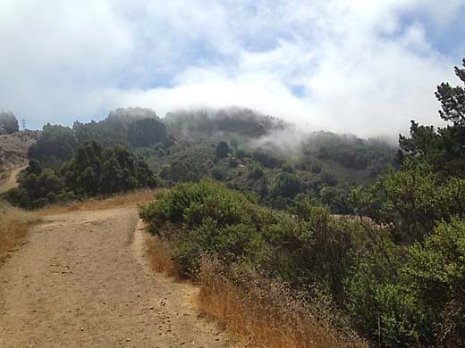
Vollmer Peak from Seaview Trail
 As I reached a high point on the ridge, the sun broke through and revealed distant views to the northeast, but the view to the west was still all fog. After dipping down a bit, the trail climbed again toward Vollmer Peak, the highest point of the Berkeley Hills. I turned right on the Vollmer Peak Trail which contoured around below the peak and then brought me down to cross South Park Drive. I didn't feel the need to reach the top. As I remember, it is just a flat area with lots of antennas. I found the gravel road leading to the Gillespie Group Camp, and a bicyclist stopped me and asked if it led to the Grizzly Peak Trail. I answered yes, and then as he disappeared down the road, I realized that with his skinny tires he wasn't a mountain biker, and he was looking for Grizzly Peak Blvd. I felt sorry for directing him down a dead-end road.

I turned off on the Grizzly Peak Trail, a single-track that climbed steeply a short distance and then leveled off along the hillside below Grizzly Peak. I was headed back to the northwest and it would be mostly downhill from here, so I coasted along at a steady pace. Fog was still hanging over the ridge so I was in and out of sun. The trail was not as scenic as the one on the other ridge, going through woods and cut through dense brush. After a while, I was looking down on the green grass of the golf course, and passing just below residences on the hill above. I was getting tired of walking and my feet were getting a bit sore. After crossing Golf Course Road, I didn't see any trail signs, so I just followed a rough path straight ahead. That turned out to be the Selby Trail, which I followed all the way down to Lake Anza, although there were a couple of unmarked road crossings that were confusing. Luckily, I guessed right every time. The lake was nearly deserted. On warm summer weekends, it can be packed with swimmers, but today there was only one. After a steep scramble down a dirt hillside below the dam, I was back at the car.

Lake Anza
 This turned out to be a very enjoyable hike. I especially liked the part along San Pablo Ridge with the blowing fog. I was surprised when I looked at the gps app on my phone and saw that I had gone more than seven miles. It didn't feel like that far. I think the cool weather had a lot to do with that. Several of my recent hikes have been considerably shorter than this one, but seemed a lot harder, and I think it was mostly because they were on hot days in the hills further east.

7.2 miles, 1550 ft. climb.


Sunday, August 17, 2014

Mt. Diablo 8-16-14

Amphitheater Trail
It was a Saturday and Maureen was doing a riding clinic all day, so I headed out for a hike. I left Darby at home because I was headed for state park land and it was going to be a hot day. My plan was to go into the Riggs Canyon area of Mount Diablo State Park, which I had visited several times before, but always from the Finley Road park entrance. A trail enters the regional park and state park at the end of Finley Road, but the nearest place you can park is the roadside 3/4 mile from the trailhead. On the map, I saw that there is a trailhead on the northeast side of the area on Morgan Territory Road. It was new to me, so I decided to check it out.

I drove up over the hill on Morgan Territory Road, and I had forgotten what a tight-knuckled road it is. For several miles it is a very steep and windy one lane with no shoulders. Luckily, I only met one on-coming car, and he backed up to a wide spot to let me pass. I passed several gates, some marked as regional park, and some private, before I came to the right one. The only sign was a fire road number, but I could see a state park trail signpost beyond the gate. There is really no place to park, but I managed to get off the pavement at a wide spot. There were no other cars around. There is a road heading to the right which is apparently the Old Finley Road, but it is signed "Private Road", so I took the straight ahead trail, the Morgan Creek Road.

The first thing I noticed was the silence. It was the kind of silence you find in the high Sierra or in the desert, but not very often in the Bay Area. As I climbed up the canyon, the second thing I noticed was the gnats. Swarms of the little buggers hovering around my face requiring nearly constant waving them away. They weren't so bad when I got out of the trees and when the breeze picked up, but they were annoying. I took the Jeremiah Creek Trail which contoured around the canyon before climbing to the top of the ridge. There were nice views west into Riggs Canyon and east to the hills of Morgan Territory. I started down into Riggs Canyon on the Old Finley Road, then turned left onto the Amphitheater Trail.

I soon came to a spot I remembered from years ago where the trail passes through a little glade with a large rock jutting out from the hillside. The curving rocky ridge above it is what they call the amphitheater. It is quite impressive, but before you know it, you are past it and back on ordinary grassy hillsides. After a while, the trail climbs steeply to the ridge top, which proved hard work for me. I was getting pretty tired and it was now quite hot. I turned left on Crestview Road, then right on Highland Ridge Road, which to my disappointment climbed a bit more until I turned left on Morgan Ridge Road. Now it was just a long descent down this grassy ridge back to the trailhead.

It turned out to be a pretty good hike, and I would have enjoyed it even more without the gnats and the heat. This must be a very little used corner of the park. When I returned to the trailhead there still were no other cars, and all day I passed only one other hiker, which is unusual for a Saturday.

4.6 miles, 1400 ft. climb


Thursday, August 7, 2014

Shell Ridge 8-6-14

on Fossil Hill Loop Trail
We had been having some unusual weather for August, several days of cool foggy days and news of flash floods in southern California. On Tuesday, the system was reaching the Bay Area, and that night we had a little rain in Hayward. By mid-morning Wednesday, everything was dry again, and I decided to go hiking at Shell Ridge. I hadn't been there in a very long time, and after hiking at Lime Ridge last week, I wanted to check out Walnut Creek's other big open space area. Shell Ridge Open Space is an even larger area than Lime Ridge and it has lots of trails. The map shows several trailheads with parking, and I chose the one at the end of Sutherland Drive, off of Walnut Blvd.

I had been debating whether to bring Darby along. I saw from the website that dogs are allowed, but wondered whether a long hike in warm weather would be good for him. I finally decided to bring him. He always wants to go with me but he doesn't know what he's getting himself into. As we started hiking, I could feel the lingering high humidity and it was already quite warm — probably in the 90's. This hike would be hard on Darby, but he was excited about going. I wasn't very concerned about running into other dogs since it was a weekday, and we passed several other hikers and runners, but only one dog, and it was no problem.

We took the first right onto the Indian Creek Trail, a single-track which followed a little dry creekbed for a mile or so. Then we were on the Briones to Mt. Diablo Trail, a fire road gradually climbing along the southwest side of the main ridge. The Borges Ranch Trail soon took us down to the Borges Ranch, an old ranch run as a living history museum and picnic area. Green grass was a welcome sight after the dry trails, and we went looking for a water faucet. We found a drinking fountain and I was letting Darby have a drink, when a park employee asked me to let him drink out of the hose instead. I guess not everyone is as casual about dog germs as I am.

on Briones to Mt. Diablo Trail
We started heading back west again on the Costanoan Trail, which kept climbing high up the hill. It was now past noon and getting hotter all the time, and we needed a couple of rest stops to make it to the top. From there it was mostly downhill, and we were able to cruise along pretty good, although we were both getting tired, and just wanted the hike to be done. I was starting to feel a bit light-headed from the heat, but maybe also from my blood pressure medication which sometimes seems to work a little too well. Back at home, we were both pretty wasted, and Darby didn't do much except lie around for the rest of the day. He's not a young dog anymore, and today's hike was probably a little too much for him, especially with the hot weather.

Except for the heat, it was a fun hike and I'll be going back there again. I like that there are a lot of small hills and valleys that bring a new views with every few steps on the trail. It's a pretty place even in this dry season, and it must be really beautiful in the springtime.

4.6 miles, 800 ft. climb