 |
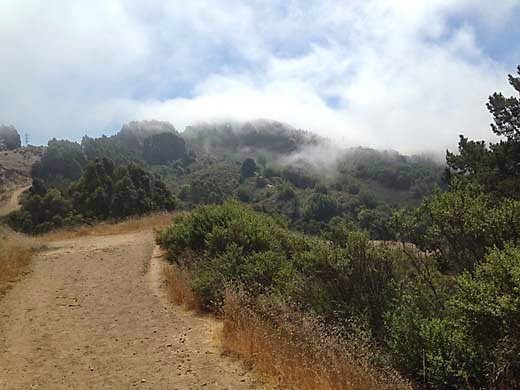
| Seaview Trail |
Tilden is one of the oldest parks in the East Bay. I have fond memories of family picnics under eucalyptus trees back when I was barely able to remember anything, in the late '40s and early '50s. The park was and is filled with features like a golf course, merry-go-round, swimming area, pony rides, and a little steam train ride. Throughout the park there is stonework that was built by the CCC in the 30s. The developed areas are all along the valley of Wildcat Creek, and when you get away from the creek, up along the ridges on either side, the park is still surprisingly wild considering that it is just over the hill from Berkeley.
Driving from Hayward around mid-morning, it was all overcast, but when I got up into the hills, I found dense fog. My plan was to do a loop around the ridges around the headwaters of Wildcat Creek starting from somewhere near Lake Anza, so I parked at the Brook picnic area just below the lake. I crossed the creek and started up the Curran Trail, then turned right on the Seaview Trail. Soon I was up in the fog again, and it was a wild scene with wisps of fog racing over the ridge against the dark trees. I had forgotten what a pretty trail this is with lots of big old Monterey Pines along it. I noticed that in many places the ground was damp and muddy, and the grass bright green, surprising because most of the east bay hills are dry as a bone right now. There has been no rain, but the fog has been condensing on the trees and dripping on the ground. It is the same process that keeps the coastal Redwood forests so green.
 |
| Vollmer Peak from Seaview Trail |
I turned off on the Grizzly Peak Trail, a single-track that climbed steeply a short distance and then leveled off along the hillside below Grizzly Peak. I was headed back to the northwest and it would be mostly downhill from here, so I coasted along at a steady pace. Fog was still hanging over the ridge so I was in and out of sun. The trail was not as scenic as the one on the other ridge, going through woods and cut through dense brush. After a while, I was looking down on the green grass of the golf course, and passing just below residences on the hill above. I was getting tired of walking and my feet were getting a bit sore. After crossing Golf Course Road, I didn't see any trail signs, so I just followed a rough path straight ahead. That turned out to be the Selby Trail, which I followed all the way down to Lake Anza, although there were a couple of unmarked road crossings that were confusing. Luckily, I guessed right every time. The lake was nearly deserted. On warm summer weekends, it can be packed with swimmers, but today there was only one. After a steep scramble down a dirt hillside below the dam, I was back at the car.
 |
| Lake Anza |
7.2 miles, 1550 ft. climb.

No comments:
Post a Comment