Saturday, May 30, 2020

Mt. Ritter - July 1986

With the current pandemic going on, I've had time on my hands, and felt like adding to my posts of past Sierra adventures. It's stuff that happened a long time ago, but the same mountains are still there, much as they were years ago.
Out of the many backpacking adventures in the Sierra over the years, one especially stands out in my memory. It was 1986 and I had done lots of weekend backpacking trips with my family and friends, and they were a lot of fun, but I was still yearning for the adventure of a challenging climb. I chose a weekend in July to try it and my goal was Mt. Lyell, the highest peak in Yosemite.

I left home after work on a Friday evening and drove into Yosemite. Around midnight, I found a place to pull off the highway and sleep in the forest. Early the next morning I was at the wilderness permit kiosk at Tuolumne Meadows, and heard stories of recent bear activity in Lyell Canyon. I didn’t like the idea of dealing with bears and decided to change my plan, and go for Mt. Ritter instead. At 13,149 ft., it is the highest peak in the whole Yosemite and Mammoth region. I had been on several trips in that area and had read John Muir’s exciting account of his climb, and for years had dreamed of doing it myself.

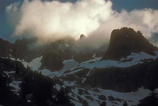
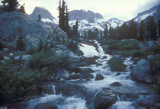
I drove over Tioga Pass to Mammoth Lakes and up to the trailhead at Agnew Meadows. I started hiking sometime in the mid-morning and made it 6 miles up to Lake Ediza in mid-afternoon. I found a secluded spot in the forest on the far side of the lake to put my sleeping bag and spent the rest of the afternoon resting and wandering around taking photos as dramatic clouds drifted over the minarets.

Mt. Ritter from Lake Ediza
Minarets in clouds
Starting up in the morning
View of Lake Ediza from below the glacier
Soon after first light in the morning, I was hiking up, following a little creek into a big snow-filled bowl at the base of Mt. Ritter and Banner Peak. I only had a rough idea of the route so I just started up over steep slabs and tufts of grass, aiming for the southeast glacier. The bottom of the glacier was moderately steep, but I felt that I could cross it with a sharp rock in my hand as a substitute for an ice axe. It’s not really a safe thing to do, but maybe better than nothing. As I climbed, it got steeper and a bit scary, but I made it off the glacier and into a gully heading up to the right. It was mostly steep, loose talus, but with no real difficulty. From the top of the gully, there was a large steep snowfield leading to the summit, but I chose to avoid it by skirting around it to the right on lots more steep talus.

Southeast glacier

View southeast from the summit
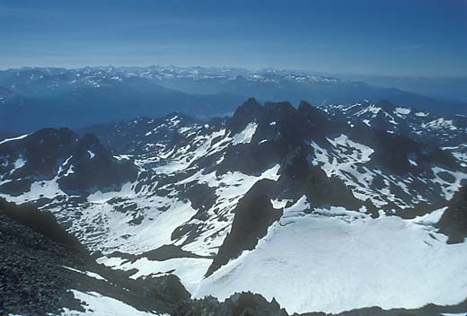
It was around noon when I arrived at the summit. After resting a bit and taking in the enormous view, I began to realize what a long way down it was and what a big job it was going to be, tired as I was. After a snack, I headed down, retracing my steps. In the gully, I slipped on a sand covered rock and scraped my hand as I fell. It was only a scratch, but a reminder that as a solo hiker, any slip could be serious. On the glacier, the snow was softer than in the morning, but still slippery, and one of my steps started to slide. I stopped myself by jamming my right heel into the snow, but in doing so, I twisted my knee and felt a sharp pain. After a couple of minutes to take stock of the situation, I felt able enough to carefully continue down. The knee still hurt, but I could walk on it. Back at my camp, I rested a bit, made a cup of coffee, and then packed up and headed down again. I made it safely back to the trailhead and a long drive home into the night.

The knee pain diminished and I soon forgot about it. I had been running fairly regularly at that time, and I continued to run nearly every day. Then in the early 90’s, my right knee began to hurt when I ran. Arthroscopic surgery showed that I had a small tear in the cartilage. I thought it was fixed, but soon the pain returned, and after a second surgery, I decided to give up running. I don’t know for sure, but I strongly suspect that it was that slip on the glacier that caused it.

Monday, February 10, 2020

Pine Canyon 2-7-20


Starting up Burma Road out of Pine Canyon
For the last few months, most of my hiking has been on the trails of Anthony Chabot Regional Park, where I am accompanied by Maureen riding our horse, Zim. He seems to like having me walking next to him and feels a bit reassured by my presence. We usually don't go more than a mile or two, but it is nice to be out there.

One Friday, Maureen had planned a long trail ride with a friend at the barn, so I decided to go out hiking by myself, and chose to start from the Macedo Ranch trailhead of Mt. Diablo State Park. It was a beautiful day and there were quite a few other hikers heading out. Everything was green and showing signs of spring coming. I went up over the hill and down into Pine Canyon, then started up the other side on Burma Road and then along the ridge. This little section of trail was new to me, and gave me some justification for this post, since most of the hike was on trails that I have written about before.

Sign at the beginning of the closed area

At the junction with the Sunset Trail, there was a sign explaining about the peregrine falcons who nest on the cliffs of Castle Rock and the closure of the area between February 1 and July 31 every year. By being here a few days into February, I had missed my chance to hike further along the ridge, but the hike was going to be long enough anyway.

I headed down the narrow Sunset Trail into a beautiful steep little canyon and then further down Pine Canyon. At the state park boundary there is a meadow with a couple of picnic tables and good views of the big rocks above. I rested here for a few minutes before turning left on the Little Yosemite Trail, a single track that climbs back out of the canyon. It was a tiring climb, but a beautiful trail.

Castle Rock

It was a harder hike than I had done it quite some time, and I was a bit stiff and sore afterwards, but it was such a nice day and very enjoyable.

5.0 miles, 1050 ft. climb


Friday, June 14, 2019

Leona Heights Park 6-14-19

York Trail
Some 40 years ago, when I was working on my book, East Bay Trails, I managed to overlook Leona Heights Park, a small Oakland city park below the Merritt College campus. I was aware of its existence, but I guess it appeared to be too small to bother with. A few years ago, I checked out Leona Canyon Regional  Park, and realized that Leona Heights was a separate park on the other side of the hill. On a nice cool Friday, Maureen was away and I was taking care of feeding our horses at the Anthony Chabot Equestrian Center. When I finished, I decided that it would be a good time for a short hike, and Leona Heights Park was nearby.

I exited highway 13 at Redwood Road, turned right onto Mountain Blvd., and after a short distance found a sign for the York Trail  I parked next to a couple of other cars on the side of the road. The trail entered a steep, narrow canyon with a nice little creek cascading over rocks in shady redwood forest. There were several footbridges crossing from one side to the other. As I continued, the trail became steeper and rougher. In many places it was barely wide enough for my feet with a near vertical drop off on the side. Other places bordered on class 3 climbing. So it is not exactly an easy trail, but worth the effort because of its beauty.

After a mile or so, the trail heads steeply up the right bank, and intersects with the McDonell Trail, a much wider and easier trail. A guy with six dogs was coming down it, and he told me that it would lead me back down to Mountain Blvd. The trail appears to be a popular one for dog walkers, and I encountered many more dogs. In the past, that would have been a major concern for me because I usually had my dog, Darby with me. He was fearful of strange dogs approaching him, and I always worried about fights, and I had to break up a few of them. Now that he is gone, I don't have to worry, but it always reminds me of how much I miss him.

View from McDonell Trail

Now out of the canyon, lots of good views open up of Oakland, the bay, and San Francisco. The trail loops back and forth in large switchbacks until it meets paved road, McDonell Ave. This one-lane road continues down through hillside homes to Mountain Blvd. A right turn and a quarter-mile walk took me back to my car.

Near the place where the trail meets the paved road is the site of the Leona Heights Sulfur Mine. I couldn't see much there, and I read that a clean-up project was started there several years ago. The mine was active from the 1890s until the 1930s, and involved tunnels into the hillside.

Another interesting feature of this park is that it contains the only old-growth redwood tree in the entire East Bay. The tree is named "Old Survivor", and it is on the steep hillside between the York Trail and the McDonell Trail. It is off the trail in dense forest, which is probably why I missed it.

This beautiful hike was a lot of fun, but don't be fooled by its short distance. It was a pretty strenuous workout because of the steepness and roughness of the trail. At least plenty strenuous for my 74-year-old body.

2.2 miles, 400 ft. climb


Wednesday, April 24, 2019

Mary Bowerman Trail 4-23-19

View northeast from summit -- North Peak and snowy Sierra
A couple of months ago I had gone up Mt. Diablo thinking of hiking the Mary Bowerman Trail, an easy three-quarter mile loop around the summit. Because it had snowed on the mountain a couple of days before, the road was closed at Juniper Camp. I thought I would walk to the summit from there, but a steep climb and an icy trail changed my mind and I turned back a little short of the top.

The Mary Bowerman Trail was built a short time after the 1977 fire which burned the whole north side of the mountain. It was originally called the "Fire Ecology Trail", and was intended to provide easy access to the area around the summit so that people could see the progress of recovery from the fire. Part of the trail on the north side is paved and provides wheelchair access to a viewing platform. I had been aware of the existence of the trail since the time of its creation, but always thought that it was too short to be worthy of a hike. These days the aging process had made short and easy a lot more desirable for me.

I drove up the mountain from the Danville side on a warm spring Tuesday morning. It being a weekday, I thought that there would be fewer bikes on the road, and there probably were, but there were enough to slow me down a bit. When I got to the top, I stopped to check out the stone summit tower. It had been many years since I had seen it and I remembered only a stairway to a viewing  platform. On a lower level, there is now a visitor center with some very nice exhibits.

I moved my car down to the lower parking area, and found the start of the trail just past the split where the road becomes divided. Contouring the steep south side of the mountain, there were some bare branches remaining from the 2013 Morgan Fire, but otherwise, everything was green and growing and already well recovered. At the base of a large rock, the Devil's Pulpit, the trail doubles back along the north side of the mountain. There were a couple of spots which were carpeted by masses of tiny pink flowers which were very pretty.

Pink flowers near Devil's Pulpit
 The trail along the shady north side soon comes to a concrete platform with several telescopes with a great view. From that point, the trail continues as a paved path until the loop is completed near the starting point. A small faded sign explains the origin of the trail with the 1977 fire, but otherwise that event is mostly forgotten and the vegetation has nearly completely regrown.

It was a short, easy hike, but quite beautiful, and it was a nice little break from life down below in the city.

0.7 miles, nearly level.


Wednesday, March 27, 2019

Morgan Territory 3-24-19


My Sunday morning was free so I went out to Morgan Territory Regional Preserve. I was thinking that it might be a good time for wildflowers, but I only found a few buttercups. The place was very green and beautiful anyway. As I started out from the Morgan Territory Road Staging Area, I remembered reading several years ago about the site of a village of the Native American people called the Volvons. It was not far outside of the park boundary, and although I didn't feel like climbing any fences today, I thought I might look around a bit. (see http://eastbayhillpeople.com/lost-city-in-the-east-bay-hills/ )

I started out heading into the southeast corner of the park. I knew that the village site was nearby but I couldn't remember exactly where. Sometimes it is nice to just wander aimlessly rather than following a planned route, and I was sort of in that kind of mood. A couple with a dog came by and stopped to look at their map. I said "maybe I should have picked up a map", and they offered to let me look at theirs, but I said "no, that's OK", and headed off the road on a narrow track across the grass. Being a little lost was not a bad feeling. The track led down toward a steep wooded ravine and I decided to turn back, circling around a little hill. There were lots of rocks around, and there right in front of me was one with a perfect round hole, an ancient bedrock mortar. There are supposed to be hundreds of them around the village site, but I was quite satisfied with finding just this one.


Still in my aimless mood, I continued along the road (the Whipsnake Trail), which turned to the southeast below an antenna crowned hill and past a stock pond. I came to a gate entering the Los Vaqueros Watershed. I didn't want to leave the regional park, so I turned back after enjoying a nice view over the distant Altamont hills.

On the hill below the antenna, there seemed to be the remains of an old road, and I thought it may be a shortcut heading north, so I followed it across the hillside. As so often happens, my shortcut came to the edge of a steep ravine blocking my way, so I headed back to the road and continued north.

I was enjoying the silence when a group of women hikers came up behind me, all talking loudly. The loudest of them was speaking an unfamiliar foreign language. Luckily, they all stopped to look at something and I was able to get ahead and regain my silence. At the Hummingbird Trail I turned left to loop around and start heading back toward the park entrance on the Volvon Trail and Condor Trail.

When I got home, I looked up more information about the Volvon village site. It sounds like if I had continued into the Los Vaqueros Watershed land on the Black Hills Trail, I would have soon come across the site. I'll go back and try that some time soon.

3.8 miles, 360 ft. climb


Tuesday, February 12, 2019

Mt Diablo 2-11-19

This winter has been one of nearly daily rain, so when another one-day break was forecast, I was ready for another hike. Only five days after my last visit to Mt. Diablo, I went back again. It had snowed again up there, so I didn't want to deal with crowds at the summit. I decided to go to the north side of the mountain where I might at least get a view of the snow covered higher peaks. I was familiar with most of the main trails from the Mitchell Canyon entrance, but I had never hiked the Mitchell Rock Trail, so that was my destination.

First I had to deal with the very inconvenient system that they have there for parking. At a gate on the in-coming road, you need to take an envelope, fill in your information on it, and deposit it with $6.00 in a slot in a post. There is no place to park nearby while you are doing that, and if you don't have exact change and a pen to write with, you are out of luck. As previously, I drove on in and parked at the visitor center hoping that someone would be there to take my money, but there wasn't, and I had to drive back out to the gate again.

It was a nice day with blue sky and lots of puffy clouds, but cold. I wore my sweatshirt and big ski jacket for the whole hike. I started up the Oak Road and found it very muddy, but by using the roadsides my boots didn't get too wet. Soon I was heading up the mountainside on the Mitchell Rock Trail and mud wasn't a problem for the rest of the way. I had to jump off the trail while several teenage bike riders zoomed by. As I rounded the mountainside, Mitchell Rock came into view, a rounded dome sticking out over the canyon. A sign listed its elevation at just over 1000 ft. I had seen that my destination, Twin Peaks, was about 1700 ft., and the prospect of another 700 ft. of climbing was not welcome.

Mitchell Rock

On the Mitchell Rock Trail
I pushed on and the beauty of the changing terrain kept my mind off the difficulty. There were lots of moss-covered rocks, patches of grassland and chaparral, and pine forest. This small area is home to Coulter Pines, a species more common in southern California, but at the edge of its range here. Some of the trees along the trail are quite large, in contrast to the smaller Gray Pines which grow all over the mountain. After a few steep rocky patches, the trail reaches the top at Twin Peaks. I didn't see two obvious peaks there, but I had noticed two rocks sticking out when viewed from the trail below. Now for the first time, I was treated to a great view across the canyons to North Peak and the summit speckled with snow. The view west across Mitchell Canyon was quite impressive too. Looking south, the ridge continued up to Eagle Peak, another 600 ft. higher, but I had had my fill of climbing for the day.

North Peak and summit from Twin Peaks
View west from Twin Peaks

I headed left down the Eagle Peak Trail, steeply descending the chaparral covered east side of the ridge. It was becoming hard on my knees, and my legs were feeling a bit shaky. Maybe I'm getting too old for this kind of thing. Finally at the bottom, I followed the Coulter Pine Trail back to the muddy Oak Trail and the parking lot.

Looking back on it now, I think this was one of the best hikes I have done in a long time. It was strenuous, but not a great distance, and the variety of terrain, vegetation, and views made it a lot of fun.

3.8 miles, 1200 ft. climb


Monday, February 11, 2019

Mt Diablo 2-6-19

It was Wednesday, and when I left my painting class around noon, there was blue sky and sun and it felt like a good chance to go for a hike after all of the rainy weather that we have been having. Now that Darby is no longer with us, I haven't been going out so much, although I still try to fit in some kind of walk every day. For many years we avoided hiking on Mt. Diablo because dogs aren't allowed on the trails, but that is no longer a concern. I thought about where to go on the mountain, and remembered that I had never been on the Mary Bowerman Trail which is a short loop around the very summit. I had known about it since its creation in the late 70s, but always thought that it would be too short to bother with.

There had been snow in the higher bay area hills on Monday night, and there would probably be some on the mountain, but I didn't really care about that. We had spent the previous weekend in a cabin on highway 4 above Arnold, and had nearly a foot of snow come down while we were there. That was enough to satisfy me for a while. Then as I drove toward Danville, I saw that there were only a few little patches of snow showing on that side of the mountain, so I didn't expect to see much.

At the South Gate, the woman at the kiosk informed me that the road was closed at Juniper Camp because of ice on the road. I drove on up, thinking that I could hike to the summit from there. When I got to Juniper, the fairly large parking area was full. I wasn't expecting crowds, but here they were. I found a wide spot to park back down the road a ways. As I started up the trail toward the summit, there was a few inches of snow in the shady areas under the trees. There were lots of people coming and going, including lots of families with small kids. As I got higher up the hillside, the crowds thinned. The afternoon sun on the snow was pretty, and many chaparral shrubs had lacy patterns of snow on their branches. There were a few spots where the trail had become dangerously icy, and it was hard to keep from slipping.

On the trail above Juniper Camp
I remembered the trail from Juniper Camp to the summit as being fairly easy, but I guess I'm not in such good shape anymore, and I was already getting pretty tired from the climb. Where the trail crosses the road near the big microwave tower, I stopped to reconsider my plan. I still had a bit more climbing to do and it was getting late in the day. I decided to just walk back down the road. It would be a longer distance but much easier walking. It was quite enjoyable walking down without worrying about the mud and ice of the trail, and looking out at the expansive views. There on the south slope of the mountain, there was very little snow, and none on the road. It was also nice to be on the road with no cars.

On the road heading back down
So the Mary Bowerman Trail will have to wait for another time. It was a nice afternoon anyway with a good walk in pretty surroundings and great views.

approximately 2.5 miles, 700 ft. climb