Friday, August 17, 2018

Past Sierra Adventures 2

Three years after that first trip, in 1976, I wanted to do something like that again. Maureen didn’t like the idea of being left at home with a two-year-old son, but she figured that maybe if she let me go for a week long trip, I would get it out of my system. My plan was to go in mid-September, take a bus to Yosemite Valley, spend seven days crossing the range, and have my mom and dad pick me up on the east side at Silver Lake. Like the previous trip, my route included enough off-trail hiking to add some adventure.

The bus ride took most of the day, with a couple hour wait for a connection in Merced. In Yosemite Valley, I got my permit and something to eat, and as it was getting dark, I found a secluded spot near Happy Isles to put my sleeping bag. I was so excited about starting out that I was up at first light and soon on the trail up out of the valley past Vernal Falls and along Illilouette Creek.

Nevada Falls
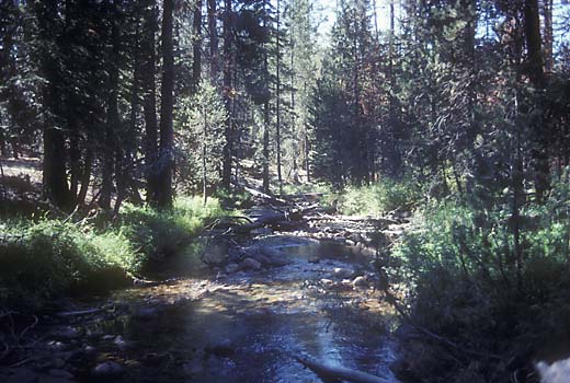
Illilouette Creek
At Ottoway Lakes trail junction
My plan had been to camp somewhere along the creek, but I was going strong and it seemed early to stop, so I kept going. I thought I could stop at Merced Pass Lakes, but after wandering around a bit I couldn’t find a lake, and there was no water around. I was very tired by now, but I needed a place with water, so I pushed on to Lower Ottoway Lake. I was in pretty good shape in those days, but after 18 miles and 6000 ft. of climbing with a heavy pack, I was about as worn out as I’ve ever been. My hips were so sore that I was having a hard time walking.
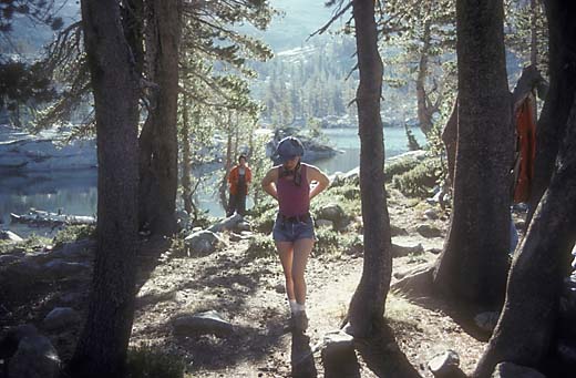
Lower Ottoway Lake and a couple of Synanon people
I soon noticed that there was a group of about a dozen people camped nearby. They were a group from Synanon, a organization that began in the 60’s to help drug addicts, and expanded in the 70’s to help people with any kind of problems. Their approach to group therapy was called “the game”, and it featured an attempt at total honesty with a lot of verbal abuse aimed at each other. A few years before, I had been in therapy for a couple of years, and for a few months, I had gone to Synanon meetings at their Oakland clubhouse, so I knew something about it. In later years, the organization fell apart in very nasty power struggles, but in the mid-70’s they were still doing pretty well. They invited me to join a “game” after dinner, so I did. They were pretty hard on each other, but they took it pretty easy on me as a guest, and I enjoyed their company.
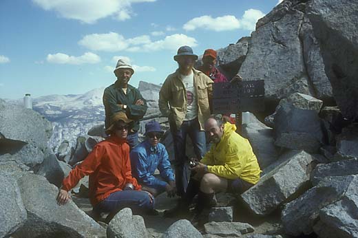
Me with some of the Synanon group at Red Peak Pass
The next morning, I hiked with several of them up to Red Peak Pass, where I said goodbye and continued on my way. Late in the afternoon, I stopped for the day in a meadow along the Triple Peak Fork of the Merced.
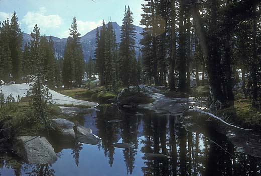
Triple Peak Fork
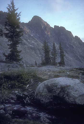
 The following day, I left the trail in the canyon of the Merced and climbed beside cascades over smooth granite to the meadows of the Lyell Fork of the Merced. It was still early in the day, but it was such a beautiful spot, and I was ahead of schedule after my 18-mile first day, so I decided to stay there. There were 360 degree high mountains, but Mount Ansel Adams dominated the view, a sharp pointed well shaped spire at the upper end of the meadows. It is not the highest peak in the area, but it was well chosen as the namesake of the photographer because it is so impressive. I spent the rest of the afternoon wandering around the meadows looking for good photos. As it got dark, I started to feel lonely and worried about bears, but none showed up.
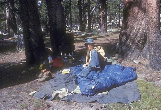
My camp at Lyell Fork of the Merced
Evening at Lyell Fork of the Merced
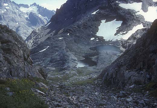
In the morning, I started off again, heading for the big unknown of my planned trip. I was going to try to cross the divide that forms the southeastern border of Yosemite just north of Electra Peak. I chose that spot because on the the topo map the contours looked a bit less dense there, and it looked like it might work. I knew that there was a passable cross country route just south of Foerster Peak, but I had always been intrigued by the basin south of Mt. Lyell, which the map showed as filled with many little lakes. I made it past several of the lakes up to lake 10702, and then headed for the divide. I found that although there were indeed a lot of lakes, it was a pretty sterile environment. I had pictured meadows and trees, but it was all barren rock.
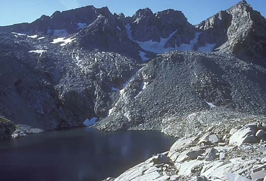
One of the lakes in the basin south of Mount Lyell
Near the top, there was some steep scree that I had to scramble quickly across to avoid sliding over a cliff edge, but I made it. The other side looked pretty scary with cliffs everywhere, but first I wanted to climb to the top of Electra Peak (12442 ft.) since it was so near. The view was awesome, especially to the southeast where the Ritter Range rose straight out of the deep canyon of the North Fork of the San Joaquin.
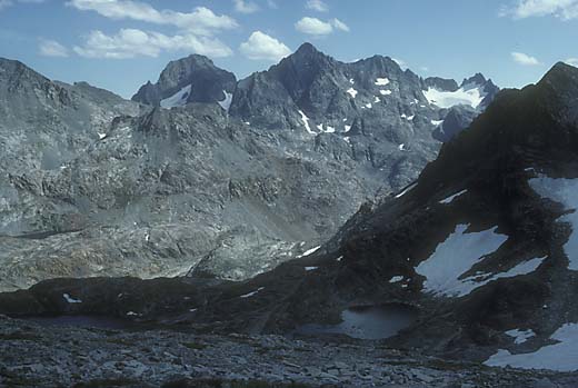
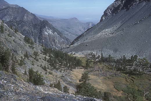
On the way down into the canyon of the North Fork of the San Joaquin
Further into the canyon of the North Fork of the San Joaquin
Then I looked for a way down to the east. At first the cliffs had looked like a solid band, but looking more closely, I noticed that at one spot big blocks of talus reached nearly to the top and I could make it down. Then there was a long slope of talus and meadow. As I walked down, I started thinking about the last few days. I began to realize that exciting as it was, this solo backpacking was also pretty lonely, and I missed having someone to talk to. My thoughts were brought back to the present when I found myself on the edge of another band of cliffs that hadn’t been visible from above. Far to the left, they looked a bit less steep, so I made a big detour and continued down. This big upper basin of the North Fork of the San Joaquin was a pretty wild, desolate place with lots of colorful rock and barren lakes. At Twin Island Lakes I looked around, and I could see a flat area a couple hundred feet below in the canyon that looked like a good campsite. I didn’t pick the best way down, and I was pretty tired, so it was a bit of a struggle. There were a few scrawny trees, but it didn’t feel like a very welcoming spot. I did appreciate the late afternoon light on the mountains above making them gold with purple shadows, which reminded me of a Maxfield Parrish painting, but soon it was just another lonely night.
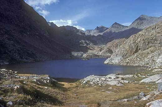
Twin Island Lakes
North Fork of the San Joaquin — 4th night's campsite
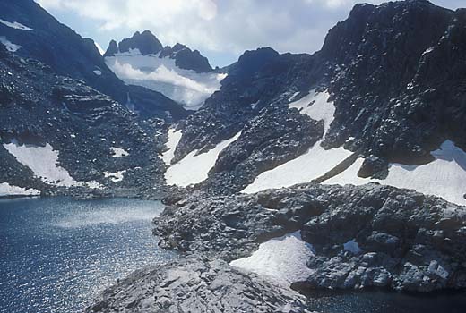
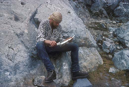
The next morning I was climbing the far side of the canyon, roughly following a cascading stream. It was steep, but there were no real problems. After a long climb I reached Ritter Lakes. It was a beautifully wild scene of bright snow, dark rock and sparkling water. It had been about four days since I had seen another human, but then as I crossed a snowbank, there were footprints. And then, as I was rounding Lake Catherine, there was a guy sitting on a rock. He looked like a larger version of myself -- mid-thirties, long blond hair and beard. He asked if I had a map, and I showed him mine. In an amazing coincidence, he had also started in Yosemite Valley, and was following a similar route. So we hiked together over North Glacier Pass and down to Thousand Island Lake, where we camped together. We talked a lot about our similar experiences and it was nice to finally have some company.

On the way up to Ritter Lakes
Ritter Lakes
Fellow Hiker at Lake Catherine
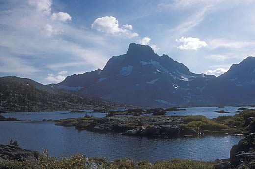
Thousand Island Lake
descending from Agnew Pass
The next morning, we made the long descent to Silver Lake, where we said goodbye, and he hitch-hiked away. I was a day early for pick-up by mom and dad, so I just hung around the general store for a few hours until evening, and then looked around for a suitable place to sleep. I found it in a clump of junipers a quarter mile or so above the road where I figured no one would bother me. The next day, mom and dad showed up as planned, and my trip was over.

It was a great trip and it satisfied my appetite for mountain adventure for quite a while. It also taught me that although solo backpacking can be fun, it was not something that I wanted to do much of again. I had always thought of myself as something of a loner, but I realized that mountain adventure was a lot more fun with friends along. In following years, I did many camping and backpacking trips with Maureen and the boys, and with other friends, and I found that although they were not as adventurous as my solo trips, they were a lot more fun.

Past Sierra Adventures 1

Lately I haven't been doing much hiking in new places to add to this blog, so I thought I would share some old memories and photos of wilderness trips of years past. Though they are not a big deal compared with the hiking and climbing that lots of people are doing these days, they were pretty exciting to me. After the years of backpacking trips with the scouts, I wondered about the possibility of backpacking by myself. Mostly I wondered whether my mind could take being alone in the wilderness for days without going nuts. I thought that maybe I could.

In 1973, I was married and we had a kid on the way, and I felt like I was soon going to be tied down forever and it was my last chance for some mountain adventure, so I planned a 3-day solo trip in the Bridgeport area. I was going to start at Twin Lakes, and do a loop around Sawtooth Ridge. It would require several miles of cross-country hiking including two high passes which were questionable. In those days, there wasn’t much information available about off-trail routes, and I had practically no climbing experience, so I wasn’t sure if my plan would work.

On a mid-July afternoon, I arived at Twin Lakes and started up the Horse Creek trail. After a mile or two, I left the trail and continued on a fairly good use-trail which led up a long talus slope. I stopped to rest in a beautiful little meadow at about 9200 ft. elevation, unpacked and walked around taking photos as the sun was setting.

View down Horse Creek from the beginning of the talus slope and a passing hiker
Meadow near first night's camp
Last stretch to Horse Creek Pass
The next morning I continued up the canyon up long talus slopes and snowfields to Horse Creek Pass at about 10700 ft. It wasn’t too hard until the last bit where the snow was steep, which made me nervous, and I scrambled around it on some steep scree. About a half mile across the head of Spiller Creek I could see Matterhorn Pass, and it looked like a problem. There was about 100 ft. of nearly vertical granite below the saddle. I began trying to climb a crack near the middle of the face, but it was too difficult and I realized how foolish it was to take chances being alone in a remote place.

Matterhorn Pass from Spiller Creek side
At the top of Matterhorn Pass
I looked around and noticed a little gully going up far to the left that might work. Luckily it did, with just a bit of scary exposure near the top. The far side was steep, but not bad, and then there was a long snowfield down into Matterhorn Canyon. Then I was back on a trail over Burro Pass. I took a long lunch break in a meadow, and then one more pass to cross, Mule Pass. There was a lot of snow, and I lost the trail several times, and very tired by now, I finally got down to Crown Lake.

Looking back to the east from near Mule Pass
descending toward Crown Lake
As I passed the lake, I stopped to talk to a couple of young guys camped there, and they invited me to come back later and smoke a joint with them. I found a campsite a bit below them, and later went back to take them up on their offer. Three of us were crowded into a tiny tent, smoking. Then one of them got out a butane stove and lit it. A flame shot out of it about 3 ft. long, and we all totally freaked out.

Back at my camp, stoned and still a bit freaked, I suddenly wondered where my wallet was. I dumped everything out of my pack and searched everywhere, but didn’t find it. I was thinking that it must have fallen out of my pack back at my lunch stop, but that was way too far to go back for it. So I went to sleep very bummed about it.

Juniper on the way down from Crown Lake
The next morning, I looked once more, and the wallet was right in the side pocket of the pack where I had put it. Maybe getting stoned in the wilderness wasn’t such a good idea. From there it was a long but easy downhill hike back to Twin Lakes. It had been a fun, successful trip and I didn’t mind being alone, although it was only a couple of nights.

Wednesday, July 4, 2018

Huckleberry 7-2-18


I had been thinking that it would be nice to do some walking in some shady woods, and the Huckleberry Preserve in the Oakland hills would be a good place for it. So on a foggy monday morning I set off on Redwood Road from Castro Valley. As I drove I remembered that along the way I would pass a trail that I had never tried, the Big Bear Loop Trail, so I stopped at the Big Bear Staging Area. The sign on the only visible trail said "to McDonald Staging Area". That's not where I wanted to go, but I followed it for a short distance and found the Big Bear Trail branching to the right. It was a steep climb up into a small ravine until the trail bent to the right and traversed the hillside through lush vegetation. After passing a water tank, the trail descended back down to Redwood Road a short distance above the parking area.

I drove on up to Skyline and followed it up to the Skyline Gate of Redwood Park. This is a very popular spot, especially with dog walkers, but luckily there were still a few places to park. I walked along with several strings of dogs on the East Ridge Trail until the Skyline Trail branched left. Going over a small hill, I saw some beautiful magenta flowers on the trail side. I don't know much about flowers, and I thought these looked like some kind of orchids, imagining that I had found something exotic. Later, at home, I showed a photo to Maureen and she told me that they were sweet peas. Not so exotic but pretty all the same. My trail crossed Pinehurst Road, and soon came to a fork. I turned right, heading lower into the canyon. After winding in and out of a couple of ravines, I came to a trail branching left heading steeply up the hillside, and I followed it. It was steep enough that in many places it climbed wooden steps. At the top, I turned left again heading back to complete my loop. All along these trails I got my fill of shady woods and lush vegetation. In many places the trail sides are walls of huckleberrys way over my head.

So I got what I was looking for -- a nice walk in beautiful woods, not too long but enough to feel like I had gotten some exercise.

Big Bear Trail:  0.5 miles, 150 ft. climb
Redwood and Huckleberry:  2.2 miles, 380 ft. climb


Wednesday, May 23, 2018

Pleasanton Ridge 5-21-18


My hiking activity has slowed down a lot in the last year or two. That's partly because age has slowed me down in general and partly because sometimes arthritis in my knee makes it painful. I try to keep active with frequent walks near home, but those wouldn't be of much interest for this blog. I've done quite a few hikes at Pleasanton Ridge, and I've always been curious about the northern half of the park, but to get there from the Foothill Staging Area would take a longer hike than I was willing to do. Then a couple of months ago, I heard that a new entrance to the park had opened further north on Foothill Road, and I wanted to check it out.

Monday, May 21, 2018 seemed like the perfect day to try it. The weather had been very cool and cloudy for a week or so, but this day began with sunshine. I drove to Pleasanton, south on Foothill Road, and then found Old Foothill Road, a narrow one-way road with parking along one side. I had no idea where the trail was and a pickup truck was backing down the road toward me, so I backed out and drove further south to the other end of Old Foothill at the Alviso Adobe. I parked there and walked up Old Foothill until I came to the Castleridge Entrance and the Courdet Trail. I expected a parking area, but the only parking was along the side of the road.

The trail started off steep, but after a quarter mile or so it became easier. Most of the trail had a fairly easy gradient, but climbs steadily for a couple of miles. The woods were beautiful with big oaks and bays and lots of ferns and wildflowers. Between the trees are views of the valley below which feels kind of like being in an airplane. I was surprised to find the trail quite busy with hikers and cyclists. It seems that local people have not wasted any time finding this spot.

I was looking forward to reaching the top of the ridge, but when I finally arrived, it felt a bit anticlimatic. The views were nice but the rolling hills of dry grass felt rather plain after all of the trees and flowers on the way up. I had thought about exploring some of the many trails branching out from that point, but the long climb had used up most of my energy. I did walk a short way both directions along the ridge just to see what was there. I was surprised to find that to the north the trail ended at a gate with a couple of large houses beyond. These must be at the top of Santos Ranch Road, a private drive that has been there for many years. The walk back down went quite pleasantly and I was soon back at the bottom.

This was really a great hike and it was easy to see why so many people were using it. I'll be likely to come back and do it again next time I feel energetic.

5.1 miles, 1100 ft. climb


Tuesday, November 1, 2016

Eden Landing 11-1-16


As a long time Hayward resident, I've spent a lot of time down at the shoreline walking around, watching the birds, and enjoying the wide open views of water and sky. My visits were always to the areas north of highway 92 which have been preserved as park land for many years. I was always curious about the miles of salt ponds and marshes on the south side of the highway which were not open to the public. I was recently reading Bay Nature Magazine and was pleased to discover that this area was now open to the public as Eden Landing Ecological Reserve.

On a Tuesday morning, I had an appointment at Kaiser, Union City, and since I had some free time after I was done, I went looking for this new area. It was also a convenient time since I didn't have my dog, Darby, with me and dogs are not allowed there. I found the small parking area at the end of Eden Landing Road, and walked along a paved road another quarter mile to an area for handicapped parking and kayak launching. I crossed a bridge and began a big loop on levees around salt ponds. It had rained the night before, but the trail was covered with sand, and there was no mud. Soon I came to a viewing area where I could see the remains of historic salt harvesting structures out in the pond. There were a lot of rows of pilings, but I couldn't guess what they had once been used for. I came to a spur trail which leads a half mile or so to a marsh viewing area, but my knee was hurting and I didn't want to add any extra walking. I figured I could come back with binoculars and a telephoto lens and maybe see some interesting birds. As it was, I enjoyed seeing big flocks of sandpipers flying in formation, swooping and turning beautifully. I also saw three big white pelicans nearby in the pond. The odors that I smelled reminded me of past visits to the shoreline. It was quite stinky, but not in a way that bothered me. As I completed the loop at the bridge, I passed a guy with a bike, the only other person out there.

In spite of the pain in my knee, it was a very enjoyable walk, very peaceful and quiet, and I plan to go back again soon.

3.7 miles, no climbing


Tuesday, September 27, 2016

Henry Coe SP 9-24-16

Monument Trail
We were spending a weekend in Morgan Hill where Maureen was participating in a horsemanship clinic with Chris Ellsworth. This clinic was all about working with cattle, and Chris is an expert, having grown up on a ranch in Wyoming. I went along to trailer a couple of horses, help out, and maybe pick up a little knowledge by watching. I find his clinics very interesting, but two full days would be more than enough, so I wanted to do some hiking too. The forecast was for increasing temperatures through the weekend, so I chose Saturday morning to hike. Henry Coe State Park is nearby, and I hadn't been there in about 30 years, so decided to check it out again. In the meantime, the park has grown a great deal, and it is the largest state park in northern California, with many square miles of wilderness. As an old guy with a sore knee, I had no hope of exploring it all. I just wanted a little taste.

I dropped Maureen off at the arena, and drove up East Dunne Ave. to the park headquarters. The road doesn't appear to have had any improvements in the last 30 years, and it felt pretty narrow and winding in my big Chevy pickup. I managed to get into a parking space in a small lot with lots of young backpackers with their gear spread all over, and went to the visitor center and asked for a recommendation for a short hike. A very nice woman ranger suggested a loop to Frog Lake and back, which appealed to me since it take me back through some of the same area I had seen years ago. These high ridges are the only place in the bay area that I know of where Ponderosa Pines grow, which makes this area rather unique.

Ponderosa Pines

My route took me on a trail up a steep hill and into the pines. It felt a bit more like the Sierra foothills than the Coast Ranges. Then there was a long downhill on a fire road. At the bottom, a sign said it was only .2 miles to Frog Lake, but I skipped that and turned right on the Flat Frog Trail. I wondered what was meant by a flat frog, but I soon got that it was the trail that was flat. The single-track winds along the hillside with hardly any change in elevation. That made it easy walking, and I was more able to relax and enjoy my surroundings. After a couple of miles, the trail came to the Manzanita Point Road. I thought I was done, but it was still another .6 miles on the Corral Trail back to the park headquarters.

View southeast from Flat Frog Trail

Even at my slow pace, it only took about 2 hours to make the loop, and I still had plenty of time to drive back down, pick up some sandwiches, and have lunch back at the horsemanship clinic. It turned out to be a very enjoyable hike. It's one I would do often if it weren't such a long drive from Hayward.

4.5 miles, 700 ft. climb

Thursday, July 21, 2016

The Preserve Trail

Now and then I look around online to see what other hikers are doing. One of my favorite sites for that is that of Bob Burd (www.snwburd.com). I've always liked being on top of a hill, but Bob carries this to a very obsessive extreme. He is the ultimate peak-bagger, spending as much time as possible climbing anything he can find. On his site, he writes interesting reports of every climb with lots of good photos. It probably contains way more information about hiking anywhere in California and the west than is available anywhere else, but to use it as an information resource may take a lot of digging. I'm always curious about blank areas on the map and his reports often satisfy that curiosity and provide a little armchair adventure.

One of his recent reports was a climb of the high point of Main Ridge, in Pleasanton Ridge Regional Park. I've been interested in this northern part of the park which I've never visited because it much too long a hike for me from the park entrance on Foothill Road. Bob chose to try a shorter approach from the northeast, which would probably mean crossing either private land or EBRPD land bank closed to the public. He didn't know which it would be but breaking rules doesn't seem to bother him much. In looking for a good starting point he happened on a staging area and small trail system near Stoneridge Mall that neither he nor I were aware of. The Preserve Staging Area is run by the city of Pleasanton, and provides a nice place to get a little exercise out in the hills.


 On a nice Thursday, I took Darby along for a drive to Pleasanton to pick up a prescription at Kaiser. When that was taken care of, I realized that the staging area was only about a block away, so why not go check it out. I hadn't really planned on doing any hiking, but there was the trail, so why not see where it led? We did a gradual climb along a grassy hillside with nice views all around. We could hear some kids playing in the creek below. Then a steeper climb and a loop around below several houses, and heading down again. Some ups and downs across a couple of ravines, and finally across the main creek at the bottom. As we did the short climb back to the staging area, we passed a couple of teenage girls leading a group of small kids. I was pleased to hear the girls explaining to the kids why they shouldn't be cutting switchbacks.

I hadn't been expecting much since the area looks pretty small on the map and it is so close to lots of development, but I was pleasantly surprised. It was a very nice little hike and I'll probably be back again sometime when I have an extra hour or so for a walk.

1.4 miles, 275 ft. climb