Between 1974 and 1981, I self-published a book called East Bay Trails, a guide to hiking trails in the East Bay, then let it go out of print. I am retired now and have more time free for hiking, and once again, I'd like to share some of what I know. This is not intended to be a guidebook. There are lots of those online and in print. My intention is simply a collection of trail experiences and thoughts that may inspire others to go out and explore.
Tuesday, October 6, 2015
Sunol 10-5-15
A week and a half after hiking at Sunol I had another free day and I decided to go back and try the Welch-Flag Hill Trail that I had noticed on the map last time. This time the weather was cooler and felt like I could handle a bit more climbing. My plan was to find some place to park on Welch Creek Road and start hiking from there. The only problem with that is that the park doesn't allow parking on the road without a permit. It's a one-lane road with no shoulders and very few places where it would even be possible to park if it were allowed. But on most weekdays the park is very lightly used and there are no rangers around, so I figured that I could probably get away with breaking the rules a bit.
First, I drove a short distance up Welch Creek Road just to check out the beginning of the trail and see if there was room to park. About a quarter mile up I saw an unmarked gate on the right. Parking looked possible but not welcoming because of a ditch and a pile of logs in the way, so I turned around and went back down to near the start of the road where there was plenty of room on the shoulder.
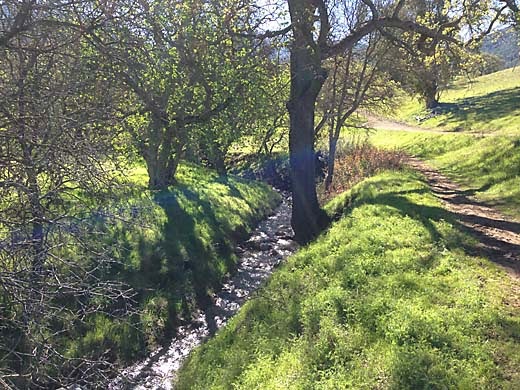
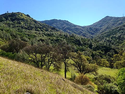
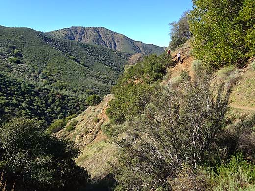
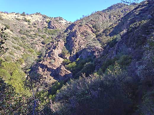
Hiking back up the road made me a bit nervous because the road is so narrow that it would be difficult to get out of the way if a car came by. Luckily, none did. Once through the gate and on the trail, I relaxed and enjoyed climbing a little oak wooded canyon. I noticed a lot of bumps and hollows along the way that were probably the result of old landslides. This whole area near the mouth of Welch Creek has some wild topography — very steep rocky hillsides rising from the valley that is the track of the Calaveras Fault. Soon the canyon opened up and then the trail climbed steeply up the nose of a ridge overlooking another steep little canyon which opens up into a valley. Soon there is a trail junction with the Flag Hill Loop Trail.
Looking back, a sign informs me that the "Welsh to Flag Hill Trail" terminates at the road and that I will have to return to Flag Hill. Obviously, they don't want people using the road as a trailhead as I did. By the way, I noticed that all of the signs along the way spelled Welsh with an "s", as in "someone from Wales", while on the map it is spelled with a "c". I turned left and continued up another steep ridge and then around the head of the valley. I came out on the ridge of Flag Hill a little below the summit, and enjoyed the big view over the central part of the park. Soon I was at the cliffs that I had seen on my previous hike, and cautiously approached the edge to take a photo. I generally like being on high places, but when it is a sheer drop off, I suddenly get very uncomfortable near the edge. I settled for a shot from a couple of feet back. The trail then continued down the ridge and back into the valley to complete a loop.
It turned to be a really nice hike with lots of interesting stuff to see along the way. If it weren't for the parking situation, I would heartily recommend it to anyone, but apparently the park district doesn't want people doing what I did today, and I wouldn't want to be responsible for getting someone into trouble for it. So I'll leave it up to you what to do with the information.
3.6 miles, 1000 ft. climb
Friday, October 2, 2015
Sunol 9-25-15
I was feeling rather aimless as I set out for a hike with Darby. We drove to Sunol without any plan and when we got there I looked at the map and noticed a trail that I don't remember seeing there before, the Flag Hill Loop Trail. We started off in that direction, but the day was pretty warm and my energy level was rather low, and wasn't too sure I felt like climbing all the way up Flag Hill. So when the trail began heading uphill away from the creek, I noticed that a well worn path continued along the creek. I thought we would follow it a short ways to see where it went. I was surprised to find that it just kept going. After a mile or so, I figured that it probably went all the way to Welch Creek Road, but then an old overgrown ranch road branched up the hill to the right, so I decided to check that out instead. It curved back along a bench a couple hundred feet above the creek, so we kept following it. The west face of Flag Hill was above us with some quite impressive cliffs at the top, cliffs that aren't visible from the main part of the park. The road finally dwindled away to nothing, but we soon found a gate that led to the Flag Hill Trail which we followed down to our starting point.
It was enough of a hike for a low-energy hot day, and it was interesting to see an unfamiliar corner of the park. The trail along the creek appeared to be quite well traveled, especially by horses, and I don't know why the park district doesn't show it on their maps. Maybe they don't want people disturbing the cattle, although much of the rest of the park is used for grazing as well. While hiking, I thought that we may have gone beyond the park boundaries, but the map shows that it is all park land. The Flag Hill Loop Trail will have to wait for another time, and I also noticed another unfamiliar trail on the map, the Welch-Flag Hill Trail. Perhaps I can combine them both in a future hike.
2.9 miles, 550 ft. climb
Thursday, August 6, 2015
Brushy Peak 8-6-15
Brushy Peak Regional Preserve is a nice little open space area conveniently located a short distance north of 580 in Livermore. I had visited it once several years ago, and I wanted to take another look at it. I knew that it was a place without much shade that could be quite uncomfortable in mid-summer heat, so I waited for a day that promised to be a bit cooler.
Darby and I started out from the staging area on the West Side Loop Trail, obeying the sign and keeping him on a leash. The sky was mostly overcast, and it was only a little bit warm, but the humidity was high and I was soon dripping with sweat as I was climbing up this little valley. Near the head of the valley, a large house on a hilltop nearby reminded me that this is not exactly wilderness. After a considerable climb, the trail cuts across the south slope of the peak just a few hundred feet below the top. The actual peak is an area held sacred by local native americans, and access is limited to those with tour reservations. I didn't feel like climbing any higher anyway. This area just below the peak is quite interesting with scattered oak trees and lots of sandstone outcroppings, not at all like the treeless lower hills.
As I began to descend the other side, there were nice views to the southeast of hills lined with wind generators. Further down, I passed not far below a line of generators, and was surprised that they made a considerable amount of noise in an otherwise very quiet place. Finally, another dry little valley took us back to the staging area. It had been a good hike in an interesting place and just about right for Darby and I, who are both getting older and don't like to get too worn out.
4.6 miles, 800 ft. climb
Monday, July 27, 2015
Las Trampas 7-27-15
It's been a while since I posted anything here, but that's mostly because I've been hiking trails that I have already covered. I've already written about most of the places within easy driving distance, and I usually don't feel like driving very far when there are so many good trails nearby. Recently, I noticed in an e-mail newsletter from EBRPD that a new addition to Las Trampas had been opened to the public, so I went there today to check it out. The Ellsworthy Staging Area is off of Ellsworthy Circle in the new Quail Ridge development along San Ramon Valley Blvd. between Danville and San Ramon.
I arrived there mid-morning to find that the development was still being built and the streets were nearly blocked by construction activity and trucks. I found the short road up the hill to the staging area, but workers were digging up the asphalt there making it impossible to get through. I found a place to park on the street. It was signed "guest parking only", but I figured that it was unlikely that anyone would come by on a Monday morning to check my guest status. After winding up the hill a short distance, I found the small staging area. Of course it was empty since driving access was blocked.
The first half mile or so of trail is on an easement through private land, but it's just like any other park trail -- a dirt road gently climbing across rolling grassland. Soon the climbing is not so gentle, and it heads nearly straight up the very steep wooded hillside. It was a nice place but the roar of traffic on 680 below made it not so peaceful. After a lot of hard work, I reached the top of the ridge with good views all around. After some more climbing to the top of a hill, I could see where the road continued along the grassy ridge to the northwest to meet the trail coming up from the Remington park entrance, a trail that I had hiked a couple of years ago. I figured that since I could see the connection and it looked just like the trail I was already on, I didn't need to hike all the way over there, so I turned around and started back down.
Going down, it seemed even steeper than coming up. It took a lot of effort to keep from sliding on the steep dirt, and my knees and feet got pretty sore. I was glad to be finishing up around noon because it was becoming a warm day.
2.7 miles, 950 ft. climb
Monday, March 9, 2015
Round Valley 3-7-15
Perfect time of year to be out on the trails. The weather is perfect, the hills are all green, wildflowers are coming out, what more could you want? It's a Saturday, a good day to leave Darby at home, so I chose a place where dogs are not allowed, Round Valley. The only other time I hiked there, last spring, I stayed mostly on the level valley floor, but this time I hiked up over a big hill.
I arrived at the parking lot around 11, and it was full of cars, so I knew that there would be lots of other people on the trails. The Hardy Canyon Trail branches left just across the bridge from the parking lot. The bridge crosses Marsh Creek, which was flowing pretty good. The other, smaller creeks that I would pass today would be all dry. Around the hillside a ways, the trail heads up a small canyon. The dry creek bed is filled with sandstone ledges and boulders and the steep banks are shaded by oaks, with lots of buttercups in the grass. It's a very pretty hike, climbing, but not too steep. After a mile or so, the canyon opens up into a big grassy bowl, and finally at the top there is suddenly a great view down into Round Valley to the west.
I sat down for a few moments for some water and a granola bar and enjoyed the view. I was afraid that the descent would be painfully steep, but it wasn't bad at all. On the way there are some interesting sandstone cliffs with a few caves. After a long way down, I was on the valley floor and following Round Valley Creek back to the parking lot.
This was really a nice hike, one of my best in a long time. I thought that by choosing a trail that went up a big hill, maybe there would be fewer people, but I had plenty of company. I didn't really mind. In fact it was kind of interesting to evesdrop on bits of conversation as people walked past.
4.8 miles, 1100 ft. climb
![]() |
| Marsh Creek near park entrance |
![]() |
| Hardy Canyon Trail |
![]() |
| Starting down toward Round Valley from the top |
This was really a nice hike, one of my best in a long time. I thought that by choosing a trail that went up a big hill, maybe there would be fewer people, but I had plenty of company. I didn't really mind. In fact it was kind of interesting to evesdrop on bits of conversation as people walked past.
4.8 miles, 1100 ft. climb
Sunday, February 15, 2015
Mt. Diablo 2-14-15
It sure makes you wonder about climate change when here it is Valentine's Day and we're having sunny weather in the 70's. But I may as well make the best of it and go for a hike. Since it's a Saturday, and I don't like to take Darby out on weekends because there are so many other dogs on the trails, I decide to leave him at home and go to Mt. Diablo where dogs are forbidden on trails. I had been thinking about hiking the Falls Trail for some time, but without rain there wouldn't be any falls. Finally, there was a major storm last weekend, so I figured that today there would be water in the creeks. I saw on the map that there was a park entrance in Clayton at the bottom of Donner Canyon, one that I had never used, but since no parking was indicated, I wasn't sure what to expect.
I got to Regency Drive off from Marsh Creek Road at around 11, and found that the street was parked up for about a quarter mile from the trailhead. I would have plenty of company on the trail. But it was a beautiful day and the sun was sparkling on the water of Donner Creek as I started up the trail. It is really a pretty creek splashing over rocks with green grass and oak trees coming right down to the banks.
Soon I noticed up ahead a group of people with a dog. I was mildly annoyed because park rules don't allow dogs on trails, but I wasn't going to say anything to them. Then up the trail comes a ranger on an ATV who stops and gives the people a ticket. It felt like a guilty pleasure to watch that happening.
I turned left onto the Hetherington Trail, a single-track along the east side of the creek. The trail crossed the creek again and I was able to step across the rocks, but then it crossed back again, and I had the choice of stepping between two big rocks covered with slippery moss, or a long jump. I chose the jump, feeling pretty sure that I could make it. Once again, I found that I am not as agile as I once was and came up about a foot short with my jump and got a wet foot.
Now the trail was climbing the hillside east of the creek through oaks and meadows. On the Wasserman Trail, I kept climbing as the hillside became more rugged. I came upon a group of about 5 people on horseback who managed to get their horses off to the side of the narrow trail to let me pass. I was thinking that this trail was a bit steep and rugged for our horses.
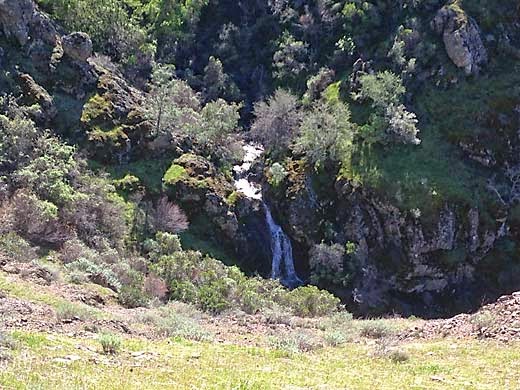
After going down the Cardinet Oaks Road for a short distance, I finally turned off onto the Falls Trail which cuts across the west face of North Peak. As I passed a couple around my age, the woman said "You have to be a mountain goat for this trail". I would have to agree. It is very narrow, steep and rocky in many places, and a slip could mean a long fall and serious injury. As the trail bent into Wild Oat Canyon, the first couple of falls came into view. They are not large falls -- maybe around 20 ft. high -- but their setting is spectacular. All around the head of Donner Canyon, very steep ravines converge far below, a vertical world of rock, brush and trees. I noticed many spring wildflowers that I didn't expect so early in the season, and shady hillsides thick with moss and maidenhair ferns. As the trail dropped down around the head of the canyon, I noticed several picturesque junipers, making it feel like it was much higher in the mountains.
Descending the west side of the canyon, with views across to where I had just been, I realized that I was pretty tired. This was a harder hike than I expected. Looking at the map beforehand, it didn't look like much. I tried to remember the only other time I hiked the trail, about 25 years ago, but I could't remember much. What I do remember is that it was a while after my first knee surgery, and my knee was hurting during the hike. I was trying to do too much too soon after surgery, and I ended up needing a second arthroscopic surgery a year or so later. Back on the Donner Canyon Road, the walking became easier, and I began thinking about food and drink. I hadn't brought any lunch and it was nearing 2 pm. I would stop and get some fast food on the way home.
It had been a really good hike. It was a bit hard, but there were so many beautiful spots to see. Now I understand why the Falls Trail shows up on a lot of lists of best Bay Area hikes. It is really a spectacular place. It could use some trail maintenance, however. On the trail, I passed a guy who commented on that, wondering aloud if there was some kind of volunteer trail crew that he could join to help with it. I just checked, and it appears that the Save Mt. Diablo organization does some of that, and I hope that this trail will get some of their attention.
6.2 miles, 1400 ft. climb
I got to Regency Drive off from Marsh Creek Road at around 11, and found that the street was parked up for about a quarter mile from the trailhead. I would have plenty of company on the trail. But it was a beautiful day and the sun was sparkling on the water of Donner Creek as I started up the trail. It is really a pretty creek splashing over rocks with green grass and oak trees coming right down to the banks.
![]() |
| Near trailhead on Donner Canyon Road |
![]() |
| Donner Canyon Road |
![]() |
| Wasserman Trail |
After going down the Cardinet Oaks Road for a short distance, I finally turned off onto the Falls Trail which cuts across the west face of North Peak. As I passed a couple around my age, the woman said "You have to be a mountain goat for this trail". I would have to agree. It is very narrow, steep and rocky in many places, and a slip could mean a long fall and serious injury. As the trail bent into Wild Oat Canyon, the first couple of falls came into view. They are not large falls -- maybe around 20 ft. high -- but their setting is spectacular. All around the head of Donner Canyon, very steep ravines converge far below, a vertical world of rock, brush and trees. I noticed many spring wildflowers that I didn't expect so early in the season, and shady hillsides thick with moss and maidenhair ferns. As the trail dropped down around the head of the canyon, I noticed several picturesque junipers, making it feel like it was much higher in the mountains.
![]() |
| Falls Trail |
![]() |
| One of the falls |
![]() |
| View from Falls Trail |
![]() |
| Indian Warrior |
6.2 miles, 1400 ft. climb
Sunday, February 1, 2015
Sunol 1-30-15
![]() |
| on the McCorkle Trail |
The last time I hiked to the Little Yosemite area, the road along Alameda Creek was closed because of construction work on the Calaveras Dam. As today was a Friday, there was no one at the Visitor Center to ask, so I assumed that the road was still closed and we started out on the Canyon View Trail instead. Looking at the park map, I see that this trail is described as having a "gentle rise in elevation". It is true that it only climbs a few hundred feet, but the first part of the trail is uncomfortably steep before it levels off along the hillside. At the Cerro Este Road which leads down to Little Yosemite, we crossed it and continued on the Canyon View Trail, which joins the Camp Ohlone Road a little further on. It was great weather for hiking -- a little cool but clear and sunny. I noticed lots of woodpeckers flitting about in the oak trees. The hills were still nice and green, but just starting to look a bit dry again after a month of no rain. The creek was still running pretty good from the December rains. Above Little Yosemite, the creekbed is a lovely wide area of gravel and big old sycamores.
We turned left on the Backpack Road which climbs up into a pretty little valley with a large rugged rock jutting out of its center. Then we turned left on the McCorkle Trail which gradually climbs around the head of the valley and across the hillside. I was thinking that this would be a nice area to be spending the night in a backpacking camp. I've never camped here, but maybe someday I could talk my grandkids into it. Finally, I reached the junction with the Cerro Este Road. Last time I came this way, I continued up over the ridge at Cerro Este, but today I felt like I had had enough climbing. Besides, the sun was getting low, and I wanted to head for home.
At this point, I got a bit confused, and wished I had a park map with me. I didn't bring one with me because I figured I knew all of these trails by heart, but sometimes my memory isn't as good as I think it is. I knew that there was an old road that headed down this ridge to the west, but I wasn't sure just where it was. I knew about this road because I remember hiking on it the first time I ever came to Sunol. That was in the mid-50s before there was a park here. My uncle, John Bruce, a biology teacher as San Ramon Valley High School, had heard about the future park, and took our families out here to check it out. We hiked way up this ridge and enjoyed the views. I remember finding a tarantula along the way.
![]() |
| off-trail on the ridge |
It was a very good hike -- beautiful place, beautiful weather, and not really too hard.
6.1 miles, 1600 ft. climb
Subscribe to:
Posts (Atom)