Sunday, February 1, 2015

Sunol 1-30-15

on the McCorkle Trail
The day started out foggy, but by noon it was beautifully clear and sunny, so after lunch, Darby and I headed to Sunol. My idea was to hike something like the route I took about 3 years ago when we got soaked by a rainstorm that started halfway through the hike. I've been trying to avoid duplication of trails in this blog, but finding new ones without a long drive is getting harder to do. So, although I've already covered most of this route, I'm just going to do it again because it is one of my favorite places. The part that I especially wanted to see was the eastern area of the park -- the backpacking camps and the McCorkle Trail.

The last time I hiked to the Little Yosemite area, the road along Alameda Creek was closed because of construction work on the Calaveras Dam. As today was a Friday, there was no one at the Visitor Center to ask, so I assumed that the road was still closed and we started out on the Canyon View Trail instead. Looking at the park map, I see that this trail is described as having a "gentle rise in elevation". It is true that it only climbs a few hundred feet, but the first part of the trail is uncomfortably steep before it levels off along the hillside. At the Cerro Este Road which leads down to Little Yosemite, we crossed it and continued on the Canyon View Trail, which joins the Camp Ohlone Road a little further on. It was great weather for hiking -- a little cool but clear and sunny. I noticed lots of woodpeckers flitting about in the oak trees. The hills were still nice and green, but just starting to look a bit dry again after a month of no rain. The creek was still running pretty good from the December rains. Above Little Yosemite, the creekbed is a lovely wide area of gravel and big old sycamores.

We turned left on the Backpack Road which climbs up into a pretty little valley with a large rugged rock jutting out of its center. Then we turned left on the McCorkle Trail which gradually climbs around the head of the valley and across the hillside. I was thinking that this would be a nice area to be spending the night in a backpacking camp. I've never camped here, but maybe someday I could talk my grandkids into it. Finally, I reached the junction with the Cerro Este Road. Last time I came this way, I continued up over the ridge at Cerro Este, but today I felt like I had had enough climbing. Besides, the sun was getting low, and I wanted to head for home.

At this point, I got a bit confused, and wished I had a park map with me. I didn't bring one with me because I figured I knew all of these trails by heart, but sometimes my memory isn't as good as I think it is. I knew that there was an old road that headed down this ridge to the west, but I wasn't sure just where it was. I knew about this road because I remember hiking on it the first time I ever came to Sunol. That was in the mid-50s before there was a park here. My uncle, John Bruce, a biology teacher as San Ramon Valley High School, had heard about the future park, and took our families out here to check it out. We hiked way up this ridge and enjoyed the views. I remember finding a tarantula along the way.

off-trail on the ridge
I probably should have turned left on the Cerro Este Road, but instead I headed cross-country over the brow of the ridge. The hillside became very steep for a long way down, and I had to step carefully to keep from slipping down. It seems that I'm not as agile as I once was. We finally came to the road and from there it was much easier going back to the Canyon View Trail. Later, at home, I was still curious about the road down the ridge that I remembered. The park map doesn't show anything there, but the USGS topo does, and a faint track shows up on satellite photos. I guess my memory is not as bad as I thought, but somehow I lost it. I think it was because there were a few cattle there and we swung wide around to avoid distrubing them.

It was a very good hike -- beautiful place, beautiful weather, and not really too hard.

6.1 miles, 1600 ft. climb


Sunday, January 11, 2015

Briones 1-10-15

Old Briones Road
After a nice hike yesterday at Dublin Hills, I was ready to go again. Maureen was going to a training clinic at a ranch near Briones, and I thought I could go along with her and then do some hiking. She was going with her friend, Cherry, and when she told me that they would be leaving at 7 am, I decided to drive separately to avoid getting up so early. I took my time with breakfast and taking Darby for a walk, and I arrived at the Bear Creek Staging Area a little after 10. I didn't bring Darby this time because it was a Saturday and there would be lots of dogs on the trail (which there were).

The morning had started out overcast and foggy, but by the time I started hiking, it was sunny with only some distant haze. I followed the Old Briones Road up the valley, an easy walk until it started climbing to the crest of the hills. I remember when this was an unpaved public road in the 50s, before there was a park. My family drove it several times just to see what was there. In those days it didn't take much to entertain people and a Sunday drive was a popular activity. Today, there were plenty of other people out on the trail, probably with much the same idea in mind, just spending some time outdoors. Maybe things haven't changed so much after all.

The climb to the ridge wasn't too hard, and I had plenty of energy left. At the top, I passed a group of about 15 boy scouts. They looked a bit tired, and I overheard one of the dads telling them that this was a 10 mile hike and they had only done about a third of it so far. I hope they all survived it OK.

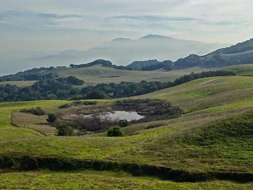
One of Sindicich Lagoons, with Mt. Diablo nearly lost in the haze
I turned left on the Briones Crest Trail and passed the two Sindicich Lagoons, weedy ponds that were partially filled from last month's rain. A couple of months ago they had been completely dry. After climbing over the shoulder of Mott Peak, the trail continued along the ridge, making a wide circle around the head of Abrigo Valley, with several mild ups and downs. There were nice views all around of distant hills. The wide trail went over a final hill and then suddenly became a narrow single-track heading quite steeply down the end of the ridge and back to the staging area.

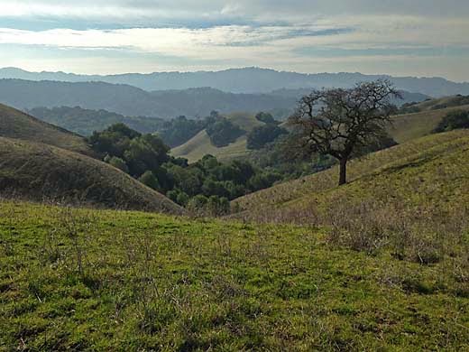
View southwest from near the west end of the Briones Crest Trail
The steep descent was a bit hard on my right knee, which hurts now and then from an old injury, but otherwise I was feeling pretty good. I drove over to the ranch where Maureen was having her clinic, and ate some lunch as I watched a group of riders learning some of the finer points of Cowboy Dressage.

5.5 miles, 1000 ft. climb


Friday, January 9, 2015

Dublin Hills 1-9-15


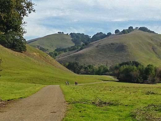
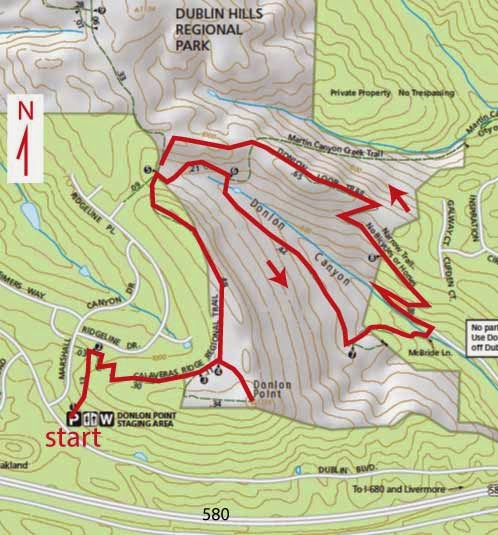
It seemed time to get back into hiking after all the holiday stuff and a very persistent cold. Besides, there were a lot of rainy days in December. I did get out for a few walks but only in nearby places that I have already written about. Today, I wanted to keep it fairly easy, so I decided to go back to Dublin Hills, a place that I first checked out a couple of years ago. On the map, I saw the possibility of a loop down into Donlon Canyon, a somewhat different route than last time, when I stayed along the ridge.

 It was a bit cool and overcast as Darby and I started out from the Donlon Point Staging Area. Last time we skipped a side trip to Donlon Point, so today, we walked the quarter mile or so to the hilltop, and found it worth the extra effort. There are great views in all directions, but especially to the south, where beautiful rolling ridges extend beyond the 580 freeway directly below. The partial overcast and hazy valleys made for quite picturesque views. As we walked north along the ridge above the rows of fairly new houses, there were lots of bluebirds flitting around ahead of us.

After a mile along the ridge, we turned right, heading past a stock pond surrounded by cattle and down into Donlon Canyon. After a gradual descent, the trail steepens through trees to the bottom. There, suddenly a condo development appears, and we walk through it for a block or so until the trail heads back up the other side of the canyon, passing a flood control pond. It's a fairly steep climb up the side of the canyon, but it didn't seem very hard, and then we were following a spur back toward the main ridge. The trail heads back down to the stock pond, but we continued along the spur passing some interesting sandstone outcroppings to complete our loop. The sun began to come out and create some dramatic scenes of light and shadow on the hills as we finished our walk.

It turned out to be just about what I had hoped for -- a nice walk with plenty of variety, good views, and not too difficult. It would be nice if the housing development was not so near, but for much of the way it was out of sight, and there was plenty of nature to see.

4.1 miles, 850 ft. climb


Monday, November 10, 2014

Mt. Diablo 11-8-14

It has been great hiking weather lately, cool and clear, and I've been taking advantage of it. On Friday, Darby and I did a nice hike at Las Trampas, a beautiful loop on Las Trampas Ridge, all on trails that I have previously written about here, so no point in writing more about them. Usually on the day after a good hike, I'm feeling like taking it easy, but on Saturday morning I felt like going out for another one. I thought that it was about time to visit Mt. Diablo again, so I left Darby at home. I wanted to see some of the rugged north side of the mountain, which I especially like, but don't visit often because of the longer drive.

I arrived at the Mitchell Canyon Staging area around mid-morning and was confronted with the problem of paying for parking. I didn't want to block the road while I tried to figure out the payment system and there were "no parking" signs all around, so I went on into the parking lot and into the visitor center. I thought for sure I could pay there, but I was told that I would have to go back to the entrance road, quite a distance away. So I went back and put my envelope with my payment into the slot, then back to the parking lot. I looked around for a ranger so I could complain about their stupid, inconvenient system, but didn't see one, so I just started hiking on the Mitchell Canyon Trail.

I remember Mitchell Canyon from when I was a kid in the 50's, and went to a big picnic at a park there. Our neighborhood in Lafayette used to get together for a picnic every summer and it was a great time for us kids because we all knew each other. I doubt that there are many neighborhoods today with such a sense of community, but it was a place where lots of young families had moved into new homes about the same time, and the kids quickly made friends. At the picnic, one of the older boys, a teenager, decided to climb Eagle Peak, and set off up the steep slope. Several hours later he was back, and I was so impressed that he had done it. Looking up at that rugged mountainside today, it's still hard to believe.

As I hiked up the canyon today, I kept looking for some sign of the picnic area, but didn't see any. In the 50's, none of the north side of the mountain was part of the state park, and the picnic site was a private park. On the USGS topographic map of the area which is dated 1953, there is a dashed rectangle marked "park" a couple of miles into the canyon. That must be the place.

Mitchell Canyon

The canyon was very pretty today, with lots of fall color, and I was enjoying the easy, mostly level trail the first couple of miles. Then the fire road begins to climb and just keeps on climbing. I remember this part of the trail from another time when I was a kid. My scout troop hiked up the mountain with full packs as training for a Sierra backpacking trip. It was a 100 degree day in early summer, and it made me pretty sick, but somehow, I made it up the mountain. Looking back on it now, it seems pretty careless that our leaders would make us do something that dangerous to our health. Today, the cool weather and lack of a pack made it a much nicer hike, but it was still pretty hard work and it seemed to take forever before the trail leveled out at Deer Flat. I was pretty well soaked with sweat when I got there.

Climbing to Deer Flat

I turned left at the trail junction, descended to cross a little dry creek, and then there was more climbing to Murchio Gap. I was tired, but still really enjoying this part of the mountain. It's a beautiful area that feels especially wild and remote. It's a patchwork of oak woodland, grassland, dense stands of manzanita and many rocky outcrops. Although it takes some hard hiking to get there, it was a popular place on a nice Saturday. I passed a couple of older people like me, but most of the other hikers were young and fit looking. Even though there were plenty of other hikers, it didn't feel at all crowded because it is such a big area.

Murchio Gap

From my high point at Murchio Gap, I started down the Back Creek Trail, which begins a steep descent on a rough single-track trail cut through thickets of manzanita. There would have been some great views if it were not for the brush which was well over my head. The footing was a bit tricky on the steep trail with lots of loose rock. I was quickly losing elevation and noticed that the manzanita had changed to Chamise, but it was still over my head. At Murchio Gap, I had been about level with Eagle Peak, but now its rugged cliffs were high above me. The downhill steepness didn't let up and my legs were starting to feel kind of rubbery. I had to concentrate on going slow and stepping carefully to avoid a fall. Finally, as the trail neared the dry creek bed, the slope began to lessen and the walking became easier.

Eagle Peak from Back Creek Trail

As I passed the junction with the Meridian Point Trail, I remembered another time on the mountain. In the early 70's, when I was working on my book, I joined a group of volunteer trail builders and spent a day working in Back Canyon. I don't remember much about it, but knowing that I had played a part in this trail being here felt pretty good. At that time the Meridian Point Trail was the only way up out of the canyon, and the trail up to Murchio Gap had not been built. As the trail came out of the canyon into gentler slopes, I took the Coulter Pine Trail across the grassy hillside back to the staging area.

It was a really enjoyable hike and I saw a lot of interesting and beautiful country, but I was pretty well worn out at the end. I got in the car and started driving home when I began to feel a bit light-headed. The feeling passed after a few minutes, but next time I finish a long hike, I will rest a while before driving.

7.5 miles, 2100 ft. climb


Tuesday, November 4, 2014

Garin 10-28-14

High Ridge Loop Trail

It's a beautiful cool, clear fall day, perfect for a hike. I don't feel like driving very far, so Darby and I go to Garin. I chose to start from the staging area near Mission Blvd. and Whipple Road in Union City, but we could just as well have started from the park's main entrance at the end of Garin Ave.

We started off up the little valley of Dry Creek's north fork. I've always especially liked this stretch of trail along the meandering creek with lots of big old sycamores. After a mile and a half, we came to Jordan Pond, where a couple of people were fishing. In the picnic area near the main entrance, we turned right and headed up the hill. After climbing about 500 ft., the trail bends to the southeast and continues gently climbing along the ridge. All along this ridge there are great views out across the bay. A side trail takes you a quarter mile to the Gossip Rock, some oak-shaded sandstone with depressions where native americans ground acorns. It's an interesting place, but we skipped it this time. The trail then descends steeply into a little canyon and back to the starting point.

This loop is one of my favorite hikes because it gives you a taste of several types of terrain -- a lovely creek, a high open ridge, and a shady little canyon. Until I got back home and looked it up, I couldn't remember whether I had covered it in this blog. I found that three years ago I had covered a shorter loop via the Pioneer Trail, but not this one. Then I remembered that hiking that shorter loop was not at all easy for me. I was not feeling very good and had to stop to rest several times. On today's hike, I went slow on the hills, but didn't stop, and I felt pretty good all the way. It made me realize that my bypass surgery really did make a difference, and that I am able to do a lot more now than I could before.

6.0 miles, 1200 ft. climb


Friday, October 17, 2014

Wildcat Canyon 10-17-14

View from San Pablo Ridge Trail
I've been trying visit most of the larger regional parks, and Wildcat Canyon near Richmond was an obvious one that I hadn't got to yet. That's mostly because it is not the easiest to get to from Hayward. It's not really such a great distance, but it means passing through some of the worst traffic in the area, and I saw plenty of it this morning. I left home a little after 9 am, which I thought would miss the worst of the commute, but ran into barely moving traffic on 580 in Oakland, and got off at High Street to take my chances on surface streets. So I wound through much of Oakland and Berkeley — an interesting tour of lots of funky neighborhoods, but a slow and tedious one. Well over an hour later, I made it to the Alvarado Park Staging Area of Wildcat Regional Park.

I immediately saw that things have changed since I was here around 40 years ago. The entrance road used to continue about a mile and a half up the canyon to a parking area. Now, that road was the trail. Darby and I started off and soon turned left on the Belgum Trail. I soon passed a sign with information about the Belgum Sanitorium that once existed on this hillside. It was established in 1914 by Dr. Hendrik Belgum to treat the mentally and emotionally disturbed. It was housed in a large stucco mansion that had been built earlier. All that remain now are some foundations and some palm trees and other exotic plants. It sounds like it was a rather strange and interesting place.

The trail soon climbed high above the sanitorium site and along a ridge to a junction with the Clark-Boas Trail coming up from El Sobrante, and the San Pablo Ridge Trail. It was all open grassland with great views all around the north bay. It was a cool, mostly overcast day which was good for hiking, but up on the ridge, the cold wind was a bit too much. From the junction, the fire road headed down across the ridge, but a well-worn path led straight up a steep hill. I chose the path to avoid losing elevation, but it was a hard climb. Then, back on the fire road, there was another steep climb up a higher hill. I was slowly making my way up when I was passed by a couple of young women going much faster and making me feel old. Finally a third hill brought us to the Mezue Trail heading down a spur ridge to the right, which took us down to the Wildcat Creek Trail, where we turned right again. It would have been nice to follow a shady trail along the creek, but it stays high up the hillside with no view of the creek at all. After a while the dirt road became a wide paved road, the old access road that I remembered from years ago.

Other than the change in the road, the park was pretty much as I remembered it — steep grassy hills with nice views and little wooded canyons — much like many of the east bay parks.

5.9 miles, 1200 ft. climb


Thursday, October 2, 2014

Redwood 10-2-14

Macdonald Trail
Hot weather was forecast for today, so I thought of where I could go hiking where it might be a little cooler. I chose Redwood Regional Park, but I thought I would try some trails that I hadn't been on in many years. I wanted to hike the Macdonald Trail in Anthony Chabot Regional Park from Redwood Road to the top of the hill at Parkridge Drive, a segment of the Bay Area Ridge Trail that I had missed in my recent hikes. But I wanted to make a loop out of it, and the only way I could figure that was to walk along Skyline Blvd. for a mile or two until I could get into Redwood Park. After that I could loop around along the Dunn Trail and the west ridge, a part of Redwood that I hadn't seen in many years.

Darby and I started hiking from the Macdonald Staging Area at about 9:30 am, early enough that it was still nice and cool. Actually, it stayed relatively cool all morning, with a nice northerly breeze. The climb up the hill wasn't too hard, and soon we were up on the ridge with some nice views through the trees. We left the park at Parkridge Drive, and walked through several residential blocks to Skyline Blvd. The walk along Skyline was much nicer than you would expect on a major street through a residential neighborhood. It's a divided road with a nice path through the median shaded by big old pine trees all the way.

Skyline Blvd.
At Redwood Road, we followed it east a few feet and then followed a trail past the Skyline Ranch Equestrian Center. Soon we were at the Trudeau Center, the former site of the EBRPD headquarters, and continuing on the Dunn Trail into the park. The trail is signed for off-leash dogs, so we were on the alert for them. We passed a couple of them with no problems because the owners were considerate enough to keep their dogs under control. The trail winds in and out of a number of little ravines with some redwoods, but mostly oak and bay trees. The Baccharis Trail led to the West Ridge Trail, and then we turned off on the Toyon Trail, a single-track leading down off the ridge. I don't think I had ever been on this trail that contours along some very steep wooded slopes. At the bottom, the Golden Spike Trail took us to the Big Bear Staging Area, and then back to our car.

I was a bit tired at the end, but it didn't seem like a particularly hard hike. It felt like maybe 4 or 5 miles, so I was surprised when I looked at the GPS on my phone and it read 7.75 miles. I usually don't look at the distance on my phone until I am done hiking. That way I don't give myself any excuse to feel more tired because of how far I have come. I guess the nice weather and the lack of any really steep hills made it easier.

7.75 miles, 1300 ft. climb