Thursday, July 10, 2014

Utah & Colorado trip 7-9-14

My dad passed away last January, and my brother Richard and I wanted to take his ashes to his home town of Logan, Utah, and have them buried next to our mom. We had a memorial service for him in March, and my cousin John came to it from Colorado. He invited us to come see him sometime, and it sounded like a good idea. We thought we could work out a trip to visit Logan, John's place, and some country in between. Maureen wasn't too thrilled by the prospect of driving across Nevada, so we came up with the idea of flying to Salt Lake, renting a car, driving to Colorado and flying home from Denver. It's not that we don't like Nevada — we have visited a lot of beautiful places there — but I-80 can be long and tiring.

So we took off from Oakland on Monday, June 30, for a 10-day trip. We don't really like to fly very much, but one thing that I like about it is being able to look out the window and see all of the interesting patterns of the land. Unfortunately, we didn't get a window seat and as soon as we were in the air, the young woman by the window shut the shade and went to sleep. In Salt Lake, everything went smoothly, and we were on the road to Logan in a little Toyota Yaris. We had asked for a compact, but I wasn't expecting a car that small. But it worked out fine since we didn't have a lot of stuff with us.

It was really great to come over the hill and see Cache Valley and Logan up against the mountains. It always brings back fond memories of vacation trips when I was a kid and we visited with family in my parents' home town. After getting a motel room in Logan, I called my cousin Leo and we found our way to his home. He and his wife, Susan, took us out to dinner at the Bluebird, a restaurant that my parents always talked about as the fanciest place in town. Leo and I were able to catch up a bit on the last 30 years or so since we had seen each other, and reminisce about some of the crazy things we did together as kids.
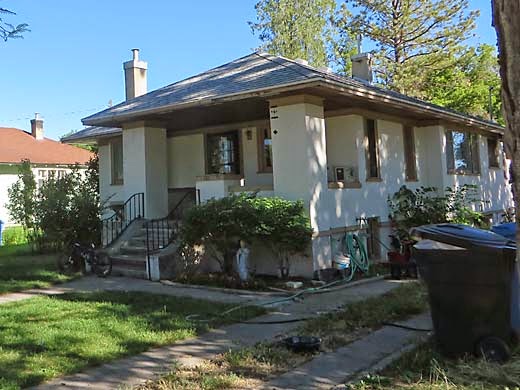
My maternal grandparents' home in Logan
Tuesday morning, Maureen and I walked around the old neighborhood where my mother's family lived. It hadn't changed much from my childhood memories. My grandfather had built his own home there along with many of the other houses on the street. The houses of two of my aunts and uncles were only a few houses away from my grandparents' home. We also walked around the neighborhood where my dad grew up, near the Logan Temple. Logan is really a nice looking town, with old tree-shaded streets and views of farmland and mountains all around. We were struck by how green everything was. It seems that northern Utah has not suffered from drought this year like California has.
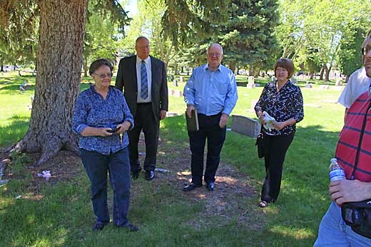
Richard and three of our cousins, Charlotte, Leo and Joy, at the Logan Cemetery
In the afternoon, we went to the cemetery, and had a little informal memorial for dad. Leo had contacted some of my other cousins and relatives and I was very pleased that they all came. I hadn't seen them in many years and it was nice to be together again. We all shared memories of dad and I was surprised that they remembered so much about him, since they were from my mom's side of the family and only saw dad when we visited from California. Later, we spent the evening at Leo's home and got to talk some more.

Logan Canyon
View from the trail at the summit of Logan Canyon
On Wednesday, we packed up and drove up beautiful Logan Canyon and stopped at the summit where there is a wonderful little loop trail through the forest. There were firs and aspens and lots of wildflowers, and sage meadows with mountain views. I always loved seeing Bear Lake, but it was a little disappointing that day because the air was very hazy. A little later, we passed through Randolph, Utah, which I was interested in seeing because my dad's father spent his first year in the U.S. there after emigrating from England in 1901. Randolph is still a tiny town in the middle of nowhere, and it must have been quite a shock for my grandfather to come alone from an industrial area near Birmingham to such as remote place. After passing through Evanston, Wyoming, we could see the snow covered peaks of the Uintas ahead, and we were soon up among them. I had good memories of a trip my family made with my maternal grandparents to Mirror Lake, and I wanted to see it again. Maureen and I took a little walk along the lakeshore and it was every bit as beautiful as I remembered it. We came down out of the mountains into Heber Valley, and stayed in a funky old motel in Heber City.

Mirror Lake
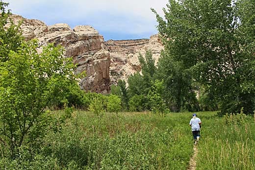
Thursday morning, we drove for a few hours east to Dinosaur National Monument. From the visitor center, a shuttle took us a short distance to the dinosaur quarry, where a building against a cliff face protects the site where many fossilized dinosaur bones were discovered. It is pretty amazing to see the bones of many dinosaurs packed together and sticking out from the rock. We drove a short ways to the Split Mountain campground and walked along the Green River. It was very scenic, but the day was rather hot, and we didn't go far. We drove to the end of a road that crosses the river and goes to the ranch of a woman who lived there alone and raised cattle until she was nearly 90. There was a log cabin in a pretty green spot in the cottonwoods, and we hiked the Hog Canyon Trail through meadows and into a box canyon heading into the sandstone face of Split Mountain. I didn't mind the heat so much because it was such a beautiful place. We spent the night in Vernal, Utah, and found a pretty good Mexican restaurant for dinner.
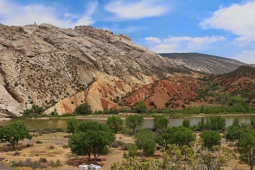
Green River at Split Mountain Campground, Dinosaur National Monument
Hog Canyon Trail
On Friday, we drove east into Colorado, and up a side road back into Dinosaur. This time we were on a plateau high above the rivers, and at the end of the road, we hiked the 1 mile trail to Harper's Corner. It follows a narrow ridge through Pinyon Pine and Junipers to its end where you can look down thousands of feet to the place where the Green and Yampa Rivers flow together, a really spectacular view.
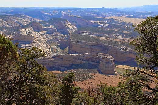
Steamboat Rock from Harper's Corner Trail
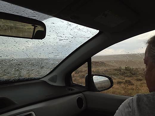
Next, we drove on to Maybelle, a tiny farm community, and made a side trip in hopes of seeing some wild mustangs. A few miles northwest is Sand Wash, a large area of BLM land where wild horses have been relocated. There are a couple of loops of dirt road where they say that with luck you may see horses. As we started out off the pavement, a large, dark cloud loomed in the west. Several miles in, the road wound up to the top of a hill, and raindrops began to fall. Suddenly, it was a downpour with some hail coming down too. We stopped, thinking that it might soon blow over, but then I realized that the ground was really getting wet. I decided that we had to try to get out of there, and started driving down the hill. The road was getting very slippery, and several times, we almost slid off it. I was really getting worried that we would get stuck out there in a very remote place with no cell phone service. But we made it back to the highway as the storm moved on by, and with no harm done except for the mud-covered car. We got a motel in Craig, and spent the fourth of July evening hearing fireworks but seeing nothing because we were on the wrong side of the building.

Near Sand Wash
In the storm, Sand Wash
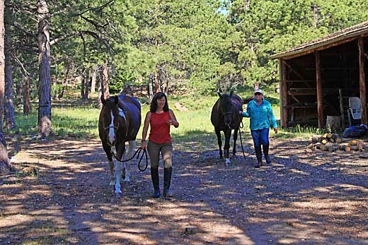
On Saturday, we drove on east through lots of nice country — sagebrush flats, green farmland, and pretty mountains — and up over Berthoud Pass to the rushing traffic of I-70. Then up through Central City to the mountains west of Boulder where we found our way to my cousin John's home. He and his wife, Pat, have a big log house on a good-sized piece of land with green meadows and pine forest, a couple of horses and four dogs. It was really a wonderful place to stay. They fed us great meals, took us on great walks, Maureen got to ride with Pat a couple of times, and I hope we didn't stay too long, but we had the best time there.
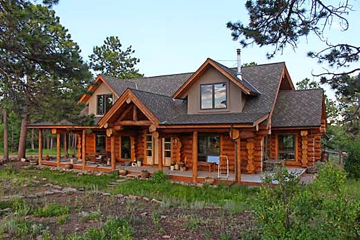
John and Pat's place
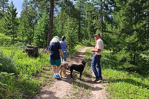
Walking the dogs with John and Pat
Pat and Maureen with Ben and Ruby
Besides several walks around the area with their dogs, on Monday we drove a few miles for a hike at a place called Brainard Lake. Parking at the two trailheads was full, so we had to park a mile or so down the road, but it was well worth a little extra walking. We did the trail around Long Lake, about a four mile loop. At over 10,000 ft. elevation, below 13,000 ft. peaks, it was a gorgeous place. We soon discovered that the going wasn't so easy because there were many patches of snow and muddy trail to go through. But it was still a very enjoyable hike. Back at John's house, I helped him unload and stack a load of hay. John kept at it until it was done, but I had to stop and rest every few bales. I guess I'm not in shape for that kind of work.
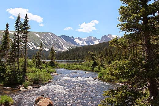
On our hike around Long Lake
On Tuesday, John and I walked the dogs again while Maureen and Pat rode the horses, and then in the afternoon, we packed up and left. We drove through Boulder and into Denver, where we wanted to see the Denver Art Museum. We found a parking garage and walked a few blocks to the museum, passing the capitol building. We saw a lot of interesting stuff there, but museums are tiring after a couple of hours. Now it was rush hour and we had to get out of downtown. After wandering around a while trying to avoid the gridlock, we made it to the freeway and to a hotel near the airport. We were a bit concerned about how to manage the logistics of returning our car and finding a restaurant because the airport is way out of town and everything is too far apart to walk. But we found that there are shuttles that make it possible.

We got up early Wednesday morning for an 8:30 am flight, and soon we were on our way home. This time I got a window seat, and got some great views of the Rockies. Clouds covered much of Utah and Nevada, but they cleared over the Sierra and let us see Yosemite, and it was fun to see some familiar places from the air.

Wednesday, June 18, 2014

Sobrante Ridge 6-17-14


It was another Tuesday when Maureen was going for her riding lesson and I wanted to go along so I could join her, her teacher, Jessica and her friend, Maureen, for lunch. I figured that I could go hiking during the two hours that the two Maureens were having their lessons. It was only a few miles to Sobrante Ridge Regional Preserve, a place I had been interested in seeing because I hadn't been there before and it includes part of the Bay Area Ridge Trail.

I followed Castro Ranch Road to Conestoga Way and parked on the street near the bottom of the hill. There is a parking area at the end of Coach Drive, but I wanted to get most of the climbing done at the start rather than the end of the hike. So I walked up the street through a fairly new residential area, to the beginning of the trail at the end of Coach Drive. A little more climbing brought me to the top of a ridge, and a little further on was a nice view of Richmond and the bay to the west. When I came to a several side trails I didn't bother to check them out because I thought that this would be a longer hike than it was. One of them led to a a grove of Alameda manzanita, which would have been interesting. I soon came to the end of the fire road and followed a single-track trail down off the ridge, quite steeply in some places.

It was a leisurely hour and fifteen minute walk, and I got back to the ranch in time to watch the last half of one of the lessons. There was not much that was very remarkable about the place, just a small stretch of typical east bay hills, but if I lived nearby, I would probably make frequent use of it.

2.6 miles, 600 ft. climb


Tuesday, May 27, 2014

Briones 5-26-14

Starting up Pereira Trail
It's Memorial Day, and Maureen is going for her weekly horseback riding lesson. She suggests that I could go along and do some hiking while she rides. Her teacher, Jessica, recently moved to a ranch on Bear Creek Road near Briones Regional Park. Sounds like a good idea to me, but since her lesson lasts an hour, it would have to be a relatively short hike. Looking at the map, I noticed that the park has expanded west a bit sometime in the last 30 years and there are some trails I haven't been on yet.

I start off by finding a gate about a half mile north of the Bear Creek Entrance and park on the road shoulder. The gate is locked and there are no signs indicating that this is a legitimate entrance to the park, but I climb over the gate anyway and start up the Deer Creek Trail. The hills have just turned from green to golden in the last week or two, so there are still a few nice green patches. It is an easy walk up this little canyon, and soon I come to a trail junction. I turn left on the Pereira Trail. A right turn would have been on the Briones Crest Trail which circles the whole park. I'm soon on a ridge heading south again. I come to a trail branching right to the Ivan Dickson Memorial. I follow it to the next little hilltop where I can see that it goes down the hill a bit to some kind of stone monument. Since I have no idea who Ivan Dickson was, I didn't bother going all the way down to it. When I got home, I looked it up and found that he was a member of the Berkeley Hiking Club who cared a lot about parks and trails, and left the park district funds to establish a volunteer trail maintenance program, which has continued since his death in 1993. Sounds interesting, and maybe I'll check it out. I continued down the ridge to complete my loop, and almost to the road walked around a little pond with lots of bullfrogs jumping into the water ahead of me.

It was a nice little hike, although I would have liked to go further, but I didn't want to keep Maureen waiting.

2.0 miles, 500 ft. climb


Thursday, May 8, 2014

Knobcone Point Loop

Rocks above connector trail

Clear and cool, it was a perfect day for a hike. I thought I would revisit the area around Knobcone Point on Mt. Diablo (Knob Point on USGS topo). A little more than a year ago, I hiked out on the Knobcone Point Trail hoping to make a loop with the Blackhawk Ridge Trail, but couldn't find a way through about a half mile of dense chaparral that separates the trails along the eastern border of the state park. I had made this loop many years ago by bushwhacking through on game trails, and it wasn't too difficult because the area had been burned several years before that, and the brush had not regrown too much. When I went back last year, the brush was so thick I didn't even think of trying to get through it. Then after that hike, I looked around online and found information about a connector trail in a slightly different location that was supposed to be pretty good, so ever since then I have been wanting to check it out.

At the South Gate, I was surprised to find a real person there to take my $10 on a Tuesday morning. The last couple of times, the gate had been unmanned. I started off from Curry Point a little before 11 am. The cool air with a slight breeze made it feel great to be out hiking, so it was a nice walk out to the end of the Knobcone Point Trail along grassy ridges, oak and pine woodlands, and rocky chaparral. As I turned right onto a spur road that leads to a power line tower, I saw a bicyclist head that way just ahead of me. After a short, steep descent, the road bends east and begins to climb again.

Paintbrush
The connector trail that I was looking for begins just at the bottom of the dip. A footpath leads uphill to the right, really no more than a use trail, and it would be easy to miss, but once you start on it, it is not at all hard to follow. It winds in trees and brush through a gap in the sandstone spine of the ridge, with interesting rocks above on all sides. I didn't see the bicyclist again, so they must have followed this trail, and I could see bike tracks in the dust. It seemed like a pretty rough trail for a bike, but they must have made it OK. After descending a little creeklet, it soon emerges on another utility road. It may be a bit harder to find this trail going in the other direction, but it is just before the road goes steeply downhill and ends about 100 yards further. This little connector trail was the best part of the hike, but it is less than a half mile and it ended all too soon.

Southern end of connector trail
on Blackhawk Ridge Trail
But the hike continued on through beautiful country, only on dirt roads rather than footpaths, so it was still very enjoyable. The utility road comes to a 5-way junction, where I turned right on the Blackhawk Ridge Trail, and descended into the canyon named Devil's Slide on the map. In the oak woodland of this canyon there were whole hillsides solid with poison oak. This seems to be an especially good year for the stuff, and not such a good time for off-trail exploring. At the bottom of the canyon, the hard part began. It is quite a climb up out of the canyon, and I was getting quite tired. I began to feel like maybe this was a bit too much for my heart, only three months after bypass surgery, so I stopped a bunch of times on the way up to catch my breath. I had hiked this trail several times many years ago, and I don't remember it being very hard then, but I guess the years have taken their toll. Back at my car, I felt fine after a few minutes rest, and overall, this was a very good day.

5.6 miles, 1200 ft. climb


Tuesday, April 22, 2014

Round Valley


Miwok Trail near beginning of hike

Earth Day was a good day for taking a hike. I didn't realize that it was Earth Day until I was already driving to Round Valley Regional Preserve for a hike, and I heard it on the radio. I had been interested in checking out this park for a long time, and actually went there to hike with my dog, Darby, a year ago, but discovered at the park entrance that dogs are not allowed. So today I left Darby at home and went by myself. I drove out on 580 to Livermore, and then Vasco Road toward Brentwood, and then Marsh Creek Road to the park. This was probably the easiest way to get there from the Hayward area. On the return drive, I went the other way, through Clayton and Walnut Creek, and it seemed to take a lot longer even though it looks more direct on the map.

I arrived at the parking lot at about 11:30 am, and was surprised to see maybe a couple dozen cars there. Most regional parks are usually almost deserted on weekdays. The Miwok Trail starts out climbing a hillside, but soon levels out and most of this hike was relatively flat. I soon found the reason for all the cars as I passed a large group of hikers going the other way. After that I saw only a few other people on the trail. The trail follows a creek up a canyon for about a mile, and then the hills open up and you are in a broad, flat valley. It is really great that this valley has been preserved because there are very few places in the Bay Area where flat ground has been left undeveloped. There is a lot of park land around, but almost all of it is hills.

On Murphy Meadow Trail


I turned left on the Murphy Meadow Trail and headed across the valley. The hills to the southwest present a fairly dramatic escarpment, rising steeply about 1500 ft. from the valley. The trail skirts along the base of these hills and then rejoins the Miwok Trail. If one were to continue on the Miwok Trail, you would climb to the top of the hills and into Morgan Territory Regional Preserve. Maybe one of these days, I'll try to organize some friends to do a car shuttle and hike this trail link.

On Miwok Trail


On Miwok Trail
I turned left on the Miwok Trail and headed back across the valley. It was a beautiful day, a bit cool and breezy with a few puffy clouds. The meadows and surrounding hills were all brilliant green. I took a lot of photos, trying to capture the beauty of it all, but most of them fall short of my expectations. I noticed lots of ground squirrels all over, and they seemed fairly unconcerned about me walking near them. Then I realized that it is probably because there are no dogs in this park. If Darby had been here with me he would have been having a great time chasing the squirrels back into their holes.

 As I walked back down the canyon, I was getting a bit tired and quite hungry, since I didn't bother to bring anything to eat. When I looked at the GPS on my iphone and saw that I had walked nearly 6 miles, I felt better about being tired. But because this trail is mostly level, it didn't seem as hard as some of the shorter walks with hills that I've done recently.

6.0 miles, 560 ft. climb


Sunday, April 20, 2014

Five Canyons

Along the ridge


I do a lot of walking in the Five Canyons area because it's close to home. Today I did a loop that I hadn't done in a while that shows off some of the best trails in the area. One of the reasons that I wanted to do it today was that I was curious about what happened to Eagle's Nest Ranch, the place where we boarded our horses 4 years ago. At that time they kicked us all out and closed the ranch. We've heard various rumors about the place over the years, and the latest was that they had leveled all of the buildings. The Five Canyons trail that I chose to take today has a great view down into Palomares canyon and the site of Eagle's Nest Ranch, so I hoped to see for myself what they had done.

I started off at the Recreation center where there is a swimming pool and tennis courts. The trail almost immediately heads down into a pretty little shady canyon. Then it crosses a road and goes through another little canyon, and then past a small playground (Ridge Trail Park), along a service road, across Five Canyons Parkway near the development entrance with its fake waterfall, and up a hill along the edge of the development. Then it comes to a paved road leading up to some water tanks, a pretty steep climb, and it soon reaches the top of the highest hill in the area.

 There was my view of the former Eagle's Nest, and it was indeed leveled — all except for a couple of small sheds. I don't know why I cared, but we had our horses there for three years and we have a lot of good memories of the place. From there it was all downhill, first along the ridge, and then steeply down into the canyon. Going down the shady canyon along the creek, I ran into a couple of old friends who I hadn't seen in quite a while. They told me that they had seen some newts further down the trail in a pool in the creek. I looked, but didn't see any, but in past years I remember lots of newts along this creek. Even with some pretty good rains in February and March, the creek is mostly dry now.

As I was hiking, I began to think about the name "Five Canyons". There seems to be only two obvious canyons here, the one with the Shady Canyon Trail and the one with the Deer Canyon Trail. Then I realized that there must have been five small canyons here at one time, but three of them were filled in by the grading for the development. This is just another example of developments all over California that are named for the natural environments that were destroyed to build them. I guess it all started just after the gold rush when they cut down a grove of oak trees to build a town and named it Oakland.

3.3 miles, 750 ft. climb

Monday, April 14, 2014

Bishop Ranch

Grey Fox Trail
I'm finally recovered enough from my heart surgery to start doing some hiking again. Actually I've already been doing some 2-3 mile walks for the past several weeks, but on trails that I've already written about here on this blog. Everyone seems surprised that I am doing so well, but it feels to me that after 2-1/2 months, it's about time that I'm back to my old self. I still have to go slow on the hills, but there's no need to hurry and I get there eventually.

Today seemed like a good day for a hike, and at first I thought of going someplace without Darby, maybe Mt. Diablo or Round Valley. But then I started feeling sorry for him being left at home, So I decided to check out Bishop Ranch Regional Open Space, which I hadn't visited in a very long time. On the map it looks like a pretty small park, but on the ground, there seems to be plenty of space for a pretty good workout.


It was a perfect day for hiking. The morning fog had just burned off as we started out a little before noon, making it cool and sunny. We started up the Grey Fox Trail, climbing steeply. In fact it is so steep that someone has carved steps into the dirt of the hillside to make it a little easier. It eases up a bit after the first hill, but continues climbing all the way to the top of a ridge. It was a beautiful walk with green grass everywhere and lots of buttercups and other wildflowers. From the top there are nice views of the higher hills to the south and of the San Ramon valley to the northeast. We turned right on the Red Tail Hawk Trail heading northwest along the top of the ridge.


My plan was to make a loop by going down the Stream View Trail, so I kept looking for a trail sign or a trail heading off to the right. We soon came to an unmarked fire road heading right. It appeared to cut across the hillside to a water tank. It didn't quite match up to what I expected from the map, but we tried it anyway. As we neared the water tank, there was a sign saying "Red Tail Trail", and at the tank, there didn't seem to be any trail heading down towards the creek, so I figured that we had gone too far and missed our turn-off. I didn't mind too much because it was a pretty trail and a gentle slope back up to the ridge.

Stream View Trail
We found the correct turn-off, unmarked and barely visible because it was overgrown with new grass, and we headed steeply down to the creek again, and then along the hillside just above it. After a while, it climbs a bit and then a footpath branches left and heads down nearer the creek and leads back to the starting point. As usual, Darby was thirsty by now and quickly found a little running water to drink. I would guess that in a few weeks more it will be all dry. So it turned out to be a very enjoyable couple of hours, and a place that I will probably come back to again soon.

3.6 miles, 700 ft. climb