With the current pandemic going on, I've had time on my hands, and felt like adding to my posts of past Sierra adventures. It's stuff that happened a long time ago, but the same mountains are still there, much as they were years ago.
Out of the many backpacking adventures in the Sierra over the years, one especially stands out in my memory. It was 1986 and I had done lots of weekend backpacking trips with my family and friends, and they were a lot of fun, but I was still yearning for the adventure of a challenging climb. I chose a weekend in July to try it and my goal was Mt. Lyell, the highest peak in Yosemite.
I left home after work on a Friday evening and drove into Yosemite. Around midnight, I found a place to pull off the highway and sleep in the forest. Early the next morning I was at the wilderness permit kiosk at Tuolumne Meadows, and heard stories of recent bear activity in Lyell Canyon. I didn’t like the idea of dealing with bears and decided to change my plan, and go for Mt. Ritter instead. At 13,149 ft., it is the highest peak in the whole Yosemite and Mammoth region. I had been on several trips in that area and had read John Muir’s exciting account of his climb, and for years had dreamed of doing it myself.
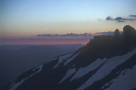
I drove over Tioga Pass to Mammoth Lakes and up to the trailhead at Agnew Meadows. I started hiking sometime in the mid-morning and made it 6 miles up to Lake Ediza in mid-afternoon. I found a secluded spot in the forest on the far side of the lake to put my sleeping bag and spent the rest of the afternoon resting and wandering around taking photos as dramatic clouds drifted over the minarets.
 |
| Mt. Ritter from Lake Ediza |
|
 |
| Minarets in clouds |
 |
| Starting up in the morning |
 |
| View of Lake Ediza from below the glacier |
Soon after first light in the morning, I was hiking up, following a little creek into a big snow-filled bowl at the base of Mt. Ritter and Banner Peak. I only had a rough idea of the route so I just started up over steep slabs and tufts of grass, aiming for the southeast glacier. The bottom of the glacier was moderately steep, but I felt that I could cross it with a sharp rock in my hand as a substitute for an ice axe. It’s not really a safe thing to do, but maybe better than nothing. As I climbed, it got steeper and a bit scary, but I made it off the glacier and into a gully heading up to the right. It was mostly steep, loose talus, but with no real difficulty. From the top of the gully, there was a large steep snowfield leading to the summit, but I chose to avoid it by skirting around it to the right on lots more steep talus.
 |
| Southeast glacier |
 |
| View southeast from the summit |
It was around noon when I arrived at the summit. After resting a bit and taking in the enormous view, I began to realize what a long way down it was and what a big job it was going to be, tired as I was. After a snack, I headed down, retracing my steps. In the gully, I slipped on a sand covered rock and scraped my hand as I fell. It was only a scratch, but a reminder that as a solo hiker, any slip could be serious. On the glacier, the snow was softer than in the morning, but still slippery, and one of my steps started to slide. I stopped myself by jamming my right heel into the snow, but in doing so, I twisted my knee and felt a sharp pain. After a couple of minutes to take stock of the situation, I felt able enough to carefully continue down. The knee still hurt, but I could walk on it. Back at my camp, I rested a bit, made a cup of coffee, and then packed up and headed down again. I made it safely back to the trailhead and a long drive home into the night.
The knee pain diminished and I soon forgot about it. I had been running fairly regularly at that time, and I continued to run nearly every day. Then in the early 90’s, my right knee began to hurt when I ran. Arthroscopic surgery showed that I had a small tear in the cartilage. I thought it was fixed, but soon the pain returned, and after a second surgery, I decided to give up running. I don’t know for sure, but I strongly suspect that it was that slip on the glacier that caused it.


