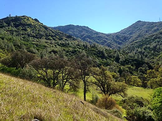
It sure makes you wonder about climate change when here it is Valentine's Day and we're having sunny weather in the 70's. But I may as well make the best of it and go for a hike. Since it's a Saturday, and I don't like to take Darby out on weekends because there are so many other dogs on the trails, I decide to leave him at home and go to Mt. Diablo where dogs are forbidden on trails. I had been thinking about hiking the Falls Trail for some time, but without rain there wouldn't be any falls. Finally, there was a major storm last weekend, so I figured that today there would be water in the creeks. I saw on the map that there was a park entrance in Clayton at the bottom of Donner Canyon, one that I had never used, but since no parking was indicated, I wasn't sure what to expect.
I got to Regency Drive off from Marsh Creek Road at around 11, and found that the street was parked up for about a quarter mile from the trailhead. I would have plenty of company on the trail. But it was a beautiful day and the sun was sparkling on the water of Donner Creek as I started up the trail. It is really a pretty creek splashing over rocks with green grass and oak trees coming right down to the banks.
 |
| Near trailhead on Donner Canyon Road |
Soon I noticed up ahead a group of people with a dog. I was mildly annoyed because park rules don't allow dogs on trails, but I wasn't going to say anything to them. Then up the trail comes a ranger on an ATV who stops and gives the people a ticket. It felt like a guilty pleasure to watch that happening.
 |
| Donner Canyon Road |
I turned left onto the Hetherington Trail, a single-track along the east side of the creek. The trail crossed the creek again and I was able to step across the rocks, but then it crossed back again, and I had the choice of stepping between two big rocks covered with slippery moss, or a long jump. I chose the jump, feeling pretty sure that I could make it. Once again, I found that I am not as agile as I once was and came up about a foot short with my jump and got a wet foot.
 |
| Wasserman Trail |
Now the trail was climbing the hillside east of the creek through oaks and meadows. On the Wasserman Trail, I kept climbing as the hillside became more rugged. I came upon a group of about 5 people on horseback who managed to get their horses off to the side of the narrow trail to let me pass. I was thinking that this trail was a bit steep and rugged for our horses.
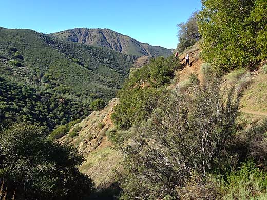
After going down the Cardinet Oaks Road for a short distance, I finally turned off onto the Falls Trail which cuts across the west face of North Peak. As I passed a couple around my age, the woman said "You have to be a mountain goat for this trail". I would have to agree. It is very narrow, steep and rocky in many places, and a slip could mean a long fall and serious injury. As the trail bent into Wild Oat Canyon, the first couple of falls came into view. They are not large falls -- maybe around 20 ft. high -- but their setting is spectacular. All around the head of Donner Canyon, very steep ravines converge far below, a vertical world of rock, brush and trees. I noticed many spring wildflowers that I didn't expect so early in the season, and shady hillsides thick with moss and maidenhair ferns. As the trail dropped down around the head of the canyon, I noticed several picturesque junipers, making it feel like it was much higher in the mountains.
 |
| Falls Trail |
 |
| One of the falls |
 |
| View from Falls Trail |
Descending the west side of the canyon, with views across to where I had just been, I realized that I was pretty tired. This was a harder hike than I expected. Looking at the map beforehand, it didn't look like much. I tried to remember the only other time I hiked the trail, about 25 years ago, but I could't remember much. What I do remember is that it was a while after my first knee surgery, and my knee was hurting during the hike. I was trying to do too much too soon after surgery, and I ended up needing a second arthroscopic surgery a year or so later. Back on the Donner Canyon Road, the walking became easier, and I began thinking about food and drink. I hadn't brought any lunch and it was nearing 2 pm. I would stop and get some fast food on the way home.
 |
| Indian Warrior |
It had been a really good hike. It was a bit hard, but there were so many beautiful spots to see. Now I understand why the Falls Trail shows up on a lot of lists of best Bay Area hikes. It is really a spectacular place. It could use some trail maintenance, however. On the trail, I passed a guy who commented on that, wondering aloud if there was some kind of volunteer trail crew that he could join to help with it. I just checked, and it appears that the Save Mt. Diablo organization does some of that, and I hope that this trail will get some of their attention.
6.2 miles, 1400 ft. climb


