Monday, November 25, 2013

11-24-13 Black Diamond Mines

On a Sunday morning, we got a call from our son, Chris, asking if we wanted to go with him and our two grandsons, Elisjsha (age 10) and Zachery (age 8), to Black Diamond Mines. It sounded fun, so Maureen and I went along. Luckily, Chris has a minivan with plenty of room so we all rode together, including his wife, Jonnie and our granddaughter, Makaila (age 3), who we dropped off in Concord to spend the afternoon with a friend.

When we got to the park, we found out that Chris picked today to come because they were having open house in the mines. As a park district employee he keeps up with events like this. At the Hazel-Atlas mine entrance, they handed everyone a hard hat and a flashlight. Neither seemed necessary, since there were no low ceilings and it was all well-lit. We followed the tunnel deep into the mountain, mostly through sandstone, and it was interesting to see the tilted layers, and in places ripple marks where the sandstone had been deposited beneath the sea. there were holes where we could see into huge chambers that had been hollowed out by mining.

in the mine
Coal mines were started here soon after the gold rush, and it was a busy place for much of the last half of the 19th century with 5 towns and thousands of miners, many of whom were recruited from mining areas of England and Wales. Then, from the 20's through the 40's, mining was resumed for sandstone for making glass. That was the part of the mine that we were exploring. We only went about a quarter mile, but they said that there were over 200 miles of tunnels in the area.

on the trail

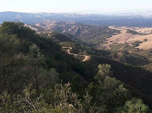
Back out of the mine, we continued on the trail up a steep little ravine. At the first trail junction, Maureen and Elisjsha decided to head back down on the trail to the right that led down another little ravine. Chris, Zachery, and I went on up to the top of the ridge and turned left, climbing another quarter mile or so to a hilltop with a great view to the valleys and ridges to the southeast.

Zachery and Chris at the top of the hill

I enjoy hiking with kids, but it takes a lot of patience and flexibility. I thought the boys would be really interested in the mine and the rocky trail, and maybe they were, but didn't show it much. They seemed much more interested in stopping for a snack along the way. The trail is quite steep, and both boys complained about how hard it was and "how much farther do we have to go?", but then a minute later were running ahead up the trail. On the way down, Zachery was running down a steep gravely place, right after his dad had told him not to run, and of course, he slipped and fell. It probably hurt, but no real damage was done.

Back at the bottom of the hill, we met up again with Maureen and Elisjsha, found a table and ate some lunch, then headed back to the car. The boys found a couple of sticks which became light-sabers, and fought a little battle up and down the mounds of tailings on the way. It all added up to a nice afternoon and we all had fun.
View east from Sommersville site

about 1.5 miles, 500 ft. climb


Tuesday, November 12, 2013

11-8-13 Anthony Chabot

A Friday afternoon and Maureen and Cherry were going riding, and I felt like a hike. For the last couple of months I've had a pain in my left heel and it has gotten worse lately. But it wasn't too bad that day and I didn't think it would give me any problems. On a couple of my hikes I've explored some of the northern end of Anthony Chabot Regional Park, going out from Bort Meadow on the Grass Valley Trail and Ranch Trail. Both times I had turned left at the Goldenrod Trail and made a loop, but I had never turned to the right. I wasn't sure how this would work, because the map shows the Goldenrod Trail deadending without connecting with any other trail or road. I figured we could find some way to get from there to the Parkridge Drive park entrance.

So Darby and I started off from the Bort Meadow Staging Area on the now familiar trail past the meadow and then steeply up the hillside to the west. Turning right onto the Goldenrod Trail at the top, we found it much the same as to the left. A young guy on a mountain bike passed us and asked if we knew where the trail ended. I had to tell him I didn't know either. Soon we came to a gate with a road on the other side. The biker went out through it, but the trail continued so we kept following it. The trail ended at another gate, and through it was what appeared to be an equestrian facility, but it was deserted -- no people or horses. A couple of the structures looked quite new, and signs said that they had been funded by the 2008 bond issue. It looked like it could be a nice place to keep a horse, and it was surprising that it was unused. At the far end of the facility, past an interesting old Spanish-style building, we came to a gate with a sign "Private Property", and a driveway beyond it. I looked at my iPhone and saw that we were only 100 yards or so from Skyline Blvd. So we walked down the driveway and found the street. This part of Skyline is a divided road with a trail along the center divider, so we didn't have to worry about the traffic.

At Parkridge Dr. we turned right and walked several blocks on sidewalks to the end of the street and the park entrance. A few yards from there, we turned right on the Macdonald Trail which gradually descended along the eastern ridge back to our starting point. It seems that this section of the Bay Area Ridge Trail is a popular trail with mountain bikers, and several of them passed us going dangerously fast. I noticed a sign for the Brittleleaf Trail heading down the east side of the ridge. I don't know what Brittleleaf is or why anyone would want to go down this .39 mile, steep dead end trail, but maybe one of these days I will check it out.

Coming down the last hill, my heel was hurting quite a lot now, and I was glad to be near the end of the hike. It probably wasn't a good idea to hike with a sore foot because the next day I could barely walk on it. Now, after a couple of days rest, it is not so bad, but I need to take it easy for a while.

Back home, I looked up Oakland City Stables, and found out that it was in use as recently as last year and that it was the site of a popular program to let city kids learn about riding and working with horses. It has an interesting history going back to the 1820's and the Peralta family, the original landowners of most of the East Bay. Apparently, the city closed it because they couldn't find a suitable manager for it and didn't want to provide any funding to keep it open.

4.6 mi. 900 ft. climb


Sunday, November 3, 2013

11-3-13 Wall Point - Mt. Diablo

View west from Wall Point
It was a nice Saturday afternoon and I wanted to go hiking. I've been avoiding hiking with Darby on weekends because there are usually lots more people out with loose dogs. If I left him home there would be no problem and besides I could go anywhere, including trails where dogs are not allowed. So I decided to go Mt. Diablo State Park. Years ago I had done a loop from the Macedo Ranch entrance that I remembered being one of my favorites, so I set out to do it again.

When I arrived at the end of Green Valley Road, I found that it required a self-service parking fee. I needed $5.00 (with senior discount), but I only had 3. I wasn't going to give up my hike for a couple of bucks, so I put what I had in the envelope and hoped that I would get away with it. I figured that it would cost them way more than $2 to track me down and give me a ticket. We'll see what happens.

I started off up over the first hill and down into Pine Canyon. Everything is very dry now, but still quite pretty in the late-season afternoon light. There was quite a lot of fall colors (at least a lot for California) along the way, especially the maples and sycamores. At the bottom of the canyon, I turned right, heading upstream and climbing gradually along the dry creek bed. After a mile or so, the road climbs more steeply and keeps climbing for a good long way. As it begins to head away from the creek, I turned right on the Secret Trail, a single-track trail that is not exactly secret since it is well-signed. It climbs some more, then cuts across the side of the ridge to the south and connects with the Wall Point Road. I turned right again and began returning along the ridge. Now it was apparent that I had gained a lot of elevation and there were lots of great views of the Blackhawk and Danville areas. The ridge, part of the Black Hills, is covered with chaparral with lots of big sandstone outcrops -- very scenic. Soon a little climbing brought me to a high point and I began to wonder where exactly was "Wall Point". Looking at the map later I found that it was at that high point. From there, the road goes up and down along the ridge, but mostly down, until the loop is done, and there is only the last small hill to cross.

Sometimes these days I remember hikes from long ago as not being too hard, but that was when I was young and in good shape. When I try them again I find them much harder than I remembered. That didn't happen so much today. I ended up tired, but not completely worn out, and it was an enjoyable afternoon.

6.2 miles, 1300 ft. climb