Friday, June 29, 2012

4-7-12 Morgan Territory

 more photos

It was a nice Saturday, and I wanted to try somewhere new. I had never been to Round Valley Regional Park, and on the map it looked interesting. The park adjoins Morgan Territory Regional Park, and I thought maybe we could hike into that area too. It was a longer drive than I usually want to do for a hike, but it we had plenty of time. We went east on 580, then north on Vasco Road. It was interesting to see some of the new wind turbines on the hills. They are huge -- several times the size of the old ones that still line some of the hills. The rocks of Vasco Caves also looked interesting. We turned left on Marsh Creek road, and soon came to the park entrance. Right there at the turn off, there was a big sign -- NO DOGS.

We needed a change of plans. Since I had thought of getting into part of Morgan Territory, why not start there and hike towards Round Valley instead. So we continued west on Marsh Creek Road and turned left on Morgan Territory Road. I was familiar with the road from many years ago, but I had forgotten that it was so narrow and winding. All the blind curves with no room to pass made me nervous, but we made it to the park entrance at the top of the hill. So we wasted an hour or so driving around, but we still didn't need to worry about time.

We started off on the Condor Trail going down past a pond and up and down some little rocky hills. I especially like this half mile or so of single-track trail. Green hillsides with rocky outcrops shaded by oaks and lots of wildflowers. Actually most of Morgan Territory is like that.

Morgan Territory Regional Park is divided into two halves by Morgan Territory Road. The western half spreading over Highland Ridge into Riggs Canyon was added just a few years ago. I'm more familiar with the eastern half which extends along a gently rolling ridgetop which drops off steeply to the east towards Los Vaqueros Reservoir and Round Valley. In all of the times I have been here in the past, I had never ventured on any of the trails going down off the ridge because I didn't want to have to make the steep climb back up. I thought I would try that this time.

So we started down the Miwok Trail. As we lost elevation, I kept thinking about how much work it would be to regain it, but it was a beautiful day, and the views were great across lower hills to the Central Valley. In one spot, there was a large area of steeply angled flat sandstone, much of it wet with rainwater seeping out of the hill. At the bottom of the slope, we turned left on the Manzanita Trail going down a little canyon shaded by tall trees. As the name suggests, there was a lot of manzanita, growing as large as small trees.

Soon we were climbing, and our pace slowed way down. It was steep for about 300 feet, then we crossed a saddle and headed down again on the Valley View Trail. We crossed a small creek below a pond, and began climbing again. This time it wasn't so steep and it didn't seem too long before we were back on the ridge. It was a good thing there would not be much more climbing, because I felt like I had had enough. We trudged on along the ridge and made it back to the car after 3 hours of hiking.

6.8 mi. -- 1500 ft. down and up

Thursday, June 28, 2012

3-25-12 Sunol


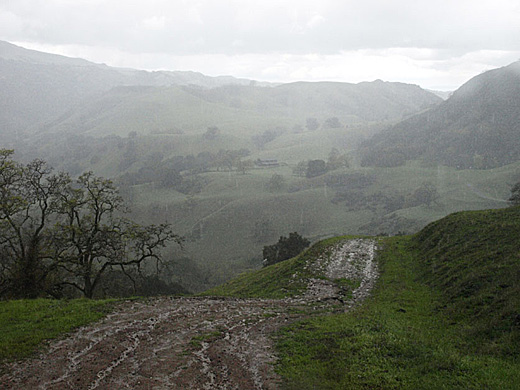
After weeks of dry, sunny weather, the rains returned for a couple of weeks. After a lot of rain on Saturday, Sunday seemed to be clearing, so Darby and I headed to Sunol for a hike. I felt like pushing it a bit more than the past few hikes, so I planned to go follow the road up Alameda Creek, then take the McCorkle Trail up the hill to Cerro Este and down the other side.

The day started off very beautiful with bright sunshine between the shadows of puffy clouds. The hills were brilliant green. There were lots of nice scenes for photos. Just beyond Little Yosemite, some people with a couple of poodles off leash were coming the other way, so Darby and I went off the trail a bit to let them pass. Soon there were more people with poodles. It must have been some kind of poodle club because there were about 10 of them. After making sure all of the poodles had passed, we got back on the trail. Near the park boundary, we turned left up the hillside Backpack Road, and then left on the McCorkle Trail. It was beautiful with the dramatic clouds, but the clouds were becoming thicker to the west. The views along the trail are great. We could see back into the higher hills to the east, and there was a dusting of snow on some of them.

The climb from the creek was starting to wear me down, but the trail kept climbing. Soon raindrops were falling. I thought it was just going to be a little shower. Anyway, by now it would have been longer to backtrack that to keep going. We turned right on the Cerro Este Road, thinking we were almost at the top of the hill. It turned out to be more climbing than I expected, but we made it to the top and it was now it was pouring rain.

We went on down the other side, walking carefully in places in slippery mud. The road winds along the hillside going steadily down, but we could see that it looked like an awfully long way to the bottom. Passing the old barn called the High Valley Camp, there were a bunch of cows in the road, and when one started coming toward us, Darby got scared and barked at it. We made it through the cows, and then it was just another mile of trying to make it down without slipping in the mud. We had been hiking in the hard rain for a good hour at least, and I was pretty much soaked through. Darby wasn't too happy about it either.

7.8 mi. -- 2100 ft. up and down

3-11-12 Willow Park loop

On another warm, clear Sunday, I took Darby on one of my old favorite hikes. It's an old favorite mostly because it is a short drive and can be easily done in less than two hours. But it is a pretty trail near the upper end of Lake Chabot, and there are some nice views.

I usually do this hike in a clockwise direction, but for some reason decided to go the other way today. It was probably because the other direction involves a long, steep climb. We started off from the parking lot for the Willow Park Golf Course. I'm not sure if hikers are supposed to park there, but no one has ever told me not to. We started up a dusty fire road, the Brandon Trail, along a ridge, a steady climb but not terribly steep. As we get higher, there are nice views of the golf course and the lake, and lots of green hills to the east and south. After a mile and a half or so, we turn left on the Towhee Trail down along a grassy hillside, then left again on the Live Oak trail. This is where it gets steep, but luckily we are going downhill for about a mile. At the flats at the head of Lake Chabot, we cross a long narrow footbridge and turn left on the Cameron Loop Trail.

It is quite warm, and by this time I am getting pretty tired. The shortest way back would be to go through the golf course, but it is clearly off-limits to hikers, and we would probably get into some kind of trouble. We crossed the narrow footbridge across the creek, turned right, then left on the Cameron Loop Trail, and climbed up a little canyon on the south side of the lake. I didn't like the climbing, but it is much shorter than the climb that we had already done. We turned left on the Ten Hills Trail, then left again on the Proctor Trail, a narrower trail that contours down the hill above the golf course. After an hour and a half, we were back at the car.

4.7 mi. -- 1200 ft. up and down

3-4-12 Five Canyons

The Sunday after hiking with the kids, I still had some time and energy for a short hike, so I did a loop at Five Canyons that I have done many times before. Five Canyons is one of my favorite places for a short hike because it is so near my home in the Fairview district of Hayward. It is one of many places where a large housing development  has given some land to the Regional Park District as mitigation for destruction of the environment on the rest of the land. It makes for an area where the trails are never far from the houses -- not exactly a wilderness experience -- but  it does have some spots that are out of sight and sound of the houses and some nice views from the ridge top.

Darby and I started off from the Recreation Center just off the main road, and followed the Shady Canyon Trail along the creek and under the high bridge of Five Canyons Parkway. This pretty little canyon is one of the places that seems quite removed from all the streets and houses, although it is not far away at all. The trail passes a little pond, mostly overgrown with cattails, and a little further on, we took a right fork and climbed up a steep wooded hill. This is the hard part, and I have to stop a couple of times to catch my breath. We wind around past a row of houses, over a little hill, and across the road. We pass tennis courts and more backyards, and soon head back down into another canyon to the west. Another half mile of ups and downs brings us back to the start.

2.3 mi. -- 550 ft. up and down

3-3-12 Marciel Gate

On another beautiful Saturday, I was going to go out for another hike, when my son Christopher called and said he was planning to take his boys out hiking too. So we decided to go together. We met at Marciel Gate in Anthony Chabot Regional Park. We didn't really have any plan about where to go. We thought we would just start out and see how far the boys would be willing to walk. The boys -- my grandsons -- are Zachery, age 6 and Elisjsha, age 8. I knew that they both are often more interested in TV and video games than outdoor activities, so I wasn't expecting too much.

We started off heading northwest, turned left onto the Cottontail Trail, and were soon descending quite steeply into Grass Valley. The kids were doing fine, stopping to look at bugs and butterflies and whacking stuff with sticks. At the trail junction near the bottom, we stopped for a while and I suggested that if we turned left, we could make a loop rather than retracing our steps. I couldn't remember just how far it was -- the last time I was on that trail was a couple of years ago and we were on horseback. Christopher and the kids were willing to try it, so we started off again.

It turned out to be a bit longer than I remembered and more up and down, but it wasn't too bad. After about a mile of mostly easy climbing, the afternoon was getting warm, and the boys began to drag -- especially Zachery. Then Elisjsha began to complain that he was hungry. We had water, but no food, so Chris and I just had to keep telling them that we had no choice but to keep on hiking. We came to the Deer Canyon Trail, and now it was quite steep. We had some very slow going for a quarter mile, but it finally leveled off and we crossed the road. It was easy up and down for another half mile or so back to the cars.

In spite of all the complaining, I think the boys had a pretty good time and took some pride in their accomplishment.

2.5 mi. -- 500 ft. down and up

2-25-12 Pleasanton Ridge


President's Day was beautiful clear and Darby and I headed out for another hike. There were lots of other people on the trail up to the ridge, many with dogs, so I had to keep Darby leashed for much of the way. Luckily the other dogs were mostly well behaved. As usual, I had envisioned a more ambitious hike that I had the energy for. I had hoped to go beyond what I had done on previous hikes -- Augustin Bernal Park, but after climbing about 700 ft. to the top of the ridge, I realized that it wasn't going to happen today. We took the Thermalito trail which winds along the western slope of the ridge, passing a couple of stock ponds. Everything was very green and pretty. After about a mile, I decided that it was far enough and took a short connecting road back to the ridge top and started heading back.

I stopped at a picnic table on a nearby hilltop to make a phone call. It felt like a very big deal. It was my first girlfriend, Rosemary, who I hadn't seen or talked to in nearly 50 years. We went together for our last year and a half of high school. After a few years, I lost track of her, and always wondered what had happened to her. My 50 year high school reunion was coming up and they had set up a website with information about classmates. I didn't want to go to the reunion because most of the few friends I had were still on the missing list. But Rosemary was listed, and I got her phone number. I made the call -- no answer -- so I left a message, and continued on my hike.

The views along the ridge were great as we made our way back down, passing some old olive groves. We took an alternate trail down from the ridge, a footpath that was a bit shorter and steeper than the road up.

A few days later, I finally got in touch with Rosemary, and a month or so later, Maureen and I spent a lovely afternoon picnicking in Redwood park with her and her husband, Bo

5.3 mi. -- 1300 ft. up and down

Wednesday, June 27, 2012

2-19-12 Las Trampas


One nice Sunday, I took Darby to Las Trampas for a hike. We parked at the turnout at the bottom of the Chamise Trail, a short distance from the parking lot at the end of the road, and started off up the Chamise Trail. Those first few switchbacks up the hill are always a little hard, coming right at the start. We turned right on the Trapline Trail, and followed it up a steep little ravine. Soon it breaks out of the woods and keeps climbing in rocky chaparral. It seemed quite warm for February, and I slowly pushed myself on up to the top of the ridge.

Just over the top, there is one of my favorite spots. A long, low rib of sandstone breaking out of a grassy hillside below hilltop oaks makes it special. As usual, I stopped again for a couple of photos. We branched left on the Sulphur Springs Trail and descended into a little canyon. At the bottom, there is the spring, piped into three old bathtubs. We climbed again to the top of another ridge, now overlooking Danville to the east, looking quite near below. We turned right on the Del Amigo Trail and followed the ridge around to where it joins the main ridge, and back to the spot with the sandstone rib. The chaparral included lots of a Ceanothus variety that was covered with puffy white blossoms.

We continued northwest along the ridge, enjoying some nice views, and came back down on the Chamise Trail to complete a figure 8 route. It was a good workout for me -- hard enough to get me tired but not worn out. It's hard to tell how it was for Darby. It seems that no matter how far we go, he is always up for it, running around chasing lizards and squirrels and not looking tired. But when we are done, he will sleep for a few hours.

3.3 mi. -- 1150 ft. up and down

Monday, June 25, 2012

11-12-11 Sunol Regional Wilderness


Several weeks after hiking in Garin, I had time for another hike. Once again, I was hoping to get some photos with a little fall color. Every year for the last 10 years or so, Maureen and I have put together a calendar with our photos to give as Christmas presents. I like to try to pick photos that fit the seasons, and we didn't have any that looked like fall or winter. I knew that along the creeks in Sunol there were a lot of sycamores and maples, so that's where we went.

It was not a nice day -- cold and overcast, and threatening to rain. But since I had the time, I may as well go anyway. Darby and I started off from the park headquarters, and wandered around a bit looking for promising scenes along the creek. I didn't find much. The flat lighting made everything kind of dull. We headed up the Indian Joe Trail. I was thinking of going all the way up to the top of the hill at Cerro Este, and looping back down the other side. Soon we found a nice place along the creek with yellow maple leaves and lots of dry brown sycamore leaves on the ground, and I took a few photos. I thought I was done, but as I started walking up the trail, I noticed the bright green moss on a leaning sycamore trunk, and stopped for one more shot -- which turned out to be the best of the bunch.

The trail gets steeper as it continues up the creek, and my progress slowed way down. I remembered hiking up here a year or two ago aiming for the cave rocks, but getting tired and giving up. This time I wanted to see if I could make it all the way, so I pushed on. I was surprised when I came upon the rocks just a hundred yards or so beyond where I turned back before.

The cave rocks are a jumble of house-sized rocks outcropping from the hillside. The spaces between them form small caves. I remember coming here nearly 30 years ago with my young sons. We had a great time climbing around on the rocks. I hadn't been here since then. I hadn't seen anyone else on the trail so far, but here there was a dad with his two small boys enjoying the rocks much like we did.

I enjoyed looking around the rocks, but I realized that I was pretty tired, and going all the way over the hill was not very appealing. We headed down, taking a connecting trail over to the hayfields road and going back down that way. Soon, the dad and two boys were behind me, and the younger boy kept running ahead, catching up with me, then waiting for the others.


Wednesday, June 20, 2012

10-15-11 Garin-Dry Creek Pioneer Regional Park


One Saturday afternoon I realized that I hadn't been out hiking in the local hills nearly as much as I used to. I decided to try to get back into it. Maureen and I had been out on the trails quite a lot with the horses, but it's not the same thing. Going out on foot, you can go at your own speed, stop anywhere you want, let your mind wander, and take photos of anything interesting along the way. That's not so easy to do on a horse. Besides, I was beginning to feel old. Even short walks around the neighborhood often tired me out. I wanted to see if I could at least get back in shape enough to do some of the trails that I used to do.
So I took Darby, my dog, and drove over to the southern park entrance at Mission Blvd. and Whipple Rd. in Union City. We started off up the dirt road that follows the north branch of Dry Creek. I was hoping to get some nice photos of autumn scenes with the big sycamores along the creek. It was too early for fall color -- the sycamores had only barely begun to give up their green leaves. I did try to take a couple of shots of the creek and the reflections in the water. Photos like that are usually difficult with Darby along. As soon as I point the camera at the water, he has to splash into the middle of it making everything muddy. I either have to shoot fast, or hold him back.

It was an easy, relaxing walk for the first mile or so, but then the trail heads up a little side canyon, and it soon becomes pretty steep. The day was warm, and I appreciated the shade of the woods, but it was still hard work. I was OK for a while as long as I kept a slow pace, but after climbing for a while, I finally needed to sit down and catch my breath. It was very quiet, and I enjoyed watching the sunlight filtering through the trees.

A little further up, I came out of the woods, crossed a grassy saddle, and headed down into another wooded canyon to complete a loop. It took about an hour and a half. I was little tired, but not bad, and I felt like maybe there was hope for me as a hiker yet.