Sunday, November 11, 2012

11-2-12 Sycamore Valley


Maureen had borrowed a saddle from her friend in San Ramon, and we needed to return it because it didn't fit Rio. We have found that he is not an easy horse to fit a saddle to. Some time recently, Maureen asked for advice from the guy at Arney's in Crow Canyon. She described Rio's shape and asked what kind of saddle might fit him, and he said nobody makes a saddle like that. By the way, even if you have no interest in horses, you might find it interesting take a look around Arney's sometime. It's like going way back in time, and I always find it amazing that they can fit so much horse stuff into such a small space.

Anyway, we thought that after dropping off the saddle in the morning, we could take Darby for a walk somewhere near there. So we went to Sycamore Valley Park on Camino Tassajara between Blackhawk and Danville, and hiked into Sycamore Valley Regional Park. This park is divided into two sections -- Short Ridge to the north, and the Sherburne Hills to the south. We chose the north section because we could make a make a loop there.

We started off past an elementary school with a playground full of kids making a lot of noise. Soon we were halfway up the ridge and we could still hear them. The trail was kind of steep in places, but it didn't take long to get up high with nice views all around. On the way up, there are some nice oak trees, but on top it is mostly grassland.

Near the top, we passed a guy with two large dogs off leash, but staying close to him. I put Darby on his leash and stepped off the trail a few feet. He said his dogs were friendly, and I replied that mine might not be. Sure enough, one of his dogs had to come over to check out Darby, and Darby replied by growling and lunging at him. Luckily, the other dog backed off and we avoided a fight. We keep running into situations like that, with dog owners who won't leash their dogs and think they are under control, but they aren't. We have ended up with some pretty ugly fights.

Along the ridge, Maureen said that wished she had brought her binoculars. Years ago we watched birds a lot, but we haven't done much of that recently. I looked around and didn't see any birds around. Then, a few minutes later, there were dozens of little birds flitting about in the hillside grass. They were moving too fast to see well, but Maureen said that they were probably goldfinches. Soon I began to notices flashes of bright yellow that confirmed her guess.

After a while, another trail headed back down, and we descended steeply into a little canyon and back to the city park. While we were on the trail, we discussed the question of when does a walk become a hike? We decided that this turned out to be a hike because there were steep hills and it was out in nature. And we decided that this was a nice little hike, but nothing very special.


2.5 mi. -- 600 ft. up and down

10-30-12 Garin


Today, our vet was coming to our barn to give our horses shots, and check them out. While we were waiting for her to show up, I decided to take Darby for a little hike. We went out on the Zeile Creek Trail, one which we have riden the horses on a couple of times, but it is a bit scary, so we usually avoid it. The scary part is right at the start, where the trail is a single-track with a nearly vertical drop off to the creek about 100 ft. below. On foot, it is no big deal, but on a horse who may spook at anything, the prospect of going off the edge is unnerving. Maureen is especially concerned with Zach, the horse she usually rides, because he is blind in one eye, and she is never sure whether he sees where he is walking.

Everything was in dense fog as we started down the trail. Although we couldn't see far, the mist in the trees was kind of pretty. After about a mile and a half, we reached the upper end of the creek and came out into a grassy valley. As we climbed over the hill and headed back down towards the barn, the fog was even thicker. It was kind of weird walking on a hillside with nothing visible except for a little bit of trail.

Our timing was good. We arrived back at the barn just as the vet was starting to look at our horses.

 
2.8 mi. -- 650 ft. up and down

10-28-12 Black Diamond Mines


Maureen had volunteered to spend a Sunday working at the snack bar at Golden Gate Fields to raise funds for Horses Honor, a group that rescues unwanted horses. I thought about going along just to watch the races, but decided to go hiking instead. I'll try to go to the races another time.

I wanted to try someplace that I hadn't been to recently, so Darby and I spent about an hour driving to Antioch and Black Diamond Mines Regional Preserve. When we got there I realized that it had been longer then I thought since I had been here -- probably about 30 years.

It didn't look much different than I remembered, but at the Somersville Road entrance, I was told that there was now an underground visitor center, and that dogs on leash were welcome there. So Darby and I walked a short ways up the hill past mounds of tailings to the entrance. After going through a tunnel, we came into a room carved out rock with interesting displays about the mining history of the place. I thought it was very nicely done.

Nearby, there was a sign for a trail leading to the Hazel-Atlas mine where they lead mine tours. I wasn't interested in a tour, but I thought I would check out the mine entrance. It had a concrete portal similar to the visitor center entrance. Apparently lots of work has been done to make these mines safe for visitors in the years since I was here before, when there were only fenced off open holes.

The Chaparral Loop Trail continued steeply up the little canyon, climbing over sandstone boulders. Most of these hills north of Mt. Diablo are steeply rounded grassland with a few oaks here and there. But here in the mining area, the terrain looks much different -- rugged, rocky hills with chaparral and pines. It feels kind of more like the Sierra foothills than the bay area.

At the top of the ridge, I turned right, intending to make my way to the Black Diamond Trail. To get there, I had to descend a couple hundred feet into another little canyon to the Manhattan Canyon Trail, then climb steeply up the other side of the canyon. From the map, I thought it might be possible to cut across off-trail and avoid this down and up, but I couldn't see any easy way across thick chaparral and very steep slopes. It was a warm day, and getting warmer, and I was sweating pretty good by the time we reached the Black Diamond Trail.

We left behind the steep single-track trails, and continued on a wide fire road. I also noticed that we were leaving the area of rocky chaparral and pines and entering an area of smooth grassy hills with oaks. Gently climbing around a hill, the views to the east showed a dramatic transition between the coal-bearing sandstone layers and the rest of the hills. We could also see far out into the central valley.

I had chosen the Black Diamond Trail partly because I wanted to check out the possibility of reaching the high point of these hills, about a half mile south of the park boundary. I could now see that there wouldn't be any real barriers besides a lot more climbing and the worry of getting caught trespassing. I also considered the possibility of descending off-trail to the Nortonville site to make a loop. I could see down into that canyon, but not enough to see if there would be brush or cliffs. It was hot, and I was tired, so we turned around and headed back down the way we had come.

We followed the Black Diamond Trail all of the way down to the Nortonville-Somersville pass. It was a bit annoying that it was not all downhill; there was some climbing involved too. We walked through the Rose Hill Cemetery, and checked out some of the interesting gravestones of 19th century miners.

Looking at the map, I realized that we had visited only a small portion of the park. I hiked most of the trails there years ago, and I'll probably check them out again, but I was quite satisfied with what we had seen today.


4.3 mi. -- 1000 ft. up and down

10-20-12 Las Trampas


Maureen was going to be working all day, so it seemed like a good time for Darby and I to go for another hike. I had recently been looking at the EBRPD map of Las Trampas, and noticed that they had added some land at the southern end of Las Trampas Ridge, and that there was a new park entrance in Danville. It was new to me anyway -- it has probably been there for a while.

The morning was very foggy, but I didn't feel like waiting, so we drove out to Danville about 10 am. The park entrance is very easy to find. From the Sycamore Valley exit on 680, go straight west through the shopping center onto Remington Loop, and look for a gated road between houses.

Here in Danville, the fog was clearing. We started out in bright sun, but we could see the fog breaking like a wave over the ridge and hiding the top. The trail starts out steep, and continues climbing steadily up the ridge. Looking back down from the edge of the fog, there was a dramatic view of the valley lit by sunbeams breaking through the fog, and the tip of Mt. Diablo barely showing above it. Then a few minutes later, we were in the fog and couldn't see very far in any direction. As we climbed, we could see what looked like the top just ahead, then another hill would appear from the mist.

Finally, after what seemed like a long climb, we reached the ridge top, and headed north along it. There wasn't much to see -- only a hundred feet or so of the trail ahead and behind us. On previous hikes, the furthest south on the ridge that I had been was the junction of the Del Amigo Trail with the Las Trampas Ridge Trail, so I wanted to make it to that point. The fog began to break up, revealing nice views of the Danville area, as we neared the junction. Finally we were there and we turned around and retraced our route all the way back.


5.7 mi. -- 1600 ft. up and down

10-18-12 Redwood

Maureen was going to lunch with a friend, so Darby and I went out for a hike. It was a very warm day, so I picked a place where it would be at least partly shady -- Redwood Regional Park. I expected that on a Thursday, there wouldn't be many people there, but the Canyon Meadow parking lot was nearly full. I saw a bunch of kids, so I think there was a school group there. We started off up the Canyon Trail and left them behind. After passing a couple of bikes and runners, we had the trail to ourselves. It's a hard, steep climb, but it doesn't last too long, and soon we were up on the East Ridge Trail.

It was one of those days when all of the trees and grass and dry leaves and rocks just seem to stand out more clearly than usual. Everything was placed just as if it was meant to be that way. Maybe that sensitivity comes from looking at things as an artist or photographer. Maybe it was because I had neglected to bring my camera and was noticing all of the potential shots that I was missing. Or maybe it's simply that some days I'm more relaxed and in the present. Anyway, even though it was hot, and there is really nothing too special about the trail, I was really enjoying it.

After a couple of miles, we turned left on the Prince Trail defending steeply back into the canyon and then following the Stream Trail back to the start. I was feeling a bit nostalgic about the three stone huts that used to be along this section of trail. I remembered a couple of times in the late 50's when I camped with the scouts in one of the huts. One time it rained the whole weekend and we spent many hours with a bunch of us cramped into a small uncomfortable space. There is no sign of the huts now, but there are a couple of newer wooden structures of a similar size. Maybe some day I'll try to find out what happened.


4.3 mi. -- 1100 ft. up and down

9-6-12 Sunol


Only a few days after my last day of work and the beginning of my retirement, I wanted to take advantage of my new freedom and go for a hike. It was a hot day, but I didn't want to let that stop me, so I headed for Sunol. On the freeway, I realized that I had only three dollars cash with me and I would need a $5 entrance fee plus a $2 dog fee to get into the park. I found a convenience store with an ATM in the town of Sunol, and then drove to the Regional Wilderness.

I quickly discovered one of the advantages of being retired and having weekdays free. This being a Thursday, the entrance kiosk was closed, so I got to keep my money, and the place was almost deserted, with only a couple of cars in the parking lot and no one around.

It had been a very long time since I had been up the Flag Hill Trail, so I decided to try it. Since it was hot ( probably mid-90's), I let Darby splash around in the creek a bit before starting up the hill. I expected it to be a steep climb, and I was right. I was using my usual approach to hills, which is to slow down to a barely moving pace, but even that was not enough, and I had to stop for several rests on the way. In spite of the heat and the hard work, it was a beautiful hillside, with old oaks, golden grass and a blue sky with puffy white clouds. As we climbed, the views got bigger until we could see much of the park below us.

Along the top of the hill there is a band of rocks and cliffs. I remember years ago there being a flag on a pole stuck in the rocks at the top, the origin of the name, Flag Hill. It is gone now. We found some shade in some oak trees near the top, and sat down to eat a sandwich. I often don't bother to take water on hikes, but I did this time, and Darby drank about half of it.

We followed the dirt road down to the barn area that they call High Valley Camp, and then down the Hayfield Road back to the car. The heat and the climbing had taken a lot out of us, and we were both quite happy to be back.


4.3 mi. -- 1650 ft. up and down

8-13-12 Jack Brooks Horse Camp


The Easy Bay is not the only place where I like the trails. I like lots of other places. And hiking is not the only thing I like to do on trails. I also ride a horse.

About 7 years ago, Maureen decided that she wanted horses in her life again (she rode her uncle's horses as a teenager). Before long she was spending lots of time being with horses, and I was feeling left out. So after 60 years of knowing next to nothing about them, I learned to ride, and soon we had two horses of our own. We have Zach, an Appaloosa, and Rio, a quarter horse. Both are now 24 years old, which is pretty old for a horse, but they are still in good shape. We also made lots of new friends among the equestrian community, and began going horse camping with some of them. One of the places that we went was Jack Brooks Horse Camp in Sam McDonald County Park near La Honda. It developed into a yearly event -- spending a week there every year with two other couples and their horses.

We usually went to Jack Brooks in early September, but this year we did it in mid-August. On Sunday, August 13 (my birthday), we packed our gear into the truck, went to the boarding stable, hitched up the trailer and loaded the horses, hay and bedding, and drove across the bay. At the campground, we found stalls for the horses, set up camp, cooked dinner -- it was a long hot day and a lot of hard work, but the good part was that we had all the next week to take it easy.

Our usual daily routine was to have a leisurely breakfast and hang around camp until late morning. Then we would saddle up and go for a ride for maybe an hour, maybe two. Then lunch and relaxing the rest of the afternoon. We took turns cooking dinner, so each couple only had to cook every third day. The only other thing we had to do was to check on the horses now and then, feed and water them, and clean stalls. Not really too much work.

It's really a beautiful place, on top of a big ridge covered with redwood and douglas fir. Around the campground there are grassy clearings with great views of the mountains all around. Most of the trails go along the ridge or down into the canyon of Pescadero Creek, about a 1000 ft. drop.

On two of the days, Maureen and I rode the Brook Trail Loop, which goes down into the canyon and back, mostly on single-track trail, often across very steep mountain sides. On the way down, we avoided some of the single-track by following a parallel fire road because we had been warned about yellow-jacket nests along the trail. Two years ago, one of our camping group, Norma, was thrown from her horse and broke her wrist after the horse was apparently stung. So we didn't want to take any chances with that. Near the bottom of the canyon, there are some old-growth redwoods with some very large trees, but the rest is all beautiful forest too.

 You can do this trail as a hike by starting at the Sam McDonald park headquarters, and going an additional 3/4 mile to the horse camp. My first visit to this area was done this way. In the mid-70's, I was working with Tom Taber doing maps for his "The Santa Cruz Mountains Trail Book". We did several hikes together gathering information for the book. My brother Richard, Tom, and I hiked the Towne Fire Road all the way to Pescadero Creek, and then back up Jones Gulch and through the YMCA camp there. The park had only recently been opened, and was only minimally developed, so we were semi-lost a good part of the way. I never forgot what a beautiful area this was, and I'm glad that I can still enjoy it today.


6.0 mi. -- 1450 ft. down and up

Wednesday, August 8, 2012

6-10-12 Diablo Foothills


On a Sunday that promised to get hot, Darby and I tried to get an early start. It was the day before my dad's 96th birthday, and I wanted to visit him in Danville. Since we were already out that way, I decided to go hiking in the Shell Ridge area. I had been on several trails in the area, but I had never been to the Castle Rock Park entrance to Diablo Foothills Regional Park, so we went there. It was about 10:30 -- not as early as I had hoped, and it was already quite warm.

As we drove in, there was a sign saying that the parking lot was full and directing us to the equestrian staging area, where we parked and started off. As we walked along the trail above the entrance road, we could see that the parking lot was not at all full and we could have saved ourselves a quarter mile or so. Oh well.

Beyond a small dam (which was dry), we followed Pine Creek up the canyon. The creek was nearly dry also, but there were a few pools remaining. We passed some interesting sandstone formations by the trail, and looked across the creek at the larger formations known as Castle Rock. After about a mile, we came to the boundary of Mt. Diablo State Park. Dogs are not allowed on park trails, so we turned right, heading up a little side canyon.

We noticed a couple of guys with a dog who ignored the signs and went on through the gate into the park, but I didn't want to risk getting into trouble. Well, maybe a little bit. In the side canyon, we soon came to another gate leading into the State Park. I wanted to loop around to the south in Diablo Foothills, but the canyon was narrow and steep-sided, and it was not practical to avoid going through the gate, so we did, for a short distance until the canyon opened up and divided into several forks. We headed off the trail to the right, crossing a little creek and climbing up a ridge. The crossing was the hardest part, as the banks were very steep and crumbly. The ridge wasn't so easy either, and the steep climbing was hard. Near the top, we climbed a fence, and I figured we were back in a dog-friendly park.

We continued over the treeless grassy hills, now heading back towards our starting point. We came to a fairly large stock pond, and Darby ran over to it for a drink. Then he started swimming around. He usually won't go in the water unless we throw a stick, but today he was too hot and dry to resist. Cooled off now, he continued with renewed energy, and chased ground squirrels all over near the trail.

I had thought that we might stay along the ridge tops all the way back, but when I saw the hill ahead where the Shell Ridge Loop Trail goes, it looked like a steep climb that would take more energy than I had left. We went on down to Pine Creek, and retraced our path back to the start. The temperatures had probably been in the mid-nineties, but there was a breeze, and it didn't feel too bad. But as we finished up the last mile or so, I had to admit that it was hot.

 5.5 mi. -- 1200 ft. up and down


6-2-12 Tolman Peak

 more photos

On a warm Saturday afternoon, I only had a couple of hours free for a hike, so I didn't want to drive too far. Darby and I went to the south entrance of Garin Park at Mission Blvd. and Whipple Ave. (which is really Dry Creek Pioneer Regional Park, but it all runs together as a single park). This time, at the first fork, we went right, leading to the Tolman Peak Trail which goes up the South Fork of Dry Creek.

There were a bunch of cattle hanging out right on the trail, but they didn't pay much attention to us. The few that were right on the trail slowly moved aside for us. I was surprised to see that one of them was a bull. He didn't have horns, and he wasn't at all interested in us as we passed by just a few feet away. Darby was perfectly behaved, and just quietly walked along beside me. We often go out on Garin trails with the horses and Darby runs along behind. He has learned that he should leave the cattle alone and he is pretty good about it now.

The trail is pretty easy for a mile and a half or so, a wide grassy valley at first, then becoming a narrow canyon. Darby ran off the trail to the nearby creek, and I thought he wanted a drink, but he bounded up the far bank and stopped, staring through a fence. There in a little clearing were three little pigs. There are lots of wild pigs throughout the hills of California, but I don't see them often. More commonly, I just see the dug-up earth around oak trees where they root for acorns. These little guys were quite young and as soon as they saw Darby, they scattered into the brush. Luckily, he didn't chase them. I suppose mama was probably not far away, and she might get defensive.

The fire road ends and a single-track trail turns left, and climbs steeply up the hillside. This last half mile was quite a killer. Even plodding along very slowly, I still needed to stop for a couple of short rests. We came out of the woods and onto the grassy hilltop that is Tolman Peak. It's really hardly a peak at all, just a bump on a spur ridge coming down from the main Walpert Ridge. But it is near the park boundary, so you can't legally go much higher.

Now on a fire road again, we started back down along the ridge, with great views down over the lower hills to Union City and the bay. Back down into the valley, we completed the loop and retraced our outbound route. I was quite ready for the hike to be done with. It was a longer and steeper hike than I remembered.

5.5 mi. -- 1350 ft. up and down

5-28-12 Las Trampas Peak

more photos

Memorial Day. Clear and warm. I took Darby back to Las Trampas again. This time I was thinking of making a loop that I have done years ago, over Las Trampas Peak and down the east side on the Madrone Trail, then looping back up to the ridge on the Corduroy Hills Trail. It goes through some interesting, more remote parts of the park, but it is a fairly long and hard hike. Of course, I should have known that my ambitious plans often fall apart after a little uphill hiking on a warm day.

Once again, we parked at the bottom of the Chamise Trail. This time we headed up the valley on the Bollinger Creek Trail. There were plenty of others out on the trail as we gently climbed for a while, then more steeply up to the saddle dividing Bollinger Creek and Las Trampas Creek. Now I was getting tired and it was a lot of work to push on up the hill to the top of the ridge. Continuing northwest along the ridge top, it seemed like a lot further than I remembered and more up and down before we began our final climb up to the peak.

More than 40 years ago, I remember hiking this ridge top with my younger brother. We were hiking from our home in Lafayette across the hills to Danville. There was no park and no trails except for ranch roads. It was all private land, but no one was around but for a few cows. It was relatively easy hiking cross-country over the grass covered hills until we reached Las Trampas Peak. From there the ridge was steep, narrow and covered with chaparral. Someone had bulldozed a fire break a short ways along the ridge, so we followed it. Soon it ended, and we pushed our way into the dense brush. From the peak, it had looked like if we could get through a mile or so along the ridge it might get easier. So on we bushwhacked, dropping down on the east side through very steep woods to avoid the chaparral. Hot and exhausted, I realized that it wasn't getting any easier, and we turned back. We fought our way back out and took an easier way down the east side of the ridge.

Hiking along the ridge today, and seeing how dense the chaparral is on the sides of the trail, it was hard to believe that we hiked through it. Finally at the peak, I stopped for a rest and looked around at the view. When I was young, I always thought of the peak as being the 1762 ft. rounded hill about a quarter mile to the north of the high point. That peak has a much better view to the north.

I was fairly tired by now, and the idea of going down the east side of the ridge and then back up was not at all appealing. We hiked back the way we had come, and then continued along the ridge. The trail drops down a little on the east side of the ridge around Vail Peak, a very pretty section of steep woods. We finally came to the Chaparral Trail, which we followed down to our car. It was a tiring but rewarding day.

4.6 mi. -- 1400 ft. up and down

5-19-12 Anthony Chabot


 On a warm, clear Saturday, Darby and I set out for another hike. I chose Anthony Chabot because I didn't want to drive far, but to make it a little different, I decided to start near the campground on the Marciel Road and loop south along the northern shore of Lake Chabot. I thought we could park at the campground entrance, but didn't see any good spots, so we backtracked a quarter mile or so to the turnoff for the group campgrounds, where there is space for parking just before the locked gate.

We walked down the Marciel Road to the Live Oak Trail, then followed it steeply down to the bottom along the edge of the golf course. Turning right on the Honker Bay Trail, we were soon next to the lake. It was a pretty warm day, and Darby was already thirsty, so he found a way through the tules to the water. It was a pleasant walk for the next mile or so along the shore, passing several other hikers and bicyclists. It became much less pleasant when the trail turned up the hillside, and climbed rather steeply 300 ft. or so. The heat and the climb finally got to me and I had to stop at a bench and rest a few minutes.

We continued on the Columbine Trail as it winds in and our of a couple of several ravines overlooking the lake. I didn't have a map with me so I was just going on memory. I thought there would be a trail branching to the right taking me back to the campground entrance, but it wasn't there. Hiking cross-country there would be out of the question, as it is all dense brush and poison oak. So it seemed much longer than I expected before we saw a path branching to the right. This path took us climbing up a ridge to the Lost Ridge group camp. Along the way, Darby heard something in the grass, and flushed out a turkey. It went running off with Darby right behind. Luckily, he doesn't like to get too far away from me, and he soon came back from his little adventure. We skirted around the edges of the camp occupied by a lot of kids, and finally made it back to the car.

After doing this hike, I told my son, Chris about it. At the time, he was working a temporary job at this park. He told me that I must have passed near the location of a Bald Eagle nest that people have been watching. I'll have to go back some time and check that out.

5.2 mi. -- 1250 ft. down and up

5-13-12 Briones

more photos


Briones has been one of my favorite parks, but I hadn't been there in a pretty long time. I guess it seemed like a longer drive than closer parks, but it is really not so far. The weather had been cool for a couple of days, and the morning started out foggy so I didn't try to get an early start. By noon, it was starting to clear, so Darby and I drove north on 580 and through the tunnel to Orinda. I saw that traffic was barely moving in the other direction, surprising for a Sunday, so I figured that we should return on 680 instead.

We started hiking from the Bear Creek Road entrance and headed southeast on the Seaborg Trail. Late spring rains and cool weather had kept the grasses green. Usually by the middle of May they would be getting dry. The trail was a easy fire road for a mile and a half or so, then climbed about 600 feet to a ridge top. I remembered that there were nice views from Lafayette Ridge, which branches from this ridge a quarter mile south, so we walked over there. We weren't disappointed. The view is great to the east and south. Mt. Diablo, Lafayette Ridge, Las Trampas and Rocky Ridges, the town of Lafayette, and the east side of the Berkeley Hills.

After a few photos, we retraced our steps and continued north along the ridge. There was still a fair amount of climbing to do as the ridge gains a couple hundred feet of elevation. The views continue to be good, first on one side, then the other as the road winds along the crest. It was still cool and windy, but clear and sunny now. We passed several other hikers, but for much of the way we were alone.

There are a collection of small antennas at one of the high points, peak 1433. Just short of this peak, I looked to the east at the very steep chaparral covered slopes that form a natural amphitheater there. I've always remembered these slopes, because in my boy scout days, a friend and I hiked up there and found a rough path out to a shallow cave that kids had carved out of the cliff. We hung out there and enjoyed the view. The ridge continues around to the northwest in gentle ups and downs, past the high point, Briones Peak.

Another memory came back, this time of hiking up to this area with my high school girlfriend. This must have been around 1961, before Briones was open as a park. There was an old unpaved county road connecting Bear Valley to Alhambra Valley, and we had parked at the summit. When we returned from our hike, there was an guy in a truck there to chew us out for trespassing, but he let us go.

On the Old Briones Road Trail, Darby and I headed southwest down off the ridge and along the valley back to the trailhead, passing many more hikers.


6.5 mi. -- 1550 ft. up and down

4-29-12 Las Trampas

 more photos

Darby and I set out for another hike in Las Trampas Regional Wilderness. This time, I was thinking about the rugged area on the west side of Rocky Ridge where it drops down to the head of Cull Canyon. I had been down the Sycamore Trail and the Devil's Hole Trail years ago, and remembered it as a very scenic area of steep wooded ravines, chaparral and sandstone cliffs. The only problem is that to get there (legally anyway), you need to climb about 1000 ft. over Rocky Ridge, descend a similar amount on the other side, and then climb back out again.

We started off from the parking lot at the end of Bollinger Canyon Road, and headed up the Elderberry trail. It climbs steeply for a half mile or so, then goes up and down in and out of ravines before climbing to the top of Rocky Ridge. It was a beautiful day, and the hills were nice and green. It has not been a great spring for wildflowers, but there were some buttercups and nice big bunches of lupines along the way.
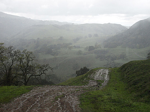
The climb was taking its toll, plus for some reason, I began to have an annoying stomach ache. I was pretty well beat by the time we reached the top. I was a bit disappointed to see that the trail continued to climb as we turned northwest along the ridge.

Where it began to level off, we stopped for a rest on a hilltop with a great view all around. I looked around a bit at the sandstone outcrops with poppies around them. The rocks are packed with fossil seashells, showing that this 2000 ft. ridge was once a seashore, and not so long ago in geologic time -- only a million years or so.


After a short rest, I felt better, but I knew that I wasn't up to the hike down the far side of the ridge. So we continued along the ridge, enjoying the great views all along the way, and went down the paved road back to the parking lot. As it often works out, even though I didn't do everything I had planned, it was a very nice hike anyway, and I didn't miss the extra 1000 ft. of climbing.

5.1 mi. -- 1550 ft. up and down

Friday, June 29, 2012

4-7-12 Morgan Territory

 more photos

It was a nice Saturday, and I wanted to try somewhere new. I had never been to Round Valley Regional Park, and on the map it looked interesting. The park adjoins Morgan Territory Regional Park, and I thought maybe we could hike into that area too. It was a longer drive than I usually want to do for a hike, but it we had plenty of time. We went east on 580, then north on Vasco Road. It was interesting to see some of the new wind turbines on the hills. They are huge -- several times the size of the old ones that still line some of the hills. The rocks of Vasco Caves also looked interesting. We turned left on Marsh Creek road, and soon came to the park entrance. Right there at the turn off, there was a big sign -- NO DOGS.

We needed a change of plans. Since I had thought of getting into part of Morgan Territory, why not start there and hike towards Round Valley instead. So we continued west on Marsh Creek Road and turned left on Morgan Territory Road. I was familiar with the road from many years ago, but I had forgotten that it was so narrow and winding. All the blind curves with no room to pass made me nervous, but we made it to the park entrance at the top of the hill. So we wasted an hour or so driving around, but we still didn't need to worry about time.

We started off on the Condor Trail going down past a pond and up and down some little rocky hills. I especially like this half mile or so of single-track trail. Green hillsides with rocky outcrops shaded by oaks and lots of wildflowers. Actually most of Morgan Territory is like that.

Morgan Territory Regional Park is divided into two halves by Morgan Territory Road. The western half spreading over Highland Ridge into Riggs Canyon was added just a few years ago. I'm more familiar with the eastern half which extends along a gently rolling ridgetop which drops off steeply to the east towards Los Vaqueros Reservoir and Round Valley. In all of the times I have been here in the past, I had never ventured on any of the trails going down off the ridge because I didn't want to have to make the steep climb back up. I thought I would try that this time.

So we started down the Miwok Trail. As we lost elevation, I kept thinking about how much work it would be to regain it, but it was a beautiful day, and the views were great across lower hills to the Central Valley. In one spot, there was a large area of steeply angled flat sandstone, much of it wet with rainwater seeping out of the hill. At the bottom of the slope, we turned left on the Manzanita Trail going down a little canyon shaded by tall trees. As the name suggests, there was a lot of manzanita, growing as large as small trees.

Soon we were climbing, and our pace slowed way down. It was steep for about 300 feet, then we crossed a saddle and headed down again on the Valley View Trail. We crossed a small creek below a pond, and began climbing again. This time it wasn't so steep and it didn't seem too long before we were back on the ridge. It was a good thing there would not be much more climbing, because I felt like I had had enough. We trudged on along the ridge and made it back to the car after 3 hours of hiking.

6.8 mi. -- 1500 ft. down and up

Thursday, June 28, 2012

3-25-12 Sunol


After weeks of dry, sunny weather, the rains returned for a couple of weeks. After a lot of rain on Saturday, Sunday seemed to be clearing, so Darby and I headed to Sunol for a hike. I felt like pushing it a bit more than the past few hikes, so I planned to go follow the road up Alameda Creek, then take the McCorkle Trail up the hill to Cerro Este and down the other side.

The day started off very beautiful with bright sunshine between the shadows of puffy clouds. The hills were brilliant green. There were lots of nice scenes for photos. Just beyond Little Yosemite, some people with a couple of poodles off leash were coming the other way, so Darby and I went off the trail a bit to let them pass. Soon there were more people with poodles. It must have been some kind of poodle club because there were about 10 of them. After making sure all of the poodles had passed, we got back on the trail. Near the park boundary, we turned left up the hillside Backpack Road, and then left on the McCorkle Trail. It was beautiful with the dramatic clouds, but the clouds were becoming thicker to the west. The views along the trail are great. We could see back into the higher hills to the east, and there was a dusting of snow on some of them.

The climb from the creek was starting to wear me down, but the trail kept climbing. Soon raindrops were falling. I thought it was just going to be a little shower. Anyway, by now it would have been longer to backtrack that to keep going. We turned right on the Cerro Este Road, thinking we were almost at the top of the hill. It turned out to be more climbing than I expected, but we made it to the top and it was now it was pouring rain.

We went on down the other side, walking carefully in places in slippery mud. The road winds along the hillside going steadily down, but we could see that it looked like an awfully long way to the bottom. Passing the old barn called the High Valley Camp, there were a bunch of cows in the road, and when one started coming toward us, Darby got scared and barked at it. We made it through the cows, and then it was just another mile of trying to make it down without slipping in the mud. We had been hiking in the hard rain for a good hour at least, and I was pretty much soaked through. Darby wasn't too happy about it either.

7.8 mi. -- 2100 ft. up and down

3-11-12 Willow Park loop

On another warm, clear Sunday, I took Darby on one of my old favorite hikes. It's an old favorite mostly because it is a short drive and can be easily done in less than two hours. But it is a pretty trail near the upper end of Lake Chabot, and there are some nice views.

I usually do this hike in a clockwise direction, but for some reason decided to go the other way today. It was probably because the other direction involves a long, steep climb. We started off from the parking lot for the Willow Park Golf Course. I'm not sure if hikers are supposed to park there, but no one has ever told me not to. We started up a dusty fire road, the Brandon Trail, along a ridge, a steady climb but not terribly steep. As we get higher, there are nice views of the golf course and the lake, and lots of green hills to the east and south. After a mile and a half or so, we turn left on the Towhee Trail down along a grassy hillside, then left again on the Live Oak trail. This is where it gets steep, but luckily we are going downhill for about a mile. At the flats at the head of Lake Chabot, we cross a long narrow footbridge and turn left on the Cameron Loop Trail.

It is quite warm, and by this time I am getting pretty tired. The shortest way back would be to go through the golf course, but it is clearly off-limits to hikers, and we would probably get into some kind of trouble. We crossed the narrow footbridge across the creek, turned right, then left on the Cameron Loop Trail, and climbed up a little canyon on the south side of the lake. I didn't like the climbing, but it is much shorter than the climb that we had already done. We turned left on the Ten Hills Trail, then left again on the Proctor Trail, a narrower trail that contours down the hill above the golf course. After an hour and a half, we were back at the car.

4.7 mi. -- 1200 ft. up and down

3-4-12 Five Canyons

The Sunday after hiking with the kids, I still had some time and energy for a short hike, so I did a loop at Five Canyons that I have done many times before. Five Canyons is one of my favorite places for a short hike because it is so near my home in the Fairview district of Hayward. It is one of many places where a large housing development  has given some land to the Regional Park District as mitigation for destruction of the environment on the rest of the land. It makes for an area where the trails are never far from the houses -- not exactly a wilderness experience -- but  it does have some spots that are out of sight and sound of the houses and some nice views from the ridge top.

Darby and I started off from the Recreation Center just off the main road, and followed the Shady Canyon Trail along the creek and under the high bridge of Five Canyons Parkway. This pretty little canyon is one of the places that seems quite removed from all the streets and houses, although it is not far away at all. The trail passes a little pond, mostly overgrown with cattails, and a little further on, we took a right fork and climbed up a steep wooded hill. This is the hard part, and I have to stop a couple of times to catch my breath. We wind around past a row of houses, over a little hill, and across the road. We pass tennis courts and more backyards, and soon head back down into another canyon to the west. Another half mile of ups and downs brings us back to the start.

2.3 mi. -- 550 ft. up and down

3-3-12 Marciel Gate

On another beautiful Saturday, I was going to go out for another hike, when my son Christopher called and said he was planning to take his boys out hiking too. So we decided to go together. We met at Marciel Gate in Anthony Chabot Regional Park. We didn't really have any plan about where to go. We thought we would just start out and see how far the boys would be willing to walk. The boys -- my grandsons -- are Zachery, age 6 and Elisjsha, age 8. I knew that they both are often more interested in TV and video games than outdoor activities, so I wasn't expecting too much.

We started off heading northwest, turned left onto the Cottontail Trail, and were soon descending quite steeply into Grass Valley. The kids were doing fine, stopping to look at bugs and butterflies and whacking stuff with sticks. At the trail junction near the bottom, we stopped for a while and I suggested that if we turned left, we could make a loop rather than retracing our steps. I couldn't remember just how far it was -- the last time I was on that trail was a couple of years ago and we were on horseback. Christopher and the kids were willing to try it, so we started off again.

It turned out to be a bit longer than I remembered and more up and down, but it wasn't too bad. After about a mile of mostly easy climbing, the afternoon was getting warm, and the boys began to drag -- especially Zachery. Then Elisjsha began to complain that he was hungry. We had water, but no food, so Chris and I just had to keep telling them that we had no choice but to keep on hiking. We came to the Deer Canyon Trail, and now it was quite steep. We had some very slow going for a quarter mile, but it finally leveled off and we crossed the road. It was easy up and down for another half mile or so back to the cars.

In spite of all the complaining, I think the boys had a pretty good time and took some pride in their accomplishment.

2.5 mi. -- 500 ft. down and up

2-25-12 Pleasanton Ridge


President's Day was beautiful clear and Darby and I headed out for another hike. There were lots of other people on the trail up to the ridge, many with dogs, so I had to keep Darby leashed for much of the way. Luckily the other dogs were mostly well behaved. As usual, I had envisioned a more ambitious hike that I had the energy for. I had hoped to go beyond what I had done on previous hikes -- Augustin Bernal Park, but after climbing about 700 ft. to the top of the ridge, I realized that it wasn't going to happen today. We took the Thermalito trail which winds along the western slope of the ridge, passing a couple of stock ponds. Everything was very green and pretty. After about a mile, I decided that it was far enough and took a short connecting road back to the ridge top and started heading back.

I stopped at a picnic table on a nearby hilltop to make a phone call. It felt like a very big deal. It was my first girlfriend, Rosemary, who I hadn't seen or talked to in nearly 50 years. We went together for our last year and a half of high school. After a few years, I lost track of her, and always wondered what had happened to her. My 50 year high school reunion was coming up and they had set up a website with information about classmates. I didn't want to go to the reunion because most of the few friends I had were still on the missing list. But Rosemary was listed, and I got her phone number. I made the call -- no answer -- so I left a message, and continued on my hike.

The views along the ridge were great as we made our way back down, passing some old olive groves. We took an alternate trail down from the ridge, a footpath that was a bit shorter and steeper than the road up.

A few days later, I finally got in touch with Rosemary, and a month or so later, Maureen and I spent a lovely afternoon picnicking in Redwood park with her and her husband, Bo

5.3 mi. -- 1300 ft. up and down

Wednesday, June 27, 2012

2-19-12 Las Trampas


One nice Sunday, I took Darby to Las Trampas for a hike. We parked at the turnout at the bottom of the Chamise Trail, a short distance from the parking lot at the end of the road, and started off up the Chamise Trail. Those first few switchbacks up the hill are always a little hard, coming right at the start. We turned right on the Trapline Trail, and followed it up a steep little ravine. Soon it breaks out of the woods and keeps climbing in rocky chaparral. It seemed quite warm for February, and I slowly pushed myself on up to the top of the ridge.

Just over the top, there is one of my favorite spots. A long, low rib of sandstone breaking out of a grassy hillside below hilltop oaks makes it special. As usual, I stopped again for a couple of photos. We branched left on the Sulphur Springs Trail and descended into a little canyon. At the bottom, there is the spring, piped into three old bathtubs. We climbed again to the top of another ridge, now overlooking Danville to the east, looking quite near below. We turned right on the Del Amigo Trail and followed the ridge around to where it joins the main ridge, and back to the spot with the sandstone rib. The chaparral included lots of a Ceanothus variety that was covered with puffy white blossoms.

We continued northwest along the ridge, enjoying some nice views, and came back down on the Chamise Trail to complete a figure 8 route. It was a good workout for me -- hard enough to get me tired but not worn out. It's hard to tell how it was for Darby. It seems that no matter how far we go, he is always up for it, running around chasing lizards and squirrels and not looking tired. But when we are done, he will sleep for a few hours.

3.3 mi. -- 1150 ft. up and down

Monday, June 25, 2012

11-12-11 Sunol Regional Wilderness


Several weeks after hiking in Garin, I had time for another hike. Once again, I was hoping to get some photos with a little fall color. Every year for the last 10 years or so, Maureen and I have put together a calendar with our photos to give as Christmas presents. I like to try to pick photos that fit the seasons, and we didn't have any that looked like fall or winter. I knew that along the creeks in Sunol there were a lot of sycamores and maples, so that's where we went.

It was not a nice day -- cold and overcast, and threatening to rain. But since I had the time, I may as well go anyway. Darby and I started off from the park headquarters, and wandered around a bit looking for promising scenes along the creek. I didn't find much. The flat lighting made everything kind of dull. We headed up the Indian Joe Trail. I was thinking of going all the way up to the top of the hill at Cerro Este, and looping back down the other side. Soon we found a nice place along the creek with yellow maple leaves and lots of dry brown sycamore leaves on the ground, and I took a few photos. I thought I was done, but as I started walking up the trail, I noticed the bright green moss on a leaning sycamore trunk, and stopped for one more shot -- which turned out to be the best of the bunch.

The trail gets steeper as it continues up the creek, and my progress slowed way down. I remembered hiking up here a year or two ago aiming for the cave rocks, but getting tired and giving up. This time I wanted to see if I could make it all the way, so I pushed on. I was surprised when I came upon the rocks just a hundred yards or so beyond where I turned back before.

The cave rocks are a jumble of house-sized rocks outcropping from the hillside. The spaces between them form small caves. I remember coming here nearly 30 years ago with my young sons. We had a great time climbing around on the rocks. I hadn't been here since then. I hadn't seen anyone else on the trail so far, but here there was a dad with his two small boys enjoying the rocks much like we did.

I enjoyed looking around the rocks, but I realized that I was pretty tired, and going all the way over the hill was not very appealing. We headed down, taking a connecting trail over to the hayfields road and going back down that way. Soon, the dad and two boys were behind me, and the younger boy kept running ahead, catching up with me, then waiting for the others.


Wednesday, June 20, 2012

10-15-11 Garin-Dry Creek Pioneer Regional Park


One Saturday afternoon I realized that I hadn't been out hiking in the local hills nearly as much as I used to. I decided to try to get back into it. Maureen and I had been out on the trails quite a lot with the horses, but it's not the same thing. Going out on foot, you can go at your own speed, stop anywhere you want, let your mind wander, and take photos of anything interesting along the way. That's not so easy to do on a horse. Besides, I was beginning to feel old. Even short walks around the neighborhood often tired me out. I wanted to see if I could at least get back in shape enough to do some of the trails that I used to do.
So I took Darby, my dog, and drove over to the southern park entrance at Mission Blvd. and Whipple Rd. in Union City. We started off up the dirt road that follows the north branch of Dry Creek. I was hoping to get some nice photos of autumn scenes with the big sycamores along the creek. It was too early for fall color -- the sycamores had only barely begun to give up their green leaves. I did try to take a couple of shots of the creek and the reflections in the water. Photos like that are usually difficult with Darby along. As soon as I point the camera at the water, he has to splash into the middle of it making everything muddy. I either have to shoot fast, or hold him back.

It was an easy, relaxing walk for the first mile or so, but then the trail heads up a little side canyon, and it soon becomes pretty steep. The day was warm, and I appreciated the shade of the woods, but it was still hard work. I was OK for a while as long as I kept a slow pace, but after climbing for a while, I finally needed to sit down and catch my breath. It was very quiet, and I enjoyed watching the sunlight filtering through the trees.

A little further up, I came out of the woods, crossed a grassy saddle, and headed down into another wooded canyon to complete a loop. It took about an hour and a half. I was little tired, but not bad, and I felt like maybe there was hope for me as a hiker yet.